A circular route to Trucherelle starting from Noyarey

A route through the woods overlooking Noyarey, leading to the hamlet of Trucherelle and then the Poyet farm.

Details

2028770
Creation:
Last update:
Last review:
  • Walking
    Activity: Walking
  • ↔
    Distance: 3.39 mi
  • ◔
    Average duration: 2h 50 
  • ▲
    Difficulty: Moderate

  • ⚐
    Back to start: Yes
  • ↗
    Ascent: + 1,473 ft
  • ↘
    Descent: - 1,460 ft

  • ▲
    Highest point: 2,195 ft
  • ▼
    Lowest point: 764 ft

Photos

Description of the walk

Park at Place Victor Jat in Noyarey.

(S/E) Set off to the left onto Chemin Hebert. At the junction with Rue du 19 mars 1962, make a zigzag turn. Stay on the road opposite to reach the junction of two paths.

(1) Turn right; further on, you’ll rejoin the Route d’Ezy. Take it to the left and quickly turn left off it (signposted ‘Ezy’) to join the wide path. Stay on this path, passing under the power lines. Continue generally westwards to reach the wide track leading to Carron.

(2) Turn left onto it. A gentle climb takes you to the junction at Ferme du Poyet.

(3) Leave the track and head left down a steep descent. You’ll reach a crossroads. Leave the track on your left (no entry sign). Carry on to the right. Pass under the power lines again. Carry on, ignoring the tracks marked with ‘No Entry’ signs. At a hairpin bend, join the track and take the one opposite. Pass through the Ferme du Poyet. Shortly afterwards, you’ll reach another crossroads.

(4) Leave the track leading to Noyarey Town Hall on your right. Take the one on the left. Begin another descent to reach the original junction.

(1) Follow the same route as on the way out to return to the car park at Place Victor Jat (S/E).

Waypoints

  1. S/E : mi 0 - alt. 764 ft - Victor Jat car park
  2. 1 : mi 0.21 - alt. 899 ft - Crossroads of the circular loop
  3. 2 : mi 1.24 - alt. 2,051 ft - Carron Track
  4. 3 : mi 1.86 - alt. 2,195 ft - Poyet crossroads
  5. 4 : mi 2.81 - alt. 1,391 ft - Turn left at the fork
  6. S/E : mi 3.39 - alt. 764 ft - Victor Jat car park

Notes

For this route, the markings are yellow but are not mentioned in the description as they are very faint. There are also a good number of Red Circles marking the route of the annual trail race known as ‘La Montée d’Ezy’.

Between (1) and: The path is in a particularly poor state and does not allow for easy progress.

Worth a visit

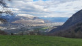
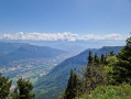
Beautiful views over the Isère valley, particularly the famous ‘Y’ formed by the confluence of the Drac on the right and the Isère on the left.

Reviews and comments

4.2 / 5
Based on 3 reviews

Reliability of the description
4.3 / 5
Ease of following the route
4.7 / 5
Route interest
3.7 / 5
sempervivum
sempervivum

Overall rating : 4.7 / 5

Date of your route : May 24, 2026
Reliability of the description : ★★★★★ Very good
Ease of following the route : ★★★★★ Very good
Route interest : ★★★★☆ Good
Very busy route : No

Circular loop of 2 hours. The steep, continuous climb is perfect for getting your legs moving in the spring... The first part of the descent is pleasant, with views of the mountain ranges.

Machine-translated

User 24639634

Overall rating : 3.7 / 5

Date of your route : Aug 26, 2025
Reliability of the description : ★★★☆☆ Average
Ease of following the route : ★★★★☆ Good
Route interest : ★★★★☆ Good
Very busy route : No

This hike is classified as moderately difficult. Even though it's short, I think it should be classified as difficult because when you climb 400 metres in 2 kilometres, for me that's difficult. That's a 20% gradient over 2 kilometres, without any breaks, right at the start of the route. I can't imagine the members of my walking group being able to manage the climb. It's true that the rest of the walk is very easy, as all the elevation gain is in the first 2 kilometres.

Machine-translated

Mploufeur
Mploufeur

Overall rating : 4.3 / 5

Date of your route : Mar 21, 2021
Reliability of the description : ★★★★★ Very good
Ease of following the route : ★★★★★ Very good
Route interest : ★★★☆☆ Average
Very busy route : No

The walking time is greatly overestimated. Allow a maximum of 2 hours, even if you’re not in great shape.
The paths are a bit stony. High-top shoes are more highly recommended than ever.

Machine-translated

Other walks in the area

For more walks, use our search engine .

The GPS track and description are the property of this route's author. Please do not copy them without permission.