Pas de l’Eyrard Circular Route

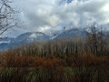
A spectacular and little-known trail less than 10 km from Grenoble! The walk suggested here is the ‘minimal’ route to cross the Pas de l’Eyrard, but there are plenty of options if you wish to extend the walk (see the ‘Nearby’ section).
Warning: the passage over the Pas de l’Eyrard is tricky, reserved for experienced walkers and not recommended for those with a fear of heights.

Details

7638617
Creation:
Last update:
Last review:
  • Walking
    Activity: Walking
  • ↔
    Distance: 2.61 mi
  • ◔
    Average duration: 2h 25 
  • ▲
    Difficulty: Difficult

  • ⚐
    Back to start: Yes
  • ↗
    Ascent: + 1,414 ft
  • ↘
    Descent: - 1,401 ft

  • ▲
    Highest point: 3,219 ft
  • ▼
    Lowest point: 2,037 ft

Photos

Description of the walk

Start at Chemin de Carron. At the hamlet of Trucherelle, turn left towards Le Poyet and follow the road for about 200 m. The start of the walk is just beyond the end of the tarmac section, at a point where the road crosses a stream that is often dry. Two forest tracks branch off on either side of the stream. Park along the road.

(S/E) Take the track on the right, on the left bank of the stream.

(1) The track soon branches off to the left, whilst a path (not shown on the IGN map) continues straight ahead. Stay on the track. Shortly after this bend, carry on straight ahead at the junction with another forest track that branches off to the right.

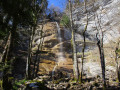
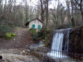
(2) When the main track veers to the left, turn right. The track soon opens out onto a small path: take this to the left (marked with a blue sign, which is rather faded in places). The path joins the Eyrard stream: follow the stream upstream until you reach the foot of the first waterfall (the path is not always clearly marked at this point).

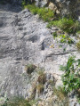
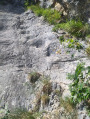
(3) Climb to the right of the waterfall along a very steep and poorly marked path right at the foot of the rock face. You’ll soon reach the rocky passage known as the Pas de l’Eyrard, which a cable and steps carved into the rock help you to cross. At the end of this section, continue climbing alongside the stream (a faintly marked path still exists) until you reach the foot of the second Eyrard waterfall, where you’ll come across a clearly visible path (Chemin de Fontrasset).

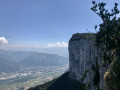
(4) Take this path to the left to cross the stream and continue through the forest, at the top of the cliff. After a while, the path joins a wide forest track at a hairpin bend.

(5) Do not take the track but turn left onto a small path, marked by a cairn, which descends steeply. This path reaches an electricity pylon: ignore a track branching off to the right at this point and continue downhill until you come out onto the Carron track.
Follow this track to the left to return to the starting point (S/E).


Waypoints

  1. S/E : mi 0 - alt. 2,037 ft - Eyrard Stream
  2. 1 : mi 0.23 - alt. 2,241 ft - Junction, turn left
  3. 2 : mi 0.5 - alt. 2,641 ft - Junction, turn right
  4. 3 : mi 0.66 - alt. 2,841 ft - First waterfall
  5. 4 : mi 0.76 - alt. 3,202 ft - Fontrasset Path
  6. 5 : mi 1.51 - alt. 2,874 ft - Hairpin bend, to the left
  7. S/E : mi 2.61 - alt. 2,037 ft - Eyrard Stream

Notes

The IGN map is very imprecise in this area: it is better to use the OpenStreetMap base map for this walk.
The proposed walk is short but is classified as ‘Difficult’ due to the terrain: there is a very steep section at the Pas de l’Eyrard, a fairly exposed section (the cable installed there is absolutely essential), and a path that is sometimes poorly marked. The Pas de l’Eyrard is impossible to cross if you suffer from vertigo.

Worth a visit

From this short walk, you can come up with numerous variations. For example:

  • Walk up from Noyarey.
  • At the junction (4), instead of turning left, turn right to join the Chemin des Bœufs and take a longer route.

Reviews and comments

4.3 / 5
Based on 4 reviews

Reliability of the description
4.3 / 5
Ease of following the route
4 / 5
Route interest
4.5 / 5
martinedemaria
martinedemaria

Overall rating : 5 / 5

Date of your route : Sep 08, 2026
Reliability of the description : ★★★★★ Very good
Ease of following the route : ★★★★★ Very good
Route interest : ★★★★★ Very good
Very busy route : No

Minimalist in terms of distance but maximalist in its spectacular and wild scenery. A short hike that’s every bit as good as the longer ones
A really, really lovely route 😊

Machine-translated

Tim
Tim

Overall rating : 3.7 / 5

Date of your route : Apr 18, 2026
Reliability of the description : ★★★☆☆ Average
Ease of following the route : ★★★★☆ Good
Route interest : ★★★★☆ Good
Very busy route : No

There are no restrictions in place for the Pas de l’Eyrard. It’s quite a sight, but the cable is sturdy; I’d suggest taking a lanyard, which will provide reassurance for anyone who finds themselves in difficulty. The balcony path above is superb. There’s never anyone around in this area.

Machine-translated

User 19195533

Overall rating : 4.3 / 5

Date of your route : Jun 24, 2025
Reliability of the description : ★★★★★ Very good
Ease of following the route : ★★★☆☆ Average
Route interest : ★★★★★ Very good
Very busy route : No

The path through the woods is a bit difficult to follow as it gradually disappears.
The equipped section is very steep, but if you don't suffer from vertigo, you just need to hold on to the cable and use the steps carved into the rock. Impressive, but ultimately easy to navigate if you are in good physical condition.

Machine-translated

gbenouville
gbenouville

@ pasdid88: I haven’t seen any signs anywhere indicating that access is prohibited… So I suppose it isn’t (or isn’t any more).
In any case, it’s true that the area is relatively dangerous. But no more so than many other routes in the region: as always when out hiking, you need to be able to assess the terrain, the conditions and your own abilities before setting off.

Machine-translated

pasdid88
pasdid88

Overall rating : 4 / 5

Date of your route : Apr 29, 2021
Reliability of the description : Not used / Not applicable
Ease of following the route : Not used / Not applicable
Route interest : ★★★★☆ Good
Very busy route : No

Please note – just for your information – the Eyrad Pass has been CLOSED for some time now, and in fact another hiker was killed there last year. So please be aware of this before you go…

Machine-translated

Other walks in the area

For more walks, use our search engine .

The GPS track and description are the property of this route's author. Please do not copy them without permission.