Walk along the Isère embankment at Pont de Veurey

More of a stroll than a hike along the right-bank embankment of the Isère, which forms part of the Voie Verte No. 2 cycle route.

Details

n°128558
Creation:
Last update:
Last review:
  • Walking
    Activity: Walking
  • ↔
    Distance: 5.59 mi
  • ◔
    Average duration: 2h 35 
  • ▲
    Difficulty: Easy

  • ⚐
    Back to start: Yes
  • ↗
    Ascent: + 39 ft
  • ↘
    Descent: - 36 ft

  • ▲
    Highest point: 653 ft
  • ▼
    Lowest point: 614 ft

Photos

Description of the walk

Park in the car park by the roundabout at the A48 exit. Head in the opposite direction to the roundabout and you’ll soon reach the tarmac path on the embankment.

(S/E) Take the embankment on the right; it separates the River Isère on the left from the Canal de la Vence on the right. Continue in a north-north-westerly direction, passing the Voreppe toll station. You’ll reach a junction at the Étang de la Roize.

(1) Ignore the track on the right and continue along the Voie Verte (VV); you’ll reach a ford clearly marked by a sign. This ford is at the confluence of the River Isère and the Canal de Vence. Walk back a few steps to reach the junction of two tracks.

(2) Turn right to take the road first, then, a few metres further on, the dirt track closed off by a barrier prohibiting access to motor vehicles. Continue along this track with the Canal de Vence on your right until you reach the Étang de la Roize

(3) Cross the canal’s spillway via the footbridge, then, a few steps further on, cross a second footbridge over the canal itself to rejoin the track you took on the way out.

(1) Take the track on the left and stroll back to the car park.

Waypoints

  1. S/E : mi 0 - alt. 650 ft - Car park near the roundabout - Isère (rivière)
  2. 1 : mi 1.56 - alt. 640 ft - Etang de la Roize junction
  3. 2 : mi 2.78 - alt. 633 ft - Volmat crossroads
  4. 3 : mi 3.82 - alt. 636 ft - Footbridge over the - Roize (cours d'eau) - Affluent du canal de Vence
  5. S/E : mi 5.59 - alt. 653 ft - Car park near the roundabout

Notes

A bit of water for this 9km route.

Worth a visit

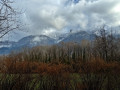
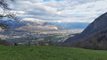
The Chartreuse is on your right at the start; on the way back, it’s the Vercors.

Reviews and comments

4.7 / 5
Based on 1 review

Reliability of the description
5 / 5
Ease of following the route
5 / 5
Route interest
4 / 5
TaX38
TaX38

Overall rating : 4.7 / 5

Date of your route : Mar 21, 2021
Reliability of the description : ★★★★★ Very good
Ease of following the route : ★★★★★ Very good
Route interest : ★★★★☆ Good
Very busy route : No

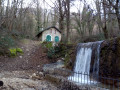
A flat but interesting walk, particularly for the views of the Isère. We recommend following the paths along the riverbank (to avoid the bikes!) wherever possible. Don’t miss the rapids on the Isère!

Machine-translated

Other walks in the area

For more walks, use our search engine .

The GPS track and description are the property of this route's author. Please do not copy them without permission.