Country:

 City:
City:


In Waldulm, park in the car park next to the sports grounds on the left-hand side of the main road from Achern to Oberkirch.
(S/E) Join the road and turn left.
(1) At the next junction, take the street furthest to the right towards the church. Walk past the church and up Kirchweg, keeping the church and then the cemetery on your left.
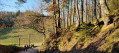
(2) At the top of the hill, turn left towards Ringelbacher Kreuz. The path runs alongside the forest and becomes tarmac.
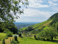
(3) At the top of the hill, turn left. The path follows the ridge through the vineyard. First view of the Rhine plain. Continue straight on towards the south.
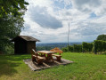
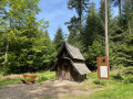
(4) At the Langhalde sign (next to a self-service drinks stand), take the path on the right which crosses the forest towards the Fatima Chapel. At the Waldköpfhütte, take the path down to the left and follow it to the Fatima Chapel. Another viewpoint over the plain and Oberkirch and its surroundings. Continue along the path.
(5) Take the hairpin bend to the left and, after a few metres, another hairpin bend to the right. Follow the tarmac path down through the vineyard to a walled picnic area. Turn right for a few metres.
(6) Turn left at the entrance to the village and, shortly afterwards, take the dirt track on the right. Continue straight on when you reach the road until the next junction.
(7) Turn left onto Rue Nierderlehen. At the next junction, turn right onto Ringelbacher Strasse for about 50 metres, cross with care, then turn onto Rue Wolfhag. Follow this street. At the next junction, turn left, still on Rue Wolfhag, towards Schwend. The road climbs.
(8) At the last house, turn onto the path on the right which leads into the forest. Follow the Yellow Diamond markings. Climb up to the Fellhauerhütte. Lovely picnic area.
(9) Head down the path to the left of the hut towards Ringelbacher Kreuz. After a left-hand bend, turn onto the path on the right, then shortly afterwards, turn onto a path on the left marked with a Yellow Diamond.
(10) When you reach the vineyard, go up to the right at the Y-junction towards Ringelbacher Kreuz and follow the path alongside the forest.
(11) At the next Y-junction, take the mountain bike path to the right. Turn left at the next junction. The path heads north and meets a T-junction.
(12) Turn right and follow the path for about 200 m to the Schwend viewpoint. Here you will find a small military cemetery. From the cemetery, head back and follow the path down towards Waldulm. At the three-way junction, go straight ahead. Cross one path, then another. Pass a shelter on a left-hand bend.
(13) Turn right at the next junction towards Waldulm. Continue following the diamond-shaped sign with a grape. As you leave the forest, the path becomes tarmac. Turn left at the T-junction, still heading towards Waldulm, to quickly reach the L86a road
(14) Cross the Oberkirch road (take care) and follow Unterbergstrasse to the junction with Berggasse.
(15) Turn left and stay on Unterbergstrasse, leaving Berggasse straight ahead. Cross the Oberkirch road. Continue straight ahead and shortly afterwards cross the park on the left.
Walk past the tennis courts to reach the car park near the sports grounds (S/E).

 Visorando Member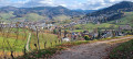


 Difficult