Country:
 City:
City:


Access from the B3 at Renchen. Take the L89 towards Oberkirch, then the K5305 towards Ulm.
In the village of Ulm, turn left towards Achern, then take the second road on the right (Armenhöfestrasse, Kaierstrasse) towards the hamlet of Kaier, where you’ll find a large car park in the woods – Renchen Ulm Parking Kaier – the starting point for our walk.
Please note: for information on signposting, see Practical Information.
(S/E) Head back towards the small road you arrived on. In front of the playground, turn right then left along the road. After about a hundred metres, turn right onto a very steep climb towards Bildstoeckelplatz. Halfway up the slope, at the junction, do not continue straight on but turn left then immediately right, and continue up the steep climb to a star-shaped junction. This is the junction marking the circular loop. See Practical Information. The signposts are rather poorly positioned.
(1) You must therefore take the first path on the left to continue this walk. After about fifty metres, you’ll reach another junction.
(2) At Am Katzenkopf, carry on straight ahead. After about 300 metres, ignore a path branching off to the right. Descend gradually along the “Ulmer Panoramaweg” to a T-junction, near the Vogesenblick viewpoint.
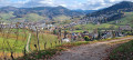
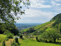
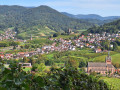
(3) Step slightly to the side as you walk along the path on the left to enjoy the view over the vineyards. The Vogesenblick lives up to its name: views of the Vosges, the Rhine plain and the village of Ulm.
Retrace your steps and head straight on. You are now on the “Achertäler Heimatpfad”. The path, winding in a series of bends, soon leads into the vineyard. At the various junctions, stay on the path that runs straight ahead, climbing gently through the vines. Once at the top of the vineyard, the path forms a hairpin bend and joins a crossroads.
(4) Turn right to head back up with your back to the plain. When you reach a junction with a bench, leave the vineyard and head straight up into the forest. You’ll come to a T-junction.
(5) Turn right, continuing slightly uphill, then carry on straight ahead until you reach another T-junction. You’ll rejoin the “Achertäler Heimatpfad”. Follow it to the left and you’ll return to the Bildstoeckelplatz crossroads.
(1) Take the path immediately on the left until you reach a junction with a tarmac road at a place called Kreuztanne.
(6) Turn right onto “Adolf Kohler Weg”, a winding path through the forest that descends slightly. Ignore the various paths branching off to the right or left. When the path bends to the left and then takes a right-hand bend, you’ll join a wide path.
(7) Turn right for a few dozen metres, then veer left onto the winding path through the high forest. Continue straight on until you come out onto a track suitable for vehicles above the Waldulm vineyard, at a place called Pfaffenberg.
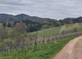
(8) Turn right. The path certainly lives up to its name here; the view over the Waldulm vineyard is magnificent. There are views of the village and the Black Forest.
Follow this small road, which forms part of the Way of St James. Continuing slightly uphill, follow the small road through vineyards and orchards. It is joined by a wider road coming from the left.
(9) Follow it; after a wide bend to the right, pass by Fridolinshütte, where the road turns south and reaches a crossroads
(10) Carry straight on, maintaining this direction, until you reach the end of the vineyards and orchards and re-enter the woodland. This is the hamlet of Langhalde.
(11) The path branches off to the right. Follow it until you reach a star-shaped junction with a picnic area and the Waldkoepfelhütte shelter.
(12) Ignore the two paths on the right and the two on the left, and take the one in the middle. At the second junction, turn right twice. You’ll reach another junction with several paths.
(13) Take the central path; do the same at the junction just after, heading towards Kaier – Küsseichhütte. You’ll soon come to the vineyard on your left. The path overlooks the vines, offering a panoramic view of the vineyard.
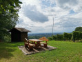
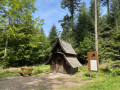
At the end of this path, overlooking the plain and the town of Ulm, is a large picnic area with a shelter, the Küsseichhütte.
(14) After taking in the panoramic view and perhaps having a short rest, retrace your steps and turn left onto a small, winding forest path that climbs gently before descending steeply. This leads back to the starting point of the walk (S/E).


 Visorando Member