Between Achern and Sasbachwalden

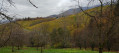
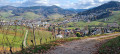
You’ll follow the Kuhlmann Weg Forest Trail, then take in the panoramic views from the Jockele Gück via the Keltischer Baumpfad (Celtic Tree Trail). You’ll then cross to the other side of the valley through the Auf der Eck vineyards and finish your walk along the River Sasbach.

Details

3951925
Creation:
Last update:
Last review:
  • Walking
    Activity: Walking
  • ↔
    Distance: 9.27 mi
  • ◔
    Average duration: 5h 45 
  • ▲
    Difficulty: Moderate

  • ⚐
    Back to start: Yes
  • ↗
    Ascent: + 1,699 ft
  • ↘
    Descent: - 1,726 ft

  • ▲
    Highest point: 1,381 ft
  • ▼
    Lowest point: 568 ft

Photos

Description of the walk

Park at the Sandweg car park via the L86 from Achern.

(S/E) Walk up Sandweg and pass the Schützengilde House. About a hundred metres further on, you’ll reach the start of a path near a cross (Illenkreutz).

(1) Turn left onto this path which runs alongside the forest. Cross a stream and follow the path to the right. Pass a path on the right and turn left. Pass a path on the left. Walk past the Lehrbienenstand (beekeeping training centre). Turn right along the Illenbach stream. Walk past the water tower, then past the football pitch. You’ll reach the Waldsee pond.

(2) Turn left, walk along the lake and continue straight ahead along the path. At the Wolfschlucht sign, take the Kullmann Weg path on the left towards Sattel. Cross the bridge and turn left. After the Kullmann Brunnen, turn left then right onto the path that climbs. After a hairpin bend to the left and a curve to the right, a path branches off to the right.

(3) Turn right onto the path leading downhill. You are now on the Keltischer Baumpfad (Celtic Tree Trail). After the Lourdes Grotte, take the path up to the left. Cross a junction. Walk past the Bergsee. Turn left onto the path, then immediately right. Take the path on the right towards the Bienenbückel shelter.

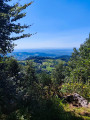
(4) Follow the tarmac road up towards the Jockele Gück. Climb up to the Jockele Gück to enjoy the panoramic view, then head back down the path at the top of the vineyard and turn left. Walk along the top of the vineyard to the viewpoint. Turn left. Go straight on at the fork in the road leading downhill, then turn left at the next fork in the road onto the path leading uphill.

(5) At the Sattel, take the path on the right towards Allmend. Go through the gate. Follow the path on the left uphill towards Sasbachwalden. At the junction, take the path (Vogelspfad) which climbs to the right. Turn left onto the path at the top of the vineyards. Follow the path downhill, then take the path leading to the road between Sasbachwalden and Kappelrodeck.

(6) Cross the road at Knetschwasen, then follow the tarmac path uphill towards Auf der Eck. Turn right towards Obere Eck. Stay on this path. Pass through the Obere Eck hamlet and continue along the tarmac path. You will reach the Grieseneck junction.

(7) Turn right at the junction towards Wolfersberg. Follow the path on the left uphill towards Birkkopfel. Turn left at the statue of the Virgin Mary, which is a lovely spot for a picnic. Turn right after the next house in the woods. Turn left onto a footpath. Cross the road (Bergstraße) and walk down the path for about thirty metres.

(8) Turn left after the bridge and follow the River Sasbach. Go straight on as you enter the village. Turn left into Rue In den Höfen and cross a bridge; 150 m further on, you’ll reach Talsstraße.

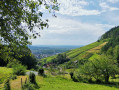
(9) Cross the road, walk a few metres to the left and turn right onto Michelbach Street, which leads uphill. Continue along the path at the end of the street. Turn left up into the vineyard, then left again. Turn left onto Auf der Eck; after a wide left-hand bend, you’ll reach the Grieseneck junction.

(7) Turn right, then immediately right again into the vineyard. Cross one junction and turn right at the next one. Turn right at the following junction and head down onto the road.

(10) Cross Rue Auf der Eck, first turn right then left, and head down the path. Follow the signs for ‘Alte Gott Panoramarounde’, which, after a wide right-hand bend, leads towards the road.

(11) Just before this, turn onto the path on the left. After about a hundred metres, cross the road and head down the path. Turn left onto Königsrainstraße and head down towards the tennis courts. Turn onto the path on the left in front of the tennis courts and join Talstraße.

(12) Cross the road and the bridge and head up the path. Walk through a cluster of houses. Take the path on the left behind a house. Turn right and pass the Münsterblick viewpoint.

(13) Turn left onto Am Schelzberg. Walk past the Vogelsberg house. Turn left onto Obersasbach towards Sandweg. Take the path through the woods. Walk down the street. Turn left at the bend, opposite house no. 17. You’ll reach the bridge over the Sasbach.

(14) Cross the bridge and follow Sasbachwaldener Straße to the left. Turn right and cross the L86 road. Walk up to the car park (S/E).


Waypoints

  1. S/E : mi 0 - alt. 600 ft - Sandweg car park
  2. 1 : mi 0.34 - alt. 656 ft - Illenkreutz junction (cross)
  3. 2 : mi 1.49 - alt. 587 ft - Waldsee pond
  4. 3 : mi 2.04 - alt. 886 ft - Keltischer Baumpfad.
  5. 4 : mi 2.65 - alt. 817 ft - The Bienenbückel shelter.
  6. 5 : mi 3.36 - alt. 951 ft - Junction towards Sattel
  7. 6 : mi 4.17 - alt. 873 ft - Road – Knetschwasen hamlet
  8. 7 : mi 5.08 - alt. 1,181 ft - Grieseneck junction.
  9. 8 : mi 5.76 - alt. 1,211 ft - Bridge over the Sasbach.
  10. 9 : mi 6.35 - alt. 902 ft - Talstrasse
  11. 10 : mi 7.1 - alt. 1,017 ft - Auf der Eck Street.
  12. 11 : mi 7.48 - alt. 781 ft - Turn left at the fork.
  13. 12 : mi 7.88 - alt. 640 ft - Talstrasse
  14. 13 : mi 8.48 - alt. 774 ft - Am Schelzberg Street.
  15. 14 : mi 9.12 - alt. 571 ft - Sasbachwaldener Strasse
  16. S/E : mi 9.27 - alt. 600 ft - Sandweg car park

Notes

Several self-service drinks dispensers.
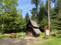
The Bienenbückel shelter. Sometimes used for a picnic.
Easy footpaths and trails.

Worth a visit

The Waldsee and Bergsee lakes.
The Kullmann Trail.
The Celtic Tree Trail (Keltischer Baumpfad).
The viewpoints at Bienebückel, Jockele Gück and Münsterblick.
The statue of the Virgin Mary.
The River Sasbach.
The vineyards.

Reviews and comments

3.8 / 5
Based on 5 reviews

Reliability of the description
3.4 / 5
Ease of following the route
3.4 / 5
Route interest
4.6 / 5
sn00p
sn00p

Overall rating : 4 / 5

Date of your route : Aug 04, 2025
Reliability of the description : ★★★★☆ Good
Ease of following the route : ★★★★☆ Good
Route interest : ★★★★☆ Good
Very busy route : Yes

A fairly pleasant hike, I enjoyed the variety and some superb views of the Vosges and the Rhine Valley.
Be careful at km 9, though, when you re-enter the forest, go down the path on the left as soon as possible, as the trail has probably been closed by a disgruntled local resident (who has put up a sign and a gate saying "no trespassing on private property").

Machine-translated

Dan Aldes
Dan Aldes

Overall rating : 5 / 5

Date of your route : Apr 21, 2025
Reliability of the description : ★★★★★ Very good
Ease of following the route : ★★★★★ Very good
Route interest : ★★★★★ Very good
Very busy route : Yes

Very nice walk, plus a very good restaurant at km 10 .

Machine-translated

aisenmann
aisenmann

Thank you for these clarifications.

Machine-translated

Marc ECKERT
Marc ECKERT

Overall rating : 4.3 / 5

Date of your route : Jun 23, 2024
Reliability of the description : ★★★★☆ Good
Ease of following the route : ★★★★☆ Good
Route interest : ★★★★★ Very good
Very busy route : No

I wanted to congratulate you on the beauty and diversity of this walk.
A truly extraordinary variety of landscapes, views and points of interest.
I strongly advise you to follow the route with the help of the visorando map; it's true that the description alone isn't enough, and I'd like to point out that it's extremely difficult to describe a 15km hike in every detail (I'm an author myself, and I'm well aware of this difficulty, which sometimes earns me criticism), given the number of paths along the way, and also point out the small number of signposts in this area.
There was just one problem: between points 2 and 3 at the end of the Wolfschlucht, it was almost impossible to see the fork to point 3; the little path leading up is behind a bench and is completely hidden by the vegetation. However, this small error in the route, which was quickly spotted on the map, enabled us to discover a magnificent "Grillplatz" 150m further up towards the Wolfschluchtsattel, an area for picnics and barbecues with numerous tables and benches, some of which are sheltered, and which is well worth the diversions even if you have to retrace your steps.
All in all, a hike I can highly recommend.

Machine-translated

Michel Bonnefon
Michel Bonnefon

Overall rating : 3.7 / 5

Date of your route : Oct 10, 2023
Reliability of the description : ★★★☆☆ Average
Ease of following the route : ★★★☆☆ Average
Route interest : ★★★★★ Very good
Very busy route : No

Lovely walk between undergrowth and vines.
However, you need to be careful on the route, as there are few signs, and the forks and changes of path are not easy.
Using the GPS to help you progress is a great help.

Machine-translated

virgule
virgule

Hello Boyard

Have you already written a route?

Machine-translated

boyard
boyard

Overall rating : 2 / 5

Date of your route : Jul 17, 2022
Reliability of the description : ★☆☆☆☆ Very disappointing
Ease of following the route : ★☆☆☆☆ Very disappointing
Route interest : ★★★★☆ Good
Very busy route : No

A varied route with forest, vineyards, viewpoints, ponds, etc. A superb area for walking, unfortunately spoiled by an irrelevant route description. There are so many possible routes in the area that the loop back to Grieseneck is not useful. In short, a route to rethink!

Machine-translated

Other walks in the area

For more walks, use our search engine .

The GPS track and description are the property of this route's author. Please do not copy them without permission.