Panoramic walk around Kappelrodeck

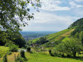
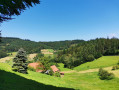
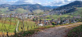
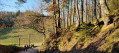
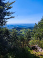
A pleasant walk around Kappelrodeck, alternating between woodland and meadows with beautiful scenery. Suitable for warm weather too, as there are quite a few shaded sections.

Details

n°52858279
Creation:
Last update:
Last review:
  • Walking
    Activity: Walking
  • ↔
    Distance: 7.81 mi
  • ◔
    Average duration: 5h 10 
  • ▲
    Difficulty: Moderate

  • ⚐
    Back to start: Yes
  • ↗
    Ascent: + 1,778 ft
  • ↘
    Descent: - 1,759 ft

  • ▲
    Highest point: 2,323 ft
  • ▼
    Lowest point: 686 ft

Photos

Description of the walk

Park in the car park at Kappelrodeck station, which is located next to the Leppert Mineralöle premises.

Signposting along the route: Yellow Diamond.

(S/E) Facing the railway line, head left; then, after the river, turn left and follow the road as it climbs past the houses and out of Kappelrodeck. Continue, still following the Yellow Diamond, to reach the Steinebach junction.

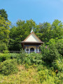
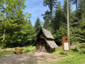
(1) Carry on straight ahead. Ignore the paths branching off to the right and left. The path turns right and heads further into the forest. Follow it for a few metres, then turn left and follow the Badischer Panoramaweg. Pass a lovely little chapel and continue to the right until, after several bends, you reach the “Auf der Eck” viewpoint.

(2) Follow the ‘Auf der Eck-Wolfersberg’ path to the right, which leads through woods and meadows to the Wolfersberg.

(3) Follow the Schapsbrunnenweg 2 on the right to Hagenberg, where there is a small schnapps fountain (make sure you have some change so you can buy a drink, schnapps or something else).

(4) Continue along the small road that climbs to the left, passing the “Hagenbergstübel” to reach the Brünnele.

(5) Carry on straight ahead until you reach a crossroads where the Schönbüch Haus is situated. At the bend, turn right – without crossing the road – and follow thefirst path that climbs to the right. Then ignore the next two paths that appear, one on the left and one on the right, and carry on straight ahead until you come to two paths, one after the other and close together, on the left.

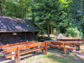
(6) Ignore thefirst one and follow thesecond, on the left, which climbs towards the Kammet, then descends to the “Blockhütte” rest area.

(7) Turn right and continue uphill for about 150 m, then follow the path down to the left towards Iberg.

(8) Turn left and continue down to Langenberg.

(9) Follow the path on the left to the next junction.

(10) Turn right at the hairpin bend and head towards Kappelrodeck.

(11) Turn left and head towards Ibergstrasse. Cross the railway line via the pedestrian underpass, then walk alongside the railway line to reach the car park at Kappelrodeck station (S/E).

Waypoints

  1. S/E : mi 0 - alt. 689 ft - Car park at Kappelrodeck station
  2. 1 : mi 0.54 - alt. 728 ft - Steinebach crossroads
  3. 2 : mi 1.67 - alt. 1,201 ft - Auf der Eck
  4. 3 : mi 2.59 - alt. 1,558 ft - Wolfersberg
  5. 4 : mi 3.08 - alt. 1,919 ft - Hagenberg
  6. 5 : mi 3.67 - alt. 2,090 ft - Brünnele
  7. 6 : mi 4.14 - alt. 2,215 ft - Crossroads
  8. 7 : mi 5.18 - alt. 1,880 ft - ‘Blockhütte’ rest area
  9. 8 : mi 6 - alt. 1,348 ft - Iberg
  10. 9 : mi 6.71 - alt. 1,043 ft - Langenberg
  11. 10 : mi 6.84 - alt. 984 ft - Hairpin bend
  12. 11 : mi 7.25 - alt. 814 ft - Kappelrodeck
  13. S/E : mi 7.81 - alt. 689 ft - Car park at Kappelrodeck station

Notes

You can have a picnic near the chapel above Kappelrodeck, at Hagenberg and at the ‘Blockhütte’ rest area.
There are also several benches along the route where you can take a break.

Worth a visit

There is a schnapps fountain along the route.
Before the Simmehof (after point (8)), you can take a short detour to admire the “Lourdes Grotto”.
At the Simmehof, you can buy chilled drinks.

Reviews and comments

4.3 / 5
Based on 2 reviews

Reliability of the description
4 / 5
Ease of following the route
4 / 5
Route interest
5 / 5
tchequemat
tchequemat

Overall rating : 4.3 / 5

Date of your route : Sep 28, 2026
Reliability of the description : ★★★★☆ Good
Ease of following the route : ★★★★☆ Good
Route interest : ★★★★★ Very good
Very busy route : Yes

Machine-translated

carlospirtu
carlospirtu

Overall rating : 4.3 / 5

Date of your route : Apr 27, 2026
Reliability of the description : ★★★★☆ Good
Ease of following the route : ★★★★☆ Good
Route interest : ★★★★★ Very good
Very busy route : No

A lovely walk, with an elevation gain of around 300 metres. Highly recommended

Machine-translated

Other walks in the area

For more walks, use our search engine .

The GPS track and description are the property of this route's author. Please do not copy them without permission.