The Saint-Sépulcre circular route starting from the Mirabeau Bridge

A circular route for mapping the terrain in a little-visited area.
Best done in the opposite direction.

Details

17198368
Creation:
Last update:
Last review:
  • Walking
    Activity: Walking
  • ↔
    Distance: 6.96 mi
  • ◔
    Average duration: 4h 20 
  • ▲
    Difficulty: Difficult

  • ⚐
    Back to start: Yes
  • ↗
    Ascent: + 1,270 ft
  • ↘
    Descent: - 1,273 ft

  • ▲
    Highest point: 1,880 ft
  • ▼
    Lowest point: 771 ft

Photos

Description of the walk

Park in the car park at the Chapelle Sainte-Madeleine on the right bank of the Durance at the Mirabeau Bridge.

(S/E) With your back to the chapel, head north along theGR®9, which runs alongside the road to the village of Mirabeau, until you reach the junction by the sewage treatment works.

(1) Continue along theGR® to the crossroads before the village. Turn right onto the road, then onto the path that follows it to reach the Chapelle de la Heath. Keep to the right to continue along the straight path through the woods and reach a large circular loop on the left: there is a geocache here.

(2) Continue along this path, passing the chapel once more, and then return to the crossroads by the sewage treatment plant, turning left.

(1) Turn right onto the wide track, pass under a power line, and carry on to the disused quarry.

(3) Turn right, walk alongside a field, turn right again and then head off-trail in a generally westerly direction to reach the pylons at the Plaine de Saint-Sépulcre.

(4) Turn left onto the yellow-markedPR® path, reach the point beneath the power line, follow it and, at a place called Lescaran, you’ll come to a crossroads of paths.

(5) Here you have two options:
- either look for the old path on the left, which was partially spared by the fire, and join the track on the right bank of the Durance,
- or keep to the right on thePR® to reach the track on the right bank of the Durance directly (choice of route).

(6) In both cases, take this track to the left. Pass by the foot of the climbing site to then reach the car park at the Chapelle Sainte-Marguerite (S/E).


Waypoints

  1. S/E : mi 0 - alt. 794 ft - Sainte-Marguerite Chapel car park - La Durance
  2. 1 : mi 1.15 - alt. 984 ft - Crossroads at the sewage treatment works
  3. 2 : mi 1.86 - alt. 1,129 ft - Geocache
  4. 3 : mi 3.56 - alt. 1,010 ft - Former quarry
  5. 4 : mi 4.71 - alt. 1,870 ft - Pylons
  6. 5 : mi 5.37 - alt. 1,355 ft - Lescaran crossroads
  7. 6 : mi 5.62 - alt. 814 ft - Durance track - La Durance
  8. S/E : mi 6.96 - alt. 791 ft - Sainte-Marguerite Chapel car park

Notes

There are no water points on this route.

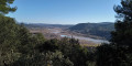
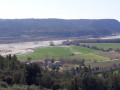
(2) View of the valley and geocache.

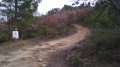
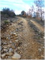
(3) Path leading to the disused quarry. At this point, there is a rock barrier to prevent motorbikes and quad bikes from passing; continue straight on to reach the top of the quarry and see it.

Between (4) and (5), look out for the 2017 fire line to the south-east.

Worth a visit

Always be cautious and plan ahead when you're outdoors. Visorando and the author of this route cannot be held responsible for any accidents occurring on this route.

The GR® and PR® markings are the intellectual property of the Fédération Française de Randonnée Pédestre.

Reviews and comments

3.2 / 5
Based on 6 reviews

Reliability of the description
2.6 / 5
Ease of following the route
3.2 / 5
Route interest
3.8 / 5
Pascale C2.
Pascale C2.
• Edited:

Thank you for your comments and suggestions. I’ll probably do this route again with a walking group from Vinon, as I’d organised a map-reading quiz for them in 2021 and they really enjoyed it. And I’m going to do my quiz again, but in the opposite direction...

Machine-translated

Vincent Delcroix
Vincent Delcroix

Overall rating : 4 / 5

Date of your route : Jan 26, 2025
Reliability of the description : Not used / Not applicable
Ease of following the route : ★★★☆☆ Average
Route interest : ★★★★★ Very good
Very busy route : No

A magnificent walk that you absolutely must do in the opposite direction to the signposted route (the directions I give below are for the opposite direction).
Three points to bear in mind: 1) The path along the banks of the Durance is unfortunately noisy due to the motorway and the A-road 2) Do not undertake this walk with young children and/or if it has rained recently: the climb is very steep and very stony, and near the highest point there is a sharp limestone pavement. 3) Without a GPS, the Visorando app and an IGN map, I would advise against setting off. In fact, part of the suggested route between points 4 and 3 is impassable, overgrown with vegetation (the impassable section begins where the track crosses the 350-metre contour line on the IGN map). This isn’t a problem, as there are alternative paths that are easy to find if you have a GPS and the map. Otherwise, it must be very tricky.
Finally, here’s a nice little variation: still following the route in reverse, about 50 metres before point 2, take the small path on the left. This leads down towards Mirabeau station and joins the Chemin de la Fangade. It shortens the walk slightly and means you don’t have to go back the same way.

Machine-translated

Pascale C2.
Pascale C2.

I’m a bit hesitant to remove access to this route on Viso Rando – it’s already really difficult in this direction, and it’s made even harder by the need to clear undergrowth beneath the power line.
The route remains an interesting option for a circular walk starting from the Mirabeau Bridge, but it’s only for experienced walkers: you’ll need to plan your route carefully, and the gradients are sometimes very steep.
I’ll certainly be doing the route the other way round in 2025, complete with a map-reading quiz, for the “Randonnée Découverte” group from Vinon-sur-Verdon, and I’ll try to post a link so that everyone can enjoy it.
Pascale

Machine-translated

kayakceur
kayakceur

Overall rating : 3.3 / 5

Date of your route : Dec 25, 2023
Reliability of the description : ★★★☆☆ Average
Ease of following the route : ★★★☆☆ Average
Route interest : ★★★★☆ Good
Very busy route : Yes

Regarding point 3, do not try to go under the power line – there is no longer a path there.
I can confirm that the descent is very dangerous.

Machine-translated

godillot1
godillot1

Overall rating : 3 / 5

Date of your route : Jan 05, 2023
Reliability of the description : ★★★☆☆ Average
Ease of following the route : ★★☆☆☆ Disappointing
Route interest : ★★★★☆ Good
Very busy route : No

Clearing of undergrowth beneath the power line makes it difficult to spot the path.
I can confirm that the descent is very dangerous.

Machine-translated

Eric 04100
Eric 04100

Overall rating : 2.3 / 5

Date of your route : Feb 06, 2022
Reliability of the description : ★☆☆☆☆ Very disappointing
Ease of following the route : ★★★★★ Very good
Route interest : ★☆☆☆☆ Very disappointing
Very busy route : No

Very dangerous descent towards the end; a very difficult walk

Machine-translated

marcheur97400
marcheur97400

Overall rating : 3.7 / 5

Date of your route : Jan 26, 2022
Reliability of the description : ★★★☆☆ Average
Ease of following the route : ★★★☆☆ Average
Route interest : ★★★★★ Very good
Very busy route : No

A very interesting walk offering beautiful views of the Durance from Cadarache to Peyrolles, the Bèdes plateau (and beyond) and the village of Mirabeau.
Whilst the first part is easy (a circular loop around the Notre-Dame de la Garrigue chapel), the ‘descent’ (it’s more of a run down) from the St Sépulcre plateau to the banks of the Durance is very steep, tricky at every turn, and follows a path that isn’t always easy to follow. I’d say the overall difficulty is ‘difficult’ rather than ‘moderate’. It’s very hard on the knees – and that’s an understatement!
Furthermore, between (3) and (4), there’s no point in getting lost ‘off-track’ beneath the power line, risking a fall into the crevices of the ravine, when you can simply take the track and then a path marked in red (though not very visible) which will lead you easily to the pylons at the Plaine du Saint Sépulcre.
Thanks to the author of this… physically demanding route!

Machine-translated

Pascale C2.
Pascale C2.

Yes, it’s a route that’s still worth a mention.
Actually, it’s better to do it the other way round to spare your knees, as it’s really steep above the Durance.
As for the section from the quarry, after WP3, my old GPS had unfortunately plotted a straight route. And it’s easier to reach and follow the power line halfway up the hill!
Thank you for doing the suggested walk and for your comments.
It’s great.
I’d also put together a 20-question map-reading quiz tailored to this walk for small groups.

Machine-translated

phildaix
phildaix

Overall rating : 3.3 / 5

Date of your route : Dec 15, 2021
Reliability of the description : ★★★☆☆ Average
Ease of following the route : ★★★☆☆ Average
Route interest : ★★★★☆ Good
Very busy route : No

Magnificent views of the snow-capped Alps; and lovely views of the Durance – it’s well worth a visit!
The route description and accompanying map are inaccurate in two places:

- After going round the field at WP3, you’re told to head broadly west; except that the terrain is very rugged (rocks of all sizes) and the vegetation very dense (thorny); we assumed we had to follow the power line, aiming for the large red and white pylon right at the far end: but it was a real struggle and didn’t seem to match the route on the map (which itself doesn’t run in a straight line); in the end, we ended up on a path, still close to the power line – and marked in red, incidentally – which must not be the one intended by the guidebook…
- after reaching that large red and white pylon (WP4), we followed the track, even though the guidebook fails to mention that you have to leave it by turning left – though we didn’t actually see a path either; this track turns into a very steep, stony and slippery path, eventually leading to the south-west of WP6; so another struggle and a long detour.

But with a few more details, it’s still a lovely walk!

Machine-translated

Other walks in the area

For more walks, use our search engine .

The GPS track and description are the property of this route's author. Please do not copy them without permission.