Country:

 City:


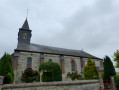
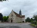
Park in Rue du Hameau in Bouchevilliers, quite close to the church and the town hall.
(S/E) With your back to the church, at the foot of the church, turn right and head up the hill until you reach a T-junction after the last house.
(1) Turn right onto Route des Chasses-Marées. At the X-junction that follows, continue straight ahead towards La Rouge Mare until you reach a junction opposite a walled property.
(2) Turn left onto Route le Camp Adam and carry on to the next junction. Turn right onto Rue de la Rouge Mare and head downhill to the junction which forms a triangle at its centre: Place des 3 Sapins in the village of Les Flamands.
(3) Keep to the left-hand side of the road and carry on straight ahead along Rue Pichard until you reach the next junction. Turn left, then left again to take Rue des Duprés. After the last house, follow the road as it curves to the right onto Route forestière des Flamands, enter the forest and continue until you reach a crossroads.
(4) Turn right onto Route forestière des Écouflards. Go straight on, ignoring the turn-offs to the right and left, and follow the hairpin bend to the right. Pass through the forest gate and arrive at a junction. Cross the road, turn right onto the D1 and head towards the sign: Forêt Domaniale de Lyons.
(5) Turn onto the path on the left, just after the sign and before the bend. At the next junction, turn left and follow the track. At the next Y-junction, turn right and follow the forest track uphill until you reach the road, Rue de Folleville.
(6) Turn right onto this road and continue along it after leaving the forest to reach the village of Neuf-Marché, near the cemetery.
(7) Turn left into Rue de la Madeleine, go past one junction and continue downhill to the junction with the traffic lights. Cross the road at the pedestrian crossing, then head straight ahead into Rue Jules Ferry, pass the town hall and arrive at the Saint-Pierre Collegiate Church.
(8) Facing the church entrance, take the path on the left. Turn left at the first junction, passing between two concrete posts. Walk past the houses until you reach the road, Avenue Abbé Lucien Bodin or the D915, and turn right. On leaving the village, take thefirst road on the right, Rue des Sablons, and continue to the village of Varges.
(9) Turn right onto Rue du Gué. At the end, keep right and cross the bridge over the Epte. Continue straight on, crossing the railway lines, until you reach a wayside cross at the entrance to the village of Saint-Pierre-es-Champs.
(10) Turn right onto Route de Bretel. Walk between the town hall and the church of Saint-Pierre-es-Champs and, at the junction, continue straight on along Rue de l’Irompha until you reach the village of Montel at the junction with the D104.
(11) Head straight ahead onto Rue de Montel and immediately turn left, following theGR® signposts. After the last house, turn right onto the small path markedGR®. Follow this path, which runs alongside houses on your right and a meadow on your left, until you reach a road, Route de Puiseux.
(12) Turn left and continue straight ahead along Rue de la Fontaine Cousin. At the end of the road, continue along the track; turn into thefirst track on the left, follow it to the road (Rue de la Croix d’Épine), then turn right to reach the D15b.
(13) Cross it carefully at the pedestrian crossing. Continue straight ahead along Rue des Grands Prés. Ignore a turn-off to the left, follow the road as it bends to the right, cross the bridge over the Epte and continue uphill to the car park on Rue du Hameau (S/E).

 Visorando Member
 Easy

 Moderate