The Côte Blanche in Ernemont-la-Villette

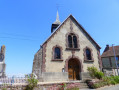
Before setting off on the route, take the time to enjoy the charm of this little Norman village and its Saint-Martin Church, dating from the 17th and 18th centuries.

Details

3105309
Creation:
Last update:
Last review:
  • Walking
    Activity: Walking
  • ↔
    Distance: 2.93 mi
  • ◔
    Average duration: 1h 35 
  • ▲
    Difficulty: Easy

  • ⚐
    Back to start: Yes
  • ↗
    Ascent: + 292 ft
  • ↘
    Descent: - 308 ft

  • ▲
    Highest point: 696 ft
  • ▼
    Lowest point: 400 ft

Photos

Description of the walk

Parking is available in the car park next to the town hall and opposite the church.

Green signposts

(S/E) Leave the car park, turn right and walk past the town hall and the church. Turn right onto the first path and follow it to the end to join the D916 at a hairpin bend.

(1) Take the road immediately on the left, Rue du Château d’Eau. Walk up the hill, admiring the changing scenery, until you reach the first path on the left. Pass under two power lines.

(2) Turn left and follow the track to a house. At the house, the track branches off to the right; depending on the season, it may be more or less visible due to tall grass and the amount of footfall.

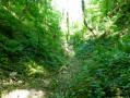
(3) At the end of the track, carefully head down the short stretch of path on the left (quite steep and very slippery in wet weather) to reach the gully, which serves as a path. After the gully comes a path (with tall grass depending on the season); follow it to the cultivated field. Turn right for 4 m and then turn left across the field to head down to a road, passing under two power lines.

(4) At the road, continue left along Rue de l’Église (D221) and turn right onto the next road, Rue de la Carel. Turn left immediately onto Rue de la Villette.

(5) Turn left onto the first track, then follow the path uphill, which is more or less overgrown. Turn left again at the next track and join the tarmac road, Chemin des Gosselins. At the T-junction further on, veer left to reach the car park next to the town hall (S/E).


Waypoints

  1. S/E : mi 0 - alt. 449 ft - Car park next to the town hall, Rue de l’Église
  2. 1 : mi 0.9 - alt. 591 ft - Rue du Château d’Eau
  3. 2 : mi 1.21 - alt. 692 ft - Path on the left
  4. 3 : mi 1.48 - alt. 696 ft - Descent into the ravine
  5. 4 : mi 1.79 - alt. 502 ft - Rue de l’Église
  6. 5 : mi 2.31 - alt. 400 ft - Rue de la Villette
  7. S/E : mi 2.93 - alt. 449 ft - Car park next to the town hall, Rue de l’Église

Notes

This ‘Quatre Rivières en Bray’ route No. 9 is signposted in green from start to finish, though there are a few gaps in places.

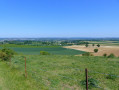
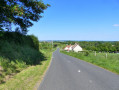
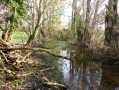
As you walk, you’ll make your way through lush greenery, lulled by birdsong. A few kilometres further on, the landscape will change once more, offering you a panoramic view of the Pays de Bray and its characteristic scenery. Cuesta, marl pits, cultivated fields and pastures – the area is truly diverse! You’ll then head down into a wood full of ash trees. Please take care and take your time! If it has rained in the days leading up to your visit, the ground may be a little slippery.

Worth a visit

The 17th- and 18th-century Saint-Martin Church in Ernemont.
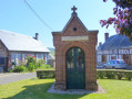
Saint-Vincent Chapel in Launay.
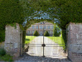
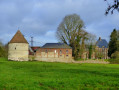
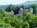
The former castle of Ernemont-la-Villette.

Reviews and comments

5 / 5
Based on 2 reviews

Reliability of the description
5 / 5
Ease of following the route
5 / 5
Route interest
5 / 5
Saka
Saka
• Edited:

Overall rating : 5 / 5

Date of your route : Jan 22, 2023
Reliability of the description : ★★★★★ Very good
Ease of following the route : ★★★★★ Very good
Route interest : ★★★★★ Very good
Very busy route : No

A lovely little walk to get back into the swing of things, even in cold weather. I even came across a doe having a little nap, just behind a small copse near some houses.
Thanks, I really enjoyed it.

Machine-translated

benoitrando
benoitrando

Thank you, Martin, for showing an interest in this route; it’s true that the ascent and descent are quite steep and cover a fair distance.
Kind regards
Benoit

Machine-translated

Martin Ader
Martin Ader

Overall rating : 5 / 5

Date of your route : Sep 27, 2020
Reliability of the description : ★★★★★ Very good
Ease of following the route : ★★★★★ Very good
Route interest : ★★★★★ Very good
Very busy route : No

A superb trail for exploring the Bray region.
Breathtaking views from the top of the cliff
A descent through dense woodland, like a primeval forest
Climb back up towards the village along a sunken path through the woodland
A village well worth a visit

Steep climb (80m)
Steep descent

Machine-translated

Other walks in the area

For more walks, use our search engine .

The GPS track and description are the property of this route's author. Please do not copy them without permission.