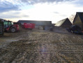
La Lande Renault

On the western plateau of the Pays de Bray, let’s explore the countryside shaped by the rhythms of nature and its agriculture on the edge of the Lyons Forest. In the 19th century, the ‘chasse-marée’ (tide-driven canal boat) passed through Bosc-Hyons.

Details

3102077
Creation:
Last update:
Last review:
  • Walking
    Activity: Walking
  • ↔
    Distance: 7.52 mi
  • ◔
    Average duration: 3h 40 
  • ▲
    Difficulty: Moderate

  • ⚐
    Back to start: Yes
  • ↗
    Ascent: + 285 ft
  • ↘
    Descent: - 262 ft

  • ▲
    Highest point: 741 ft
  • ▼
    Lowest point: 502 ft

Photos

Description of the walk

Parking at the village square.

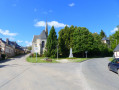
(S/E) Set off opposite the church and turn right onto Route de la Feuillie. Go up the hill, ignore a road on the right, and pass the ‘Out of Town’ sign.

(1) Ignore the path on the right marked with a green sign and continue along the D62 until you reach the junction with the signpost.

(2) Turn right onto Route de la Vallée Dollée, go under the power lines and carry on to the right-angled bend.

(3) Ignore the turn-off to the hamlet and continue along the path opposite. Follow the path until you reach the tarmac road at the hamlet of La Lande Renault. Carry on to the first junction, where you’ll see the sign for Beauvoir-en-Lyons and Le Clos Féron.

(4) Turn left onto Rue du Clos Féron, passing the hamlet of La Mare Ricard. At the junction, cross the road and take the path directly opposite. At the T-junction, turn right and continue to the road.

(5) Turn left onto the Route Principale (D 1). Ignore the first track on the right which leads between the houses and carry on straight ahead.

(6) Before a telecoms mast, turn onto the road on the right and follow the track until you rejoin the road after passing under the power lines.

(7) Turn right onto Rue du Bus. Cross a junction and carry on straight ahead onto Rue du Moulin. Continue straight on up the gentle slope until you reach the first house on the right-hand side in the hamlet known as Le Moulin.

(8) Take the track branching off to the right, just before the house, and carry on straight ahead across the fields. At one point, the track is difficult to make out due to the tall grass, but it remains visible if you look carefully. After the overhead power lines, the track ends; the ground slopes down and then up again. Simply follow the edge of the field, keeping to the right, until you reach the road further up – this is permitted.

(9) At the road, turn left onto Route des Carreaux, continue for about 150 metres and turn right onto the first path. Carry on along this grassy path, through the fields, and join the road just after the barn.

(1) Turn left onto the Route de la Feuillie and, immediately after the Bezancourt sign, veer left onto the Vieille Rue. Follow this road to the village square (S/E).

Waypoints

  1. S/E : mi 0 - alt. 505 ft - Village square
  2. 1 : mi 0.43 - alt. 597 ft - Crossroads at the circular loop
  3. 2 : mi 1.12 - alt. 623 ft - Route de la Feuillie
  4. 3 : mi 1.5 - alt. 633 ft - Route de la Vallée Dollée
  5. 4 : mi 2.64 - alt. 712 ft - Rue du Clos Féron
  6. 5 : mi 3.22 - alt. 728 ft - Main Road
  7. 6 : mi 3.52 - alt. 738 ft - Turn right at the fork
  8. 7 : mi 4.72 - alt. 686 ft - Rue du Bus
  9. 8 : mi 5.42 - alt. 673 ft - A place known as Le Moulin
  10. 9 : mi 6.03 - alt. 686 ft - Route des Carreaux
  11. S/E : mi 7.52 - alt. 502 ft - Village square

Worth a visit

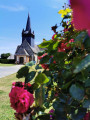
Saint-Aubin Church.
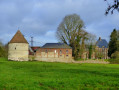
Charles VII’s manor house, dating from the 16th century.
The Landel Glassworks.
La Pierre qui Tourne, menhir.

Reviews and comments

4 / 5
Based on 3 reviews

Reliability of the description
4.3 / 5
Ease of following the route
4.7 / 5
Route interest
3 / 5
Obé
Obé

Overall rating : 3 / 5

Date of your route : Oct 08, 2022
Reliability of the description : ★★★★☆ Good
Ease of following the route : ★★★★☆ Good
Route interest : ★☆☆☆☆ Very disappointing
Very busy route : No

high-voltage power line, wind turbines, tarmac, apart from the starting village, a rather uninspiring route

Machine-translated

bruno de gisors
bruno de gisors

Overall rating : 4 / 5

Date of your route : May 26, 2021
Reliability of the description : ★★★★☆ Good
Ease of following the route : ★★★★★ Very good
Route interest : ★★★☆☆ Average
Very busy route : No

Hi, regarding the parking arrangements: the village square is very small, so we can leave the spaces for residents. There is a car park at the top of the road that branches off to the left of the church. The small grassy section between markers 1 and 9 was simply impassable. We have split the route into two sections; the other section will be completed at a later date. Kind regards

Machine-translated

grandin
grandin ★
reveljfmm
reveljfmm

Overall rating : 5 / 5

Date of your route : Jun 30, 2020
Reliability of the description : ★★★★★ Very good
Ease of following the route : ★★★★★ Very good
Route interest : ★★★★★ Very good
Very busy route : No

Even on a cloudy day, this route is brilliant
Thanks to the creator
I’ve been trying to create my own route in Mont Saint Aignan (76) but to no avail: there’s no set procedure for doing so. Please could you help me?

Machine-translated

Other walks in the area

For more walks, use our search engine .

The GPS track and description are the property of this route's author. Please do not copy them without permission.