La Hêtraie and the Rouge Mare monument

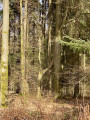
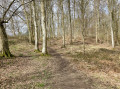
Discover the flora and fauna of the Lyons State Forest and the Rouge Mare memorial site.

Details

n°2153680
Creation:
Last update:
Last review:
  • Walking
    Activity: Walking
  • ↔
    Distance: 8.69 mi
  • ◔
    Average duration: 4h 25 
  • ▲
    Difficulty: Average

  • ⚐
    Back to start: Yes
  • ↗
    Ascent: + 518 ft
  • ↘
    Descent: - 538 ft

  • ▲
    Highest point: 650 ft
  • ▼
    Lowest point: 371 ft

Photos

Description of the walk

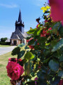
Park in the car park at Montroty church.

(S/E) At the rear of the church, with your back to the cemetery, set off along the path opposite and take the first path on the right. Pass two turnings on the right, follow the bend to the left and immediately take the first right. Continue to the T-junction and turn right, heading towards the road.

(1) Turn left onto the D1. Immediately take the first right, go past the forest gate, round the bend to the left and take the first right. Take the first path on the left – watch out for tall grass; the path is not very visible for the first few metres – there is a fuchsia marker on a wooden post. At the end of the track, at the T-junction, turn left and then immediately take the first track on the right; continue to the T-junction.

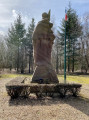
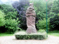
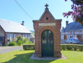
(2) Turn right onto the Route Forestière des Flamands and immediately take the first path on the left. Continue straight on, staying on the same path, until you reach the Route Forestière du Monument. At the road, turn left, go through the gate and immediately turn right to visit or pay your respects at the Rouge Mare Monument.

(3) Retrace your steps along the Route Forestière du Monument and continue straight on until you reach the Gros Bouleau junction.

(4) At the junction, take the second left onto the Route Forestière du Gros Bouleau. Carry on straight ahead; at the end, the path narrows and is not very visible for a few metres. Follow the path, ignoring two turn-offs to the right, and continue along this same path until you reach the junction, where you’ll find a boundary marker bearing the inscription XI 587 on the left.

(5) Turn right and carry on to the next junction with the Route Forestière de Viseneuil and the Route Forestière de la Haye.

(6) At the junction, turn right onto the Route Forestière de la Haye and continue to the junction at Rond des Quatre Cantons.

(7) At the Rond des Quatre Cantons, take the first left onto the Route Forestière du Robinet Cuit. Take the first track on the right until you reach the next junction.

(8) Take the second left. Carry on straight ahead, staying on the same track, which veers once to the right and once to the left, until you reach the Route du Bord du Bois.

(9) Turn right until you reach the next T-junction. Continue left onto the D1, Rue Godard. Go straight on, continue round the bend to the right and turn right at the first street to reach the car park at Montroty church (S/E).


Waypoints

  1. S/E : mi 0 - alt. 646 ft - Montroty church car park
  2. 1 : mi 0.81 - alt. 525 ft - Departmental Road 1
  3. 2 : mi 2.22 - alt. 568 ft
  4. 3 : mi 3.14 - alt. 568 ft - Rouge Mare Monument
  5. 4 : mi 3.73 - alt. 538 ft - Rond du Gros Bouleau
  6. 5 : mi 5.15 - alt. 427 ft - Viseneuil forest track
  7. 6 : mi 5.92 - alt. 564 ft - Crossroads, turn right
  8. 7 : mi 6.62 - alt. 489 ft - Rond des Quatre Cantons
  9. 8 : mi 7.39 - alt. 627 ft - At the crossroads, take the second left
  10. 9 : mi 7.84 - alt. 650 ft - Route du Bord du Bois
  11. S/E : mi 8.69 - alt. 646 ft - Montroty church car park

Notes

At the scene, there is a fuchsia-coloured marker which is more or less visible in certain places.

Worth a visit

The following is an extract from *Combat de la Rougemare et des Flamands*
The Rouge Mare memorial: On 16 September 1914, at around 8.30 am, Octavie Delacour, aged 56, left her home in the hamlet of Bord du Bois in the commune of Martagny and set off along the forest track to reach Ferrières-en-Bray. After walking for about 1 kilometre, a soldier dressed in an ash-grey uniform suddenly emerged, with a zigzag in hand, and signalled for her to stop. Following a discussion between the sentry and Captain Tilling, the latter allowed Octavie to continue on her way, but she had recognised the helmets and the language. Emerging from the forest near the Fieffé farm, she spotted two other sentries hidden in the thickets and made her way towards Neuf-Marché.
On arriving in Neuf-Marché, she warned the mayor that the Prussians were in the woods. The mayor sent the rural constable to investigate. He returned without having seen anything… he hadn’t been in the right place.
Continuing on her way, Octavie Delacour stopped at the 3rdGendarmerie Legion in Gournay-en-Bray at midday, where she set about proving that it was Prussians, not the English, who were in the forest keeping watch, and that these were the very same soldiers who had occupied the region during the 1870 war when she was about twelve years old. She did not entirely succeed in convincing the brigade commander, Sergeant Jules Crosnier, but he, mindful of his duty, decided to go and investigate the scene, arranging to meet up with the Mainneville brigade, based in the department of Eure, in order to pinpoint the location where these soldiers had been spotted.
After requisitioning a car, Sergeant Jules Crosnier (aged 47), constables Eugène Praets (aged 61) and Eugène Lebas (aged 43) – all three armed with revolvers and rifles – set off accompanied by Edmond Noiret, a deputy schoolteacher and member of the Civil Guard, Fernand Blacher, who knew the area well, and René Allée, the driver of the vehicle – the latter two being unarmed –. They arrived at the edge of the forest at 2.25 pm, spotted a German sentry hiding behind a tree and, moments later, came under heavy musket fire. The three gendarmes were killed instantly and Fernand Blacher was mortally wounded. Edmond Noiret hurried back to the car where the driver, René Allée, was waiting, and they set off towards Maineville, where, 200 metres further down the road, they met the gendarmes from that town, who had heard the gunfire and were arriving by bicycle. The sergeant alerted the police stations in Les Andelys and Étrépagny, which arrived on the scene quickly by car, accompanied by the sub-prefect of Les Andelys.

Reviews and comments

4.3 / 5
Based on 2 reviews

Reliability of the description
4.5 / 5
Ease of following the route
4 / 5
Route interest
4.5 / 5
benoitrando
benoitrando

Hello alexchuff,

I’d like some clarification, if you can provide it, following your comment, so that I can possibly change this route point.
At the end of point 1, I had written and transcribed the following, as I hadn’t seen any other route: At the end of the track, at the T-junction, turn left to join the Route Forestière des Écouflards.

Following your comment, it seems we could write: At the end of the track, at the T-junction, turn left and then take the first track on the right to join the Route Forestière des Flamands.

I’m waiting for your confirmation before changing anything.
Thanks in advance

Machine-translated

alexchuff
alexchuff

Overall rating : 4.3 / 5

Date of your route : Mar 28, 2021
Reliability of the description : ★★★★★ Very good
Ease of following the route : ★★★★☆ Good
Route interest : ★★★★☆ Good
Very busy route : No

A lovely, easy and smooth ride. A bit too flat and tough for my liking.
A few historical notes on the route.

Please note there is an error on the route: before point 2, you must turn right and not go all the way to point 2 if you want to follow the purple markings.

Machine-translated

benoitrando
benoitrando

Hello Bouzou37, where exactly did the route go wrong, please? This is so that I can correct it if possible.

Kind regards
Benoit

Machine-translated

Bouzou37
Bouzou37

Overall rating : 4.3 / 5

Date of your route : May 21, 2020
Reliability of the description : ★★★★☆ Good
Ease of following the route : ★★★★☆ Good
Route interest : ★★★★★ Very good
Very busy route : No

The route was not perfectly signposted with Red Discs. Between the signposts and the Visorando description, we only missed the right path once.
This walk is very enjoyable.

Machine-translated

Other walks in the area

For more walks, use our search engine .

The GPS track and description are the property of this route's author. Please do not copy them without permission.