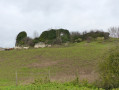
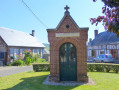
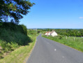
The Bois du Temple and Saint-Pierre Collegiate Church

Neuf-Marché lies on the border between the “boutonnière du Pays de Bray” and the Epte valley. The Epte once marked the border between the Kingdom of France and the Duchy of Normandy. Neuf-Marché has benefited from this unique location, as evidenced today by the richness of its heritage.

Details

2154332
Creation:
Last update:
Last review:
  • Walking
    Activity: Walking
  • ↔
    Distance: 8.02 mi
  • ◔
    Average duration: 4h 05 
  • ▲
    Difficulty: Moderate

  • ⚐
    Back to start: Yes
  • ↗
    Ascent: + 492 ft
  • ↘
    Descent: - 499 ft

  • ▲
    Highest point: 719 ft
  • ▼
    Lowest point: 269 ft

Photos

Description of the walk

Parking is available in the car park opposite the town hall.

(S/E) Opposite the town hall, turn right onto Rue Jules Ferry and continue to the traffic lights. Cross the avenue and turn into the street slightly to the left opposite, Rue du Bourg. Keep left immediately afterwards, then take the first right onto Rue Messent. At the end, turn right again onto Rue de la Poterne and continue to the first junction.

(1) Turn left onto Rue de la Madeleine. Ignore the next street on the right; walk past the cemetery and carry on to the junction with the D1. Continue carefully to the right, walking alongside the road.

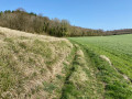
(2) Take the first small road on the right and continue along Chemin du Four à Chaux. At the T-junction, first turn right then left and carry on straight ahead between a cultivated field on your left and a row of trees on your right. Keep going straight along the path through the woodland and then across the fields.
At the end, the path turns left; turn right immediately between two wooded areas and carry on to the village of Montroty. Continue straight ahead along the tarmac road (Chemin de la Côte d’Oliviers).

(3) At the T-junction, turn right onto the tarmac road (Chemin de la Ravine), go downhill and then uphill again until you reach the four-way junction. Turn right onto Rue de Folleville, then take the first left onto Rue de la Mare aux Cerfs until you reach the right-angled left-hand bend.

(4) Leave the road and veer right to pass through the wooden barriers. Continue along a narrow path between cultivated fields and hedgerows. Carry on along this path, stepping over old concrete electricity poles lying across the way. At the last set of poles, there is a T-junction.

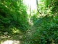
(5) Turn right to head down into the ravine: be careful, the ground is very slippery. Once you reach the field at the T-junction, first turn right then left to go down the path and reach the D221 road.

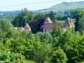
(6) Follow the road to the right; there is very little traffic. Keep going straight on, passing the Ferme des Verts, which is on the corner of the final right-hand bend, and continue to the wayside cross. Opposite is Vardes Castle.

(7) At the Stop sign, cross the D915 with care, turn right and, 60 metres further on, take the first left into Rue Saint-Rémy. In the next bend, keep right onto Chemin des Sablons, which continues as the street of the same name. Join the D915 at the entrance to the village.

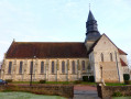
(8) At the T-junction, turn left and walk carefully along the road . In the wide left-hand bend that follows, take the first left into Rue de la Serrurerie. Once you’ve left the tarmac behind, take the grassy path; at the end, turn right, then left, then right to arrive in front of the Collégiale Saint-Pierre.

(9) Continue left along Rue du Moulin, passing the vicarage on your right, until you reach a T-junction. On the corner to your left is a steam engine.

(10) Turn right onto the Grande Rue and carry on to the traffic lights. Cross the D915 at the pedestrian crossing and continue straight ahead along Rue Neuve des Fosses for about 200 metres to reach the ruins of the fortified castle.

(11) Retrace your steps to the traffic lights, turn left for 10 metres and cross the D915 again using another pedestrian crossing. Then follow Rue Jules Ferry straight ahead to return to the car park (S/E).


Waypoints

  1. S/E : mi 0 - alt. 279 ft - Town hall car park
  2. 1 : mi 0.23 - alt. 308 ft - Rue de la Madeleine
  3. 2 : mi 0.68 - alt. 335 ft - Turn right at the fork
  4. 3 : mi 2.87 - alt. 633 ft - Chemin de la Ravine
  5. 4 : mi 3.78 - alt. 699 ft - Rue de la Mare aux Cerfs
  6. 5 : mi 4.33 - alt. 696 ft - 4th electricity pole, junction of footpaths
  7. 6 : mi 4.65 - alt. 502 ft - Rue de l’Église – D221
  8. 7 : mi 6.01 - alt. 318 ft - D 915 – Vardes Castle
  9. 8 : mi 6.84 - alt. 289 ft - D 915 – village entrance
  10. 9 : mi 7.4 - alt. 279 ft - Saint-Pierre Collegiate Church
  11. 10 : mi 7.57 - alt. 269 ft - Grande Rue, steam engine
  12. 11 : mi 7.82 - alt. 295 ft - Ruins of the fortified castle
  13. S/E : mi 8.02 - alt. 279 ft - Town hall car park

Worth a visit

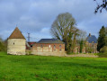
Vardes Castle (private), 17th century.
The former vicarage (1766) on Rue Saint-Rémy, on the right as you face the castle.
Saint-Pierre Collegiate Church (10th and 12th centuries).
The vicarage on Rue du Moulin (18th century).
The 19th-century steam engine.
Ruins of the 12th-century fortified castle.

Reviews and comments

4 / 5
Based on 4 reviews

Reliability of the description
4 / 5
Ease of following the route
4.5 / 5
Route interest
3.5 / 5
Thierryons
Thierryons

Overall rating : 4.5 / 5

Date of your route : Mar 29, 2025
Reliability of the description : Not used / Not applicable
Ease of following the route : ★★★★★ Very good
Route interest : ★★★★☆ Good
Very busy route : No

A really nice walk, although towards the end the route takes us along a busy main road. I’ve chosen an alternative route which involves taking, between points 7 and 8, 100 metres after Vardes Castle, Rue du Gué, then turning right in St Pierre-es-Champs onto Route de Bretel and finally onto Route de l’Irompha as far as point 10; it’s much safer.

Machine-translated

Templario
Templario

Overall rating : 4.3 / 5

Date of your route : Jun 10, 2024
Reliability of the description : ★★★★★ Very good
Ease of following the route : ★★★★★ Very good
Route interest : ★★★☆☆ Average
Very busy route : Yes

Thank you. There are plenty of routes and they’re well explained, though they’re sometimes a bit long for older people who are at a slight disadvantage due to certain mobility issues.

Machine-translated

benoitrando
benoitrando

I would go there in person to check this issue between points 4 and 5, but at the moment I’m unable to get there due to some minor health issues.
Thank you, vbv48, for reporting the problem.

Machine-translated

vbv48
vbv48
• Edited:

Overall rating : 3 / 5

Date of your route : Sep 10, 2022
Reliability of the description : ★★☆☆☆ Disappointing
Ease of following the route : ★★★★☆ Good
Route interest : ★★★☆☆ Average
Very busy route : No

The route is blocked between points 4 and 5 after the deer pond; there is no path and no access to the ravine; you must turn back and return to Neuf-Marché via the Bois du Temple (a dull tarmac road).
A map of the route is displayed outside the town hall, but it gives no indication of this insurmountable obstacle.

Machine-translated

ODPI
ODPI
• Edited:

Overall rating : 4.3 / 5

Date of your route : Jun 20, 2020
Reliability of the description : ★★★★★ Very good
Ease of following the route : ★★★★☆ Good
Route interest : ★★★★☆ Good
Very busy route : No

A pleasant walk along paths that often run along the edge of woods, sometimes through the undergrowth, and with a few sections on tarmac. The route is very well maintained. At any rate, when we did it, the paths had been cleared of undergrowth.

Machine-translated

Other walks in the area

For more walks, use our search engine .

The GPS track and description are the property of this route's author. Please do not copy them without permission.