Forest walk around Lautenbach

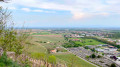
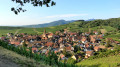
Starting from Buhl, this route takes you mainly through woodland. You’ll climb up to the Col de Bannstein, then cycle close to the Engelstein, above Lautenbach, enjoying a lovely view, before cycling around the Demberg.

Details

n°18678634
Creation:
Last update:
Last review:
  • Mountain biking
    Activity: Mountain biking
  • ↔
    Distance: 11.28 mi
  • ◔
    Duration according to the author: 3 hrs 
  • ▲
    Difficulty: Moderate

  • ⚐
    Back to start: Yes
  • ↗
    Ascent: + 1,312 ft
  • ↘
    Descent: - 1,299 ft

  • ▲
    Highest point: 1,991 ft
  • ▼
    Lowest point: 1,119 ft

Photos

Description of the route

Parking is available at the car park in front of Buhl School.

(S/E) From the car park, walk down to the Stop sign. Turn left, then immediately right onto the Pont du Cordonnier. At the end of the street, turn right onto Rue Saint-Gangolf.
At the Stop sign, turn left onto Rue de la Gare (where the Blue Disc signposting begins), then carry on straight ahead at the traffic lights. Take the first left onto Rue de la Liberté, and turn right at the next Stop sign. Leave Buhl.

(1) Shortly after entering the forest, at the three-way junction, continue to the left.

(2) Walk past the back of the Saint-Gangolph Chapel, then, at the next junction, take the path that continues to climb, slightly to the right.

(3) Once you reach the Col de Bannstein (end of the Blue Disc markings), follow the road to the left for a few metres, then turn left. Descend for about 300 m, then take the first forest track on the right.
At the first junction, continue to the left (Red Ring markings) and enjoy a 1 km descent until you reach a three-way junction.

(4) Carry on to the right here and at the next junction to begin the ascent (start of the Blue Ring markings). At the picnic table, continue straight on to the summit.

(5) Once you’ve reached the summit, you can dismount and ride down to the Chaudron du Diable.
Then continue straight on and, after the viewpoint, begin a descent of approximately 2 km.
At the next junction, take the track on the left at an acute angle. Carefully make your way down the slope to join the D430.

(6) Cross the road, follow it down for 100 metres, then turn right to enter Lautenbachzell (end of the Blue Ring markings). In front of the town hall, turn left onto Rue des Fleurs, pass the school, then, at the Stop sign, turn right onto Grand Rue.

(7) Just before the bridge, turn right and follow the Chemin du Geffenthal (Blue Disc markings).

(8) At the junction of the forest tracks, continue left to head back down. Take care on the road at the bottom of the track.

(9) Turn sharply left and follow the road downhill to the Rimlishof.

(10) After passing a few houses on your left, look carefully for the footpath on the left – just before a small car park, also on the left – which leads to a bridge. Continue along the footpath.

(11) Back in Buhl, turn right into Rue du Breuel, then at the stop sign, turn left into Rue Florival, and finally left into Rue de l’École, just before the chemist’s, to return to the car park (S/E).

Waypoints

  1. S/E : mi 0 - alt. 1,129 ft - Car park on Rue de l’École near the - Église de Buhl
  2. 1 : mi 0.75 - alt. 1,217 ft - Junction
  3. 2 : mi 1.39 - alt. 1,332 ft - Chapelle Saint Gangolphe
  4. 3 : mi 2.12 - alt. 1,588 ft - Col du Bannstein
  5. 4 : mi 4.13 - alt. 1,555 ft - End of 1st descent
  6. 5 : mi 5.02 - alt. 1,962 ft - Le Chaudron du Diable
  7. 6 : mi 6.5 - alt. 1,362 ft - End of the second descent – Arrival at Lautenbachzell
  8. 7 : mi 7.15 - alt. 1,289 ft - Ascent to the Demberg - La Lauch
  9. 8 : mi 9.34 - alt. 1,499 ft - Start of the 3rd descent
  10. 9 : mi 9.91 - alt. 1,302 ft - Departmental road
  11. 10 : mi 10.57 - alt. 1,191 ft - Breitenbachrunz crossing
  12. 11 : mi 10.93 - alt. 1,145 ft - Entrance to Buhl
  13. S/E : mi 11.28 - alt. 1,129 ft - Car park on Rue de l’École

Notes

During or after heavy rain, the paths may be muddy.
There are several picnic tables available: at the Col du Bannstein (3), at Kreuzbach (between (4) and (5)) or by the roadside on the river side (6).

Worth a visit

(5) There are some lovely views across the whole of the Florival valley from the summit: at the Chaudron du Diable, slightly below the path, and a little further along the path itself, where there is a bench and an orientation table from which to enjoy the panoramic view.

(6) You’ll pass the Vivarium du Moulin, which is open during its opening hours.

Reviews and comments

5 / 5
Based on 1 review

Reliability of the description
5 / 5
Ease of following the route
5 / 5
Route interest
5 / 5
franck.neyer
franck.neyer

Overall rating : 5 / 5

Date of your route : Sep 28, 2026
Reliability of the description : ★★★★★ Very good
Ease of following the route : ★★★★★ Very good
Route interest : ★★★★★ Very good
Very busy route : Yes

It’s a shame that the descents are so often just wide tracks

Machine-translated

Other walks in the area

For more walks, use our search engine .

The GPS track and description are the property of this route's author. Please do not copy them without permission.