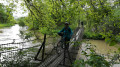
Above Guebwiller, between the forest and the vineyards

Starting from Buhl, this route takes you up to the Col de Bannstein via the village of Schweighouse, before entering the Schimberg Forest, which you’ll cross until you reach the vineyards near Bergholtz. You’ll then head back up the valley through the vineyards to the east of Guebwiller.

Details

21371622
Creation:
Last update:
Last review:
  • Mountain biking
    Activity: Mountain biking
  • ↔
    Distance: 10.45 mi
  • ◔
    Duration according to the author: 2 hrs 
  • ▲
    Difficulty: Moderate

  • ⚐
    Back to start: Yes
  • ↗
    Ascent: + 1,211 ft
  • ↘
    Descent: - 1,234 ft

  • ▲
    Highest point: 1,890 ft
  • ▼
    Lowest point: 981 ft

Photos

Description of the route

Parking is available in the car park in front of the school in Buhl.

(S/E) From the car park, walk down to the Stop sign. Turn left, then immediately right onto the Pont du Cordonnier. At the end of the street, turn left onto Rue Saint-Gangolf. At the Stop sign, continue slightly to the right onto Rue du Florival, then take the second right onto Rue du Montag. Cross the road carefully, then follow the cycle path to the left. At the ‘give way’ sign, continue to the right to enter Schweighouse.

(1) At the speed bump, turn right. Ride past the church, then at the three-way junction, turn right. Head left between numbers 25 and 27 on Rue Saint-Michel to climb up to the higher part of the village.
Back amongst the houses, take the first right onto Bannstein.

(2) Once past the Saint-Gangolph Chapel, at the crossroads, turn left (Red Ring markings) to enter the forest and begin the climb to the pass.

(3) At the pass, turn right, then immediately right again (marked with a Red Disc). Cycle on to the Col du Dreibannstein.

(4) Once you reach the pass and its mountain hut, turn left (Blue Triangle signpost) and follow the path down until you emerge from the forest at Egten (elevation 298) and arrive at a four-way junction as you enter the vineyard.

(5) Take the first right (Red Diamond sign). Cycle 1.5 km straight on to reach thesecond four-way junction.

(6) Turn right for a short climb. Do not enter the forest but continue along the path as it winds left. Follow the path through the vineyard until you come out onto a concrete road.

(7) Turn right to climb above the houses. Continue along the path round the first hairpin bend, then, at the junction at the foot of the trees, take the path that climbs the steepest, on the left. Keep going for 1.2 km until you reach the residential area. Go down the street, turning left at the first Stop sign.
Take care on the road. At the second ‘Stop’ sign, join the departmental road and turn right.

(8) At the traffic lights, turn right onto Rue du Trottberg. Take the first left and cycle through the residential area. Once you’ve left the residential area, carry on straight ahead to join the cycle path.

(9) At the end of the cycle path, turn left and cross the main road at the traffic lights. Pass the war memorial and then turn right. At the Stop sign, continue to the right and then left to reach the car park (S/E)

Waypoints

  1. S/E : mi 0 - alt. 1,129 ft - Car park on Rue de l’École
  2. 1 : mi 0.85 - alt. 1,201 ft - Schweighouse
  3. 2 : mi 1.81 - alt. 1,335 ft - Chapelle Saint Gangolphe
  4. 3 : mi 2.54 - alt. 1,585 ft - Col du Bannstein
  5. 4 : mi 4.64 - alt. 1,775 ft - Col du Dreibannstein (537m)
  6. 5 : mi 6.16 - alt. 984 ft - Bergholtz vineyard
  7. 6 : mi 7.08 - alt. 1,017 ft - Four-way junction
  8. 7 : mi 7.84 - alt. 1,024 ft - Crossroads
  9. 8 : mi 8.97 - alt. 1,017 ft - Trottberg - La Lauch
  10. 9 : mi 10.14 - alt. 1,119 ft - Buhl
  11. S/E : mi 10.45 - alt. 1,129 ft - Car park on Rue de l’École

Notes

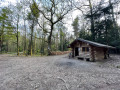
(4) Picnic tables and a mountain hut are available at the Col du Dreibannstein.

Worth a visit

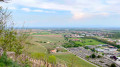
Between (5) and (7), you’ll pass the vineyards of the Grand Cru wines Kessler, Spiegel, Saering and, finally, Kitterlé.
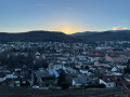
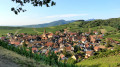
The walk offers beautiful views between (1) and (2), as well as between (5) and (8).

Reviews and comments

4.8 / 5
Based on 2 reviews

Reliability of the description
5 / 5
Ease of following the route
5 / 5
Route interest
4.5 / 5
filfcsm
filfcsm

Overall rating : 5 / 5

Date of your route : Apr 22, 2024
Reliability of the description : ★★★★★ Very good
Ease of following the route : ★★★★★ Very good
Route interest : ★★★★★ Very good
Very busy route : Yes

A lovely walk in the sunshine
Mainly through the vineyards

Machine-translated

filfcsm
filfcsm

Hello – a brilliant walk through woodland and vineyards
No particular difficulties
No issues with signposting

Have a lovely day

Filfcsm

Machine-translated

edualc
edualc

Overall rating : 4.7 / 5

Date of your route : May 20, 2022
Reliability of the description : ★★★★★ Very good
Ease of following the route : ★★★★★ Very good
Route interest : ★★★★☆ Good
Very busy route : Yes

Machine-translated

Other walks in the area

For more walks, use our search engine .

The GPS track and description are the property of this route's author. Please do not copy them without permission.