


Refine your search for walks in Dôme de Barrot (2135m)
Dôme de Barrot (2135m) walks


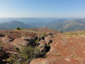
 Dôme de Barrot via Léouvé
 Visorando Member
 11.48 mi
 +3,999 ft
 -3,999 ft
 8h 45
 Difficult
 Departure from La Croix-sur-Roudoule (Alpes-Maritimes)
From Léouvé to the Dôme de Barrot, in the red rocks between Daluis and Cians.
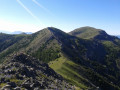
Dôme de Barrot, Cime du Pra and Tête de la Colombière
 14.22 mi
+3,041 ft
-3,018 ft
9h 10
Difficult
Departure from Péone (Alpes-Maritimes)
A walk starting from Valberg that crosses the resort’s ski area and a wilder section towards the end. From the top of these peaks, a remarkably colourful landscape unfolds below, featuring the characteristic red rocks of the Cians and Daluis. You can also admire the 360° views of the peaks (Mont Saint-Honorat on one side, Le Mounier and the Cime Nègre above Valberg on the other, etc.)
Tour du Raton via Les Granges d’Auvare and the Dôme de Barrot
 13.12 mi
+2,946 ft
-2,946 ft
7 hrs
 Very difficult
Departure from Beuil (Alpes-Maritimes)
A lovely circular walk above the Gorges du Cians through the red rock formations, relatively uncrowded with walkers and taking in a wide variety of landscapes. This walk offers two options: one involves a straightforward ascent to the Tour du Raton, whilst the other leads to the summit of the Dôme de Barrot, which offers a superb panorama of the Mercantour. An ideal spring hike to appreciate the shades of green and red above the gorges and enjoy the flowers at their peak.
Walks near Dôme de Barrot (2135m)
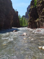
Daluis Gorges
 2.33 mi
+482 ft
-676 ft
1h 30
 Moderate
Departure from Guillaumes (Alpes-Maritimes)
A route at the bottom of the superb Daluis Gorges! A water hike to be undertaken only in good weather, ideal in summer during hot weather. A hike accessible to children who can swim. Closed shoes are essential.
This hike crosses a protected natural site that is subject to regulations. See practical information.
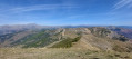
From the Pont des Roberts to Valberg via the Baisse du Barrot
 13.13 mi
+4,921 ft
-1,949 ft
8 hrs
Very difficult
Departure from Guillaumes (Alpes-Maritimes)
A beautiful, long, straight-line hike, with significant elevation gain but no technical difficulties. It requires at least two vehicles: one at the start and one at the finish.
From the Aygue Blanche bridge to Montagne de l’Estrop
 3.69 mi
+3,209 ft
-0 ft
4h 30
Difficult
Departure from Péone (Alpes-Maritimes)
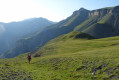
This hike is the first stage of a two-day circular route leading to the ascent of Mont Mounier.
Starting from the Pont d’Aygue Blanche near Péone, you’ll climb gradually towards the small plateau of the Montagne de l’Estrop, where you can camp in sheltered conditions. A stage through deciduous woodland and mountain pastures at the foot of the rocky ridge of the Montagne de l’Alp.
Ascent to the Roua bivouac from Puget-Théniers
8.34 mi
+3,714 ft
-837 ft
7h 05
Difficult
Departure from Puget-Théniers (Alpes-Maritimes)
A day’s hike to reach the Roua bivouac site. The walk starts from the terminus of bus route 675 coming from Nice. The stop at the Roua bivouac allows you to then complete a circular Daluis Gorges route or climb the Dôme de Barrot, which overlooks the Permian red pelite massif. You cross the gorges and the Roudoule Valley, with its steep, wild ravines. After the village of La Croix-sur-Roudoule, you complete the ascent via the Roman road through the landscape of red pelites.
From Puget-Théniers to Entrevaux via the Col de Vélacs
 7.84 mi
+2,776 ft
-2,543 ft
6h 00
Moderate
Departure from Puget-Théniers (Alpes-Maritimes)
A very beautiful walk running alongside and overlooking the Var valley. The varied woodland is very pleasant. The arrival at the citadel of Entrevaux, followed by the views over the Var valley and the village rooftops, are the highlight of the day.
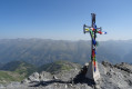
Mont Mounier as seen from the Montagne de l’Estrop
 10.63 mi
+2,703 ft
-5,919 ft
7 hrs
Very difficult
Departure from Péone (Alpes-Maritimes)
This hike forms thesecond stage of the ascent of Mont Mounier.
Starting from the Montagne de l’Estrop, you’ll climb to the Col de Crousette for a beautiful view over the valley of the same name and the Haute-Tinée. You’ll then reach the Mont Mounier ridge, which you’ll follow to the summit.
The descent takes you through the hamlet of La Colle before climbing back up towards the Tête de Charnaye, then down again towards the altisurface, and finally the final descent to the Pont d’Aygue Blanche.
Roure - Saint Dalmas Valdeblore
9.54 mi
+3,261 ft
-2,657 ft
7h 15
Difficult
Departure from Alpes-Maritimes
Étape de la traversée des Alpes avec un départ de Roure jusqu'à Saint Dalmas de Valdeblore.
Randonnée allant de la vallée de la Tinée à l'arrière pays niçois.
Gueydan Bridge – Entrevaux via the summit of La Lette
 10.68 mi
+3,665 ft
-3,845 ft
8h 05
Difficult
Departure from Saint-Benoît (Alpes-de-Haute-Provence) (Alpes-de-Haute-Provence)
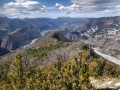
A beautiful, challenging route that keeps you on the ridgelines. The C-shaped configuration of the Var means that throughout this ascent you can admire the river’s banks on both the north and south sides. At the end of the hike, wander through the narrow streets lined with old walls in this magnificent village.
From the Longon Refuge to Saint-Dalmas
 15.05 mi
+3,540 ft
-5,518 ft
10h 00
Difficult
Departure from Alpes-Maritimes
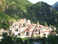
This nineteenth stage continues the long traverse of the Mercantour. From the Refuge de Longon, the path descends the Vallon du Longon diagonally across the slope to the hamlet of Rougios, before following the Fracha forest road and then taking a shortcut to the pretty Provençal village of Roure. Via a stony descent, it cuts across the hairpin bends of the M130 and M30 roads and reaches Saint-Sauveur-sur-Tinée, which it passes through before climbing up to the Chapelle Saint-Roch. Running along the hillside, it crosses the Vallon du Romarinier, passes through the hamlet of Roubinastre, crosses the Ravin de l’Esclosé and arrives at Rimplas. The GR®5 descends gently towards the small pass of Ragias and crosses the Vallon Gros, before climbing back up to the ridge on that side of the slope and then skirting the hamlet of La Bolline. From there, it climbs to the hamlet of La Roche and then ascends the ridge of the Vallon de Bramafam to reach Saint-Dalmas Valdeblore.
Roya - Roure
17.57 mi
+4,469 ft
-5,830 ft
12h 00
Difficult
Departure from Saint-Étienne-de-Tinée (Alpes-Maritimes)
Étape de la traversée des Alpes de Roya jusqu'à Roure. Randonnée allant de la Haute Tinée en passant par le Mercantour où l'on peut apercevoir des vautours. À l'approche du Col de Croussette un univers minéral nous attend puis un plateau quasi désertique pour finir par la douceur des pâturages de Roure.