Dôme de Barrot, Cime du Pra and Tête de la Colombière

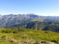
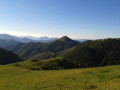
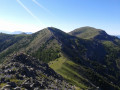
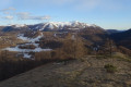
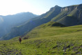
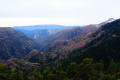
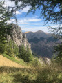
A walk starting from Valberg that crosses the resort’s ski area and a wilder section towards the end. From the top of these peaks, a remarkably colourful landscape unfolds below, featuring the characteristic red rocks of the Cians and Daluis. You can also admire the 360° views of the peaks (Mont Saint-Honorat on one side, Le Mounier and the Cime Nègre above Valberg on the other, etc.)

Details

1373016
Creation:
Last update:
Last review:
  • Walking
    Activity: Walking
  • ↔
    Distance: 14.22 mi
  • ◔
    Average duration: 9h 10 
  • ▲
    Difficulty: Difficult

  • ⚐
    Back to start: Yes
  • ↗
    Ascent: + 3,041 ft
  • ↘
    Descent: - 3,018 ft

  • ▲
    Highest point: 6,988 ft
  • ▼
    Lowest point: 5,492 ft

Photos

Description of the walk

In the centre of the village of Valberg, head for the meadow at the foot of the Garibeuil slopes. The start is the same as that of the Sentier Planétaire.

(S/E) Follow the Sentier Planétaire as it heads into the woods. Pass by Lac du Sénateur, the first artificial lake on the route (these lakes are relatively recent and do not appear on old maps, nor do some of the paths).

(1) At Lac du Sénateur, continue along the Sentier Planétaire and pass the Abri Sainte-Marie.

(2) A few metres past the Abri Sainte-Marie, the path joins a track. Continue along this track to the right, towards the Col des Anguillers.

(3) At Col des Anguillers (marker 24), you’ll come across the second artificial lake, Lac des Anguillers. Leave the Sentier Planétaire here and follow the track that climbs above the lake to marker 25.

(4) At marker 25, follow the track to the right towards the Col du Raton. The track winds round the mountain and descends to the pass.

(5) At the Col du Raton (marker 126), continue southwards along a hillside path (barely marked for the first few metres) towards Baisse de Barrot. Go round the small hill (elevation 1834) to your left, which lies to the south, and the path soon becomes more clearly marked.

(6) At the junction, below a shepherd’s hut, continue to the right and leave the path that leads down to the bottom of the valley.

(7) From the Baisse de Barrot (marker 130), head left up towards the Dôme de Barrot, following the ridge. The path is barely marked (or not marked at all), but the ascent presents no difficulty.

(8) After admiring the view from the Dôme de Barrot (2136m), head back down to the Baisse de Barrot.

(7) Climb up the other side towards the Cime du Pra. Here too, the path disappears.

(9) From the Cime du Pra (2,076 m), to reach the Tête de la Colombière, go round the rocky outcrop (labelled ‘la Courbaisse’ on the map) via the north-eastern slope. The path runs below. Join it where it emerges from the trees and follow it across the scree until you reach the ridge. The ascent to the Tête de la Colombière is straightforward along the ridge, although there is no clearly marked path.

(10) The Tête de la Colombière (2,060 m) is hidden a few metres behind the first summit. Return by retracing your steps. It will be easier to find the path this way. When the path fades away, below the Cime du Pra, continue on level ground until you reach a small path at the ridge. Follow it to the left until you reach the top of the Pas Brûlé ski lift.

(11) From the top of the Pas Brûlé ski lift, head back down the piste to reach the Col du Raton.

(5) Then return along the same route as on the way out until you reach the junction for the Abri Sainte-Marie.

(2) A few metres before Abri Sainte-Marie, the Sentier Planétaire leaves the track. Follow the track to the right, which goes round the Tête du Sapet and passes on the other side of Lac du Sénateur.
You can also follow the Sentier Planétaire to complete the route via the same path as on the way there.

(12) At Lac du Sénateur, continue along the track, which now goes round the Croix du Sapet. At the final hairpin bend, overlooking the Garibeuil building, leave the track and head straight down through the grass to the starting point (S/E).

Waypoints

  1. S/E : mi 0 - alt. 5,492 ft - Start: village centre - Valberg
  2. 1 : mi 0.79 - alt. 5,712 ft - Lac du Sénateur
  3. 2 : mi 1.67 - alt. 5,925 ft - Sainte-Marie shelter
  4. 3 : mi 2.2 - alt. 6,109 ft - (b.24) - Col des Anguillers (1859m)
  5. 4 : mi 2.78 - alt. 6,224 ft - Marker 25
  6. 5 : mi 3.66 - alt. 5,961 ft - (b.126) - Col de Raton (1818m)
  7. 6 : mi 4.86 - alt. 6,106 ft - Crossroads, turn right
  8. 7 : mi 5.37 - alt. 6,437 ft - Baisse de Barrot (b.130)
  9. 8 : mi 6.08 - alt. 6,969 ft - Dôme de Barrot (2135m)
  10. 9 : mi 7.15 - alt. 6,798 ft - Cime du Prat (2075m)
  11. 10 : mi 8.25 - alt. 6,749 ft - Tête de la Colombière
  12. 11 : mi 9.58 - alt. 6,490 ft - Top of the Pas Brûlé ski lift
  13. 12 : mi 13.23 - alt. 5,745 ft - Lac du Sénateur
  14. S/E : mi 14.22 - alt. 5,492 ft - Finish: village centre

Notes

There are no water sources along the route. The start and finish follow recently laid, family-friendly tracks and paths, but the most remote section requires sturdy footwear.

This route passes through a protected area, which may be subject to special regulations:

Reviews and comments

4.9 / 5
Based on 3 reviews

Reliability of the description
4.7 / 5
Ease of following the route
5 / 5
Route interest
5 / 5
Picson06230
Picson06230

Overall rating : 5 / 5

Date of your route : Jul 06, 2026
Reliability of the description : ★★★★★ Very good
Ease of following the route : ★★★★★ Very good
Route interest : ★★★★★ Very good
Very busy route : No

A lovely walk, which we had to cut short, limiting ourselves to the Dôme Barrot because of the heat.
Stunning views

Machine-translated

Escapades
Escapades

Overall rating : 5 / 5

Date of your route : May 27, 2024
Reliability of the description : ★★★★★ Very good
Ease of following the route : ★★★★★ Very good
Route interest : ★★★★★ Very good
Very busy route : No

I altered the route by skipping the La Colombière section, which I replaced with a circular loop via the Barrot dome along the ridge, offering superb views of the Auvare slope.

Machine-translated

Picson06230
Picson06230

Overall rating : 4.7 / 5

Date of your route : Jul 14, 2020
Reliability of the description : ★★★★☆ Good
Ease of following the route : ★★★★★ Very good
Route interest : ★★★★★ Very good
Very busy route : No

A walk offering some lovely views
.Take particular care on the return leg, which follows paths open to mountain bikes – especially when they’re coming downhill....
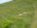
The start of the poorly marked path after the Col de Raton – which is said to be hard to spot – is just before some stone slabs (see attached photo). A solitary larch tree stands just beyond it, on the edge of the path we’ll take on the way back.

Machine-translated

Other walks in the area

For more walks, use our search engine .

The GPS track and description are the property of this route's author. Please do not copy them without permission.