Cians Cliffs

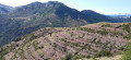
A unique walk through the landscape of the Gorges du Cians. The Cians, a small alpine torrent that is sometimes dry and sometimes raging during the snowmelt, flows into the Var upstream of Touët-sur-Var after carving out a 23-kilometre, acrobatic course, winding its way through the red rock via deep, narrow gorges.

Although I have classified this walk as difficult, this is only due to its distance and the sections exposed to the wind and sun (depending on the season). Nevertheless, apart from a few short sections that may prove tricky, it presents no technical difficulties.

Details

35717640
Creation:
Last update:
Last review:
  • Walking
    Activity: Walking
  • ↔
    Distance: 11.80 mi
  • ◔
    Average duration: 8h 10 
  • ▲
    Difficulty: Difficult

  • ⚐
    Back to start: Yes
  • ↗
    Ascent: + 3,133 ft
  • ↘
    Descent: - 3,133 ft

  • ▲
    Highest point: 6,552 ft
  • ▼
    Lowest point: 4,085 ft

Photos

Description of the walk

Park in the small car park just before the hamlet of Pré de Chaudi (marker 67).

(S/E) Ford the Cians to reach a small track on the left bank. Walk up to marker 72.

(1) Turn right onto the Sentier de la Pinéa and climb up a series of hairpin bends to the barns at Giarons (marker 74).

(2) Turn right, then left a few dozen metres further on to continue (south-east) to a wide dip at marker 76.

(3) Head down the slope opposite to reach marker 121.

(4) Turn right (south-west) onto a path that winds downwards around the long shoulder of Les Cluots, then heads east and passes two drinking troughs before narrowing.

(5) In the first large ravine, a rockfall forces you to lose 30 metres in height to avoid the obstacle. After a second ravine, the path continues to bend towards the south-east, descending very gently in a zigzag pattern beneath some remarkable ruiniform rocks. Pass marker 120, continue south-east to easily reach the Serre barns and marker 119.

(6) Turn right. The path is level at first, as it runs alongside an old water channel through layers of rock.

(7) This tricky but very short section crosses a small ravine, then this veritable goat’s path (in the literal sense) reaches the vast grassy plateau of Challas. Follow the markings carefully to reach Les Traverses, a hamlet of ruined barns.

(8) After the barns, follow a fairly wide old mule track down to the Ablé footbridge (marker 71).

(9) Cross the footbridge and head up the Route de Nice on the right for 1 km, following the Cians river, to reach the car park where you started (S/E).

Waypoints

  1. S/E : mi 0 - alt. 4,226 ft - Car park, marker 67
  2. 1 : mi 0.39 - alt. 4,354 ft - Marker 72
  3. 2 : mi 1.4 - alt. 5,420 ft - Granges de Giarons
  4. 3 : mi 2.75 - alt. 6,401 ft - Marker 76, Baisse
  5. 4 : mi 2.86 - alt. 6,358 ft - Marker 121
  6. 5 : mi 4.96 - alt. 5,699 ft - Gorge
  7. 6 : mi 6.29 - alt. 4,872 ft - Granges du Serre
  8. 7 : mi 8.26 - alt. 5,233 ft - Le Challas, a tricky section
  9. 8 : mi 10.26 - alt. 4,662 ft - Les Traverses
  10. 9 : mi 11.2 - alt. 4,085 ft - Ablé Footbridge - Cians (cours d'eau) - Affluent du Var
  11. S/E : mi 11.8 - alt. 4,222 ft - Car park, marker 67

Notes

Remember to bring enough water (around 2 litres or even 3 litres per person), depending on the season.

Worth a visit

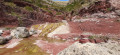
Throughout the walk, you’ll have the opportunity to refresh your knowledge of the region’s topography. Of particular note is the geological contrast between the crystalline bedrock of Le Barrot – recognisable by its red soils (pelites composed of volcanic sediments and lacustrine muds from the late Palaeozoic) – and the Beuil site, which sits on sedimentary sequences of marl and limestone deposited on the bedrock during the Mesozoic era.
In its original sense, a pelite is a finely detrital, clayey rock that forms a paste when mixed with water.

Reviews and comments

4.5 / 5
Based on 2 reviews

Reliability of the description
4 / 5
Ease of following the route
4.5 / 5
Route interest
5 / 5
Longpan
Longpan

Overall rating : 4 / 5

Date of your route : Aug 23, 2025
Reliability of the description : ★★★☆☆ Average
Ease of following the route : ★★★★☆ Good
Route interest : ★★★★★ Very good
Very busy route : No

A magnificent ride (completed on 23/08/2025), with two particularly remarkable sections:
- The beginning (points 1 to 4): breathtaking panoramic views of the Mercantour.
- The end (points 7 to 9): the corniches of the Cians offer magnificent landscapes.

Tip: If you're short on time, focus on one of these two sections.
For the "corniches" section (7-9), park 1 km further down at point 9.

Technical points:
The most challenging sections are between points 4 and 7, which, in my opinion, is not the most beautiful part of the route. However, it does allow you to complete the itinerary.

Corrections to the Visorando description:
- Point 5: There is no rockfall requiring a 30 m detour. Between the two watering holes (after the descent behind Les Clots) and Les Serres (point 6), the path is narrow in places and requires caution in 3-4 spots. It is also important to follow the yellow markings and posts.
- Point 7: The tricky section is not before the grassy plateau of Les Challas, but after it. However, it can be easily bypassed by climbing 2 m (yellow mark visible).
- From 7 to the forest: Follow the yellow markings and cairns carefully, as they are easy to miss.

Last point: Set off early to avoid herds, especially near the two watering holes, where a slightly technical section follows immediately (it is best to concentrate on the path rather than the sheepdogs...)

Machine-translated

oenolatre
oenolatre

Overall rating : 5 / 5

Date of your route : May 05, 2025
Reliability of the description : ★★★★★ Very good
Ease of following the route : ★★★★★ Very good
Route interest : ★★★★★ Very good
Very busy route : No

The first part of the walk takes you to a beautiful valley at the foot of the Cluots and the Tête de Giarons. After the B119, there is a lovely path that takes you high above the Cians gorges in a spectacular setting.
The route isn’t particularly difficult, but there are a few tricky sections on sloping pelite rock.
A brilliant walk that I highly recommend.

Machine-translated

Other walks in the area

For more walks, use our search engine .

The GPS track and description are the property of this route's author. Please do not copy them without permission.