Country:

 City:
City:


Park in the car park on Rue du Mont Mounier or on Place du Mercantour.
(S/E) From marker 1, take the path that climbs between the houses and leads to a road near a large shed. Head towards marker 2 on the left (Route de la Colle, the road closest to the shed).
(1) Follow Route de la Colle until you reach a three-way junction at marker 3.
(2) Turn right towards Picougul onto Route de la Rouille Basse. Follow this road until you reach a hairpin bend to the left.
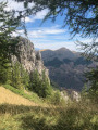
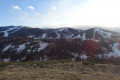
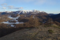
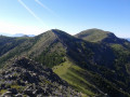
(3) Just before the bend, leave the road and head up to the right along a faintly marked path which joins the ridge path. Continue in this way to the summit of Picougul, which offers a lovely view of the slopes at Valberg, the Cluots, Mont Mounier and the Tête du Garnier.
(4) Return to the starting point via the same route (S/E).

 Visorando Member
 Difficult
  Local authority
 Moderate