Tour of the Berthaucourt Plateau

A brisk little walk with a nice little climb to start with, passing by the Resistance monument, then a descent towards Montcy-Saint-Pierre through the woods (with a lovely view of the two Montcys) before returning to the finish via the Voie Verte.

Details

n°34987629
Creation:
Last update:
–
Last review:
  • Walking
    Activity: Walking
  • ↔
    Distance: 2.93 mi
  • ◔
    Average duration: 1h 35 
  • ▲
    Difficulty: Easy

  • ⚐
    Back to start: Yes
  • ↗
    Ascent: + 226 ft
  • ↘
    Descent: - 230 ft

  • ▲
    Highest point: 715 ft
  • ▼
    Lowest point: 459 ft
  • ⚐ Country: France
  • ⚐ City: Charleville-Mézières (08090|08000)
  • ⚑
    Start/End: N 49.758566° / E 4.725669°
  • Accessible from the train station Gare de Charleville-Mézières.
  • ❏
    IGN map(s): Ref. 3009SB
  • Hour-by-hour weather

Photos

Description of the walk

The route starts at the Pont des Martyrs de la Résistance.

(S/E) Head towards the Theux neighbourhood. After the railway bridge (be sure to keep to the right – there’s no pedestrian crossing on the left!), continue until you reach the road on the left.

(1) Keep following the Chemin du Mémorial to the left. The road isn’t very busy, but you should still take care. Pass the Resistance Memorial on your left and continue for about a hundred metres towards the first houses at the top of Le Theux.

(2) Take the small tarmac road on the left and carry on to the end of the road, at the plant room.

(3) Go round it on the left. Once you’re behind the building, carry on along the path that leads away from it to the left, then turn left again at the next junction. Start heading down towards Montcy-Saint-Pierre along the Chemin de la Croix, all the way to the bottom.

(4) Turn left onto Rue du Bois en Val, which ends at the Voie Verte. Follow it, taking care of the many cyclists using the path.
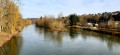
After the lock, the starting point bridge comes into view. A ramp on the left just before the bridge leads up to it (S/E).

Waypoints

  1. S/E : mi 0 - alt. 489 ft - Pont des Martyrs de la Résistance
  2. 1 : mi 0.14 - alt. 486 ft - Start of the Memorial Trail
  3. 2 : mi 0.98 - alt. 686 ft - Bourseul Crossroads, Clairons Memorial
  4. 3 : mi 1.24 - alt. 715 ft - Behind the plant room
  5. 4 : mi 1.7 - alt. 509 ft - Rue du Bois en Val – Greenway
  6. S/E : mi 2.93 - alt. 489 ft - Bridge of the Martyrs of the Resistance

Notes

There are no shelters or water points along the route.

Worth a visit

Once you reach the summit of the Berthaucourt plateau, you can visit the Memorial dedicated to the martyrs of the Ardennes Resistance. Engraved there are the names of the 506 male and female resistance fighters from the Ardennes who died during the occupation.
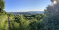
During the descent towards Montcy-Saint-Pierre along the Way of the Cross, you can admire the panoramic view overlooking the two Montcys: Saint-Pierre (now a district of Charleville-Mézières) and Notre-Dame in the background.

Reviews and comments

5 / 5
Based on 1 review

Reliability of the description
5 / 5
Ease of following the route
5 / 5
Route interest
5 / 5
User 13345107

Overall rating : 5 / 5

Date of your route : Sep 15, 2026
Reliability of the description : ★★★★★ Very good
Ease of following the route : ★★★★★ Very good
Route interest : ★★★★★ Very good
Very busy route : Yes

A lovely little walk just a stone’s throw from the town centre.
A cool, shaded stretch along the banks of the Meuse.
Stunning panoramic views of the town from the top of the plateau.
Easy and suitable for everyone

Machine-translated

Other walks in the area

For more walks, use our search engine .

The GPS track and description are the property of this route's author. Please do not copy them without permission.