Saint-Hilaire de Warcq Chapel, starting from Mézières

From Mézières to the Saint-Hilaire Chapel in Warcq via the Moulin de Prix and the Étang de la Warenne.
In front of the chapel, on the Saint-Hilaire plain, stood the Roman ford on the Reims–Cologne road via Warcq. (in *Terres Ardennaises*, 04/2020) This 11.5 km circular route, which is easy to follow and navigate, takes in the Moulin de Prix-les-Mézières, the Water Tower in Warcq and the Étang de la Warenne.

Details

12020749
Creation:
Last update:
Last review:
  • Walking
    Activity: Walking
  • ↔
    Distance: 7.07 mi
  • ◔
    Average duration: 3h 15 
  • ▲
    Difficulty: Moderate

  • ⚐
    Back to start: Yes
  • ↗
    Ascent: + 39 ft
  • ↘
    Descent: - 39 ft

  • ▲
    Highest point: 518 ft
  • ▼
    Lowest point: 463 ft

Photos

Description of the walk

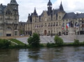
Start: Place de l’Hôtel de Ville, Mézières.

(S/E) Cross the Pont de la Victoire and turn right to follow the riverbank behind the building.

(1) Follow the riverbank along the Quai de l’Esplanade. When you reach the public gardens, continue along a path running along the right-hand side. Walk alongside the Parc des Expositions until you reach the bridge under the motorway.

(2) Continue under the bridge along the path that follows the Meuse until you reach a short tarmac road leading to Rue de Mézières.

(3) Turn right and follow this street, then Rue du Moulin, until you reach the former Moulin à Couleurs in Prix-les-Mézières.
‘Depending on the condition of the riverbank (water level and vegetation), it is sometimes possible to continue along the banks of the Meuse as far as a street that joins Rue de Mézières, either directly or via Rue de la Meuse, which is accessed via a flight of steps on the right.’

(4) Shortly after the mill, the street bends to the left; after this bend, turn right onto Chemin de la Maladrie.

(5) At the end of this path, carry on straight ahead along a track that crosses the Ruisseau de Praëlle via a small concrete bridge.

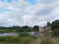
(6) Turn right at the trees, then left at the Chapelle Saint-Hilaire, which you can see on your right. Turn right just before a farm building.
The path continues until it reaches the Demi-Lune crossroads.

(7) Then turn right onto Route de This, heading towards the village of Warcq. Please note: this short stretch follows a road which may be busy.

(8) At the first junction, turn right onto Rue de la Grand Porte, then right again onto Rue du Rivage.
Walk past the tower and continue to the bridge, which you cross heading towards Mézières.

(9) Shortly after the bridge, turn right onto Chemin du Bac, which veers towards the riverbank. Leave the tarmac and continue along a footpath.

(10) At the end of this track, veer left until you reach a path on the right which cuts through the gardens to join the Promenade de la Warenne.

(11) Do not take the promenade to the left, but continue straight ahead along a path that goes round the Étang de la Warenne on the right, until you reach the Promenade de la Warenne.

(12) Turn right and follow the banks of the Meuse, passing behind the hospital until you reach a car park. Walk through it until you come to a greenway that passes under the motorway bridge.
Continue along the Quai des Arquebusiers to the end. Then cross a small bridge on the left which leads to the Quai de la Tour du Roy. Turn right onto it, then follow the Quai de la Porte Noire to the Place de l’Hôtel de Ville.
Then turn right to reach the Place de l’Hôtel de Ville in Mézières (S/E).

Waypoints

  1. S/E : mi 0 - alt. 479 ft - Monument on Place de l’Hôtel de Ville
  2. 1 : mi 0.13 - alt. 482 ft - Quai de l’Esplanade - Meuse (fleuve)
  3. 2 : mi 0.79 - alt. 472 ft - Passage under the motorway
  4. 3 : mi 1.62 - alt. 486 ft - Rue de Mézières
  5. 4 : mi 2.01 - alt. 476 ft - Prix les Mézières Mill
  6. 5 : mi 2.44 - alt. 472 ft - Praëlle Stream
  7. 6 : mi 2.69 - alt. 479 ft - Saint-Hilaire Chapel
  8. 7 : mi 3.28 - alt. 472 ft - Demi-Lune crossroads
  9. 8 : mi 3.62 - alt. 469 ft - Entrance to Warcq
  10. 9 : mi 4.06 - alt. 486 ft - Chemin du Bac
  11. 10 : mi 4.64 - alt. 469 ft - Jardins à la Warenne
  12. 11 : mi 4.86 - alt. 469 ft - Étang de la Warenne
  13. 12 : mi 5.49 - alt. 479 ft - Promenade de la Warenne
  14. S/E : mi 7.07 - alt. 479 ft - Monument on Place de l’Hôtel de Ville

Reviews and comments

4.1 / 5
Based on 3 reviews

Reliability of the description
4.7 / 5
Ease of following the route
4 / 5
Route interest
3.7 / 5
Yves Thaleret
Yves Thaleret
• Edited:

Overall rating : 4.7 / 5

Date of your route : Dec 02, 2025
Reliability of the description : ★★★★★ Very good
Ease of following the route : ★★★★★ Very good
Route interest : ★★★★☆ Good
Very busy route : No

Between points 7 and 8, rather than walking along the country road for 300 metres with the cars, it is better to continue along the dirt track once you reach point 7 towards the barns along the Route de la Demi-Lune, as you will immediately find yourself in a built-up area with a pavement. Once you reach the This stream, you can turn right and follow the D9 towards Warcq, walking safely on the right bank of the stream. This is a much more comfortable and safer route than the one indicated in the description of this hike.

Machine-translated

FredA
FredA

Overall rating : 3.7 / 5

Date of your route : Jun 08, 2024
Reliability of the description : ★★★★☆ Good
Ease of following the route : ★★★★☆ Good
Route interest : ★★★☆☆ Average
Very busy route : No

A marshy stretch at Prix-les-Mézières!
I had to give up.

Machine-translated

Jacques2019
Jacques2019

In fact, this section depends on the water level of the Meuse and the condition of the vegetation. I have cycled along it before, but it is unpredictable, which is why this section is not included in the route.

Machine-translated

croco
croco

Overall rating : 4 / 5

Date of your route : Aug 15, 2021
Reliability of the description : ★★★★★ Very good
Ease of following the route : ★★★☆☆ Average
Route interest : ★★★★☆ Good
Very busy route : No

A lovely walk, but I couldn’t make it to the Moulin à Couleur by following the Meuse from Rue de la Meuse. It seems the path is closed

Machine-translated

Other walks in the area

For more walks, use our search engine .

The GPS track and description are the property of this route's author. Please do not copy them without permission.