Country:

 City:
City:


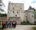
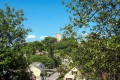
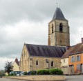
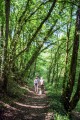
(S) From the Church of Saint-Germain-d’Auxerre (with a 13th-century crypt worth visiting before setting off), in Saint-Germain-de-la-Coudre, head down Rue de l’Église towards the D7. Turn left onto the D7 and follow it for 50 metres towards La-Chapelle-Souëf.
(1) Take the first street on the right (Rue de l’Ile) and cross the river. Turn right onto this street, which runs alongside the river and leads to a house called La Ferté-Vidame – which you’ll have no trouble distinguishing from the town and castle of Saint-Simon, situated much further north in the Perche region. At the end of this street, turn right (Le Beauchet) to join the D107, then follow the D107 to the left (take care) and take the second turning on the right.
(2) Follow a path on the right, lined with vegetation – the Clos Fontaine – for 600 metres. There is a section with a very steep slope and steps. Carry on straight ahead until you reach the small road, which you cross.
(3) Opposite, take the dirt track near the Moutonnières riding centre.
(4) At the roundabout, carry straight on, leaving the Route de la Ronde de la Lune on your right, and continue for about 1 km.
(5) Turn right at almost a right angle. Follow this lovely forest lane until you reach the tarmac road. Turn left towards the Hameau du Chêne Vert.
(6) Cross the D107 with care and take the small tarmac road to Mont Corbin opposite. Follow this road, which takes a wide bend to the right and becomes a dirt track from Bois le Roy. Continue until you reach the D107.
(7) Cross the D107 again (take care) and take the road on the left which passes in front of the Theil water reservoir. Head down towards Le Theil-sur-Huisne until you reach the D636, taking in the view of the Theil and the Huisne valley as you go.
In Le Theil, turn left onto Rue des Ponts and follow the railway line as far as the tunnel. Turn right under the tunnel, then left onto Rue de la Pêcherie, until you reach the D407 (Rue de la Vallée), which you’ll follow to the right to cross the River Huisne. As you pass, take a moment to look at the derelict industrial site: the former Abadie cigarette paper mills, whose chimney is a listed building. Leave Le Theil.
(8) Leave the D407 very quickly and take a small road branching off to the left instead.
(9) At the Fork in the road, turn left towards La Thibaudière, an abandoned farmstead. Follow the tree-lined sunken lane which climbs to the right of La Thibaudière until you reach the tarmac of the D288. Follow this for 200 metres to the left and take the first right (Le Costier).
(10) Turn right; the road takes a wide left-hand bend before climbing up the hillside. Climb up to Haut Queux, and continue in the same direction along a tree-lined path that runs alongside the property. Follow this path straight on until you reach La Bellangerie, in the commune of Mâle.
(11) Turn right onto a tarmac road leading to the Place de l’Église in Mâle. Carry on to the right after Saint-Martin’s Church, onto the D288, which you’ll find here. Walk past the cemetery and continue along the D288, which turns left 100 metres after the cemetery (towards Nogent-le-Rotrou; be careful not to carry on straight ahead onto the D635).
(12) Here, there are two options: For the more adventurous, take the Charabaux circular route and its dirt tracks by turning onto the first track on the right. . Cross a small road and head straight on towards the hamlet of Charabaux, eventually rejoining the D288, which you’ll follow to the right. Alternatively, for those in a hurry, continue along the tarmac D288 until you reach the access track to La Cochetière (which you leave on your left) and carry on along the D288, then take the first dirt track on the right.
(13) Follow this charming, tree-lined sunken track which leads out onto the D923. Above all, do not cross immediately, but walk alongside the hedge as far as the car park, then carefully cross this major national road at the opposite side to reach the small road to Bellevue/Les Clairets. Part of the Jambette mountain bike trail. At Les Clairets, follow the road which bends sharply to the left and goes round the Abbaye des Clairets alongside a high wall; this same road then turns right, opposite the entrance gate to the abbey. Continue on the D137.
(14) After a wide bend to the left, join the track branching off to the left towards La Hennerie. Follow it to the edge of the Bois de la Haute Galaisière, then leave this track to follow the one branching off to the right, which runs behind La Hennerie. On reaching La Basse Galaisière, turn left onto the tarmac road until you reach the D13.
(15) Turn right onto the D13 and follow it for about 700 metres. Turn left onto the Chemin du Chaillois. Walk alongside the Chaillois estate and take the path leading off to the left, behind the Chaillois.
(16) This local track leads into the Bois de Beausoleil. The woodland is private and a hunting ground during the season (from November to February). You are therefore advised to stay on the local track and not to enter the private woodland. Hunting and mushroom picking are prohibited there. On leaving the Bois de Beausoleil, continue straight on, passing the Haie Godefroy on your left.
(17) Leave the path and take the first road on the right that you come to, then immediately take the first left. Follow this road (D137.10), which becomes tarmacked from L’Aumonerie onwards. Pass through the hamlet of Le Bout du Bois and continue on to La Ménardière.
(18) At La Ménardière, turn left. Pass through Chatillon and continue along the same road.
(19) Take the first tree-lined track on your right. This track runs alongside a large estate on its left (Les Chênes). It then descends towards the Ronne Valley (sometimes misspelt ‘Rhône’ on IGN maps, amongst others).
(20) As you emerge from the woodland, enjoy the view of Château Saint-Jean, which overlooks Nogent-le-Rotrou from the top of its hill. Cross the D955 with care, then the River Rhône, and continue straight on to enter Nogent-le-Rotrou. At the end of the road, turn right onto the Route de Souancé and follow it for 100 metres until you reach the first street on the left.
(21) Follow this road as it climbs up the promontory of Château Saint-Jean. Walk up to the castle car park (the castle is open to visitors), from where you can reach the town centre, the Tourist Office or the SNCF railway station.
(22) Go down the steps that run alongside the château and lead to the historic Pâty district. Or by bike: take an alternative route.
(23) After visiting the historic quarter, continue along Rue Maute Lelasseux and then take the lane at the end of it. Next, turn left onto Avenue Camille Gaté, cross Avenue de la République and continue along Avenue George Clémenceau. Turn right onto Rue Chaillou, then left onto Rue du Gouverneur and head for the car park at Place Saint-Pol (E).

 Association / Club / Walk leader
 Moderate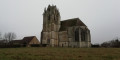
 Easy
Easy 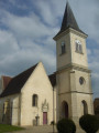
 Visorando Member