Country:

 City:
City:


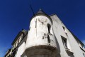
(S) Start from Mortagne-au-Perche, in front of the Maison pour tous, on Place du Tribunal. Head up Rue du Colonel Guérin, pass by the Church of Notre-Dame, then continue straight on along Rue Notre-Dame (market square on Saturday mornings). Cross Place de la République (use the pedestrian crossing) and continue along Rue du Faubourg Saint-Langis lès Mortagne.
(1) Turn left at the corner by a butcher’s shop onto Rue Moncacune, then immediately right down Ruelle des Loges, which runs alongside the rear of some beautiful Mortagne properties. At the first fork in the road, turn left, then follow the path downhill for about 600 to 800 metres, passing a beautiful farmhouse enclosed by high stone walls on your left – a place known as Les Loges – and continue until you reach a road. Cross this road and take the path that runs to the left of a house and then under two viaducts of the old railway line.
(2) Pass the old sewage treatment works on your left and turn right onto the grassy dirt track; follow it, taking care to keep to the left for about 800 m through beautiful meadows in a small valley where a stream flows peacefully.
At the end of this track, after passing an access track to a farm on your right, go under an overpass carrying the Mortagne-au-Perche bypass.
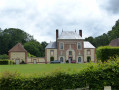
(3) Follow the path branching off to the left (a short, steep slope) alongside the bypass, then go round a copse on your right. Ignore the path leading uphill to the left and continue along the dirt track that runs alongside a field for about 300 m. Take the first path on the right (for 50 m) which leads to an old gatekeeper’s house (numbered 64 on its façade) and continue to the left along the route of an old railway line. Follow this for about 1 km until you come to a small tarmac road, leading to a second gatekeeper’s house (in the hamlet of La Noë Lamier). Turn round to see Prulay Castle directly to the north, nestled in the valley.
(4) Take the small road on the right for about 500 metres. Pass Prulay Mill and, after the hill, take the small tarmac road on your left.
(5) Pass through the hamlet of La Forterie, then turn right onto a dirt track until you reach the last house. Note the imposing chestnut tree on your right. After 200 m, at the Fork in the road, take the sunken track on the right and continue for about 1.5 km across the fields to the hamlet known as L’Hôtel Cointaux.
(6) Pass through this hamlet and continue to the tarmac road, the D 272. Turn right towards Parfondeval.
(7) After about 600 m, at the top of the hill, take the small road on the left towards Les Rougères. Follow it for about 800 m.
(8) Pass through the Ferme des Rougères.
(9) Turn right onto a slightly uphill dirt track and continue through cultivated fields until you reach La Cosnière farm. Pass this farm on your left and carry on straight ahead until you reach the D 931.
(10) Take care. Cross the road, then, continuing along the tarmac section, follow a dirt track (about 1 km). Pass the hamlet of Les Jonets on your left. When you reach the hamlet of ‘La Petite Gallonière’, take the small tarmac road on the left and follow it, passing the hamlets of ‘Les Bois’, ‘Les Caves’, ‘Les Mares’ and ‘Bouchigny’ on your left.
(11) Take care: fast-moving traffic. At the junction with the D 372 (magnificent view of the Ecouves Forest, the Butte Chaumont and the Mont des Avaloirs), turn left towards the village of Coulimer.
Enter the village (grocery shop/bar). Go round the church on the right, then follow a winding, uphill tarmac road.
(12) On leaving the village, follow the D 650 towards the Écuries des Lys. Pass the water tower at the top of the hill on your right. Follow the D 650 for about 1.2 km and pass Mont Froger.
(13) Turn left at the first junction and follow this small road for about 1 km.
(14) Then turn right onto Chemin du Logis (signposted ‘TCP’) and follow this natural track for about 900 metres
(15) You’ll come out onto the D 7; turn left straight away and follow it for 200 metres, until you reach the Gravelle crossroads.
(16) Take care – this is a very busy road. At the Stop sign, turn right onto the D 931 (towards Mamers). Walk for about 400 m, keeping to the side of the road.
(17) Take the path on the right after an EDF transformer station (house) and follow it for about 1 km. Pass the path leading to La Petite Bourdonnière on your right and you’ll come to a T-junction.
(18) Turn right and follow the path for about 1.2 km (a lovely avenue of pollarded oaks, known locally as ‘trognes’).
(19) At the dairy farm, turn left to reach the village of Pervenchères.
(20) You’ll arrive in the centre of the village. The pond, about a hundred metres from the church towards Montgaudry and La Saboterie (D 297), is an ideal spot for a picnic. Alternatively, turn left and, at the Fork in the road immediately ahead, follow the road to the right towards La Perrière and Mamers (passing the media centre on your left). Continue for about 1 km until you reach the D 931.
(21) Take care. Take this busy road to the left, then immediately turn right (about 50 m) towards the Manoir de Blavou. Follow the small tarmac road to the entrance to the manor house on the left.
(22) After about a hundred metres, continue along the road to the right until you reach the Oratory of Saint Jacques (information board). Take the dirt track opposite, which is about 1.5 km long. Pass a wooden chalet with a pond on your right. Continue until you reach a small tarmac road (D 649) at La Fleutrie.
(23) Take the road on the right and follow it for about 1.2 km.
(24) At the junction with the D 275 road leading to La Perrière, cross it and take the grassy path starting on the other side of the road. Continue along this path lined with hedges. As you emerge from this ‘green tunnel’, head to the right and then immediately left (before the entrance to the Saint-Hilaire farm) and take the very narrow sunken path downhill. There’s a lovely view of the village of La Perrière.
Before the small tarmac road, take the path on the left (marked in yellow) which runs alongside a cultivated field. Head into the woodland, following the dirt track (you’ll pass near the Montperthuis spring on your left).
(25) When you reach the junction with a track leading to the Piponnerie farm, first turn right then left, crossing a small wooden bridge. Follow the track straight ahead until you come to a tarmac road leading to the village of La Perrière; head into the village until you reach the main square (E).
 Association / Club / Walk leader
 Difficult
  Visorando Member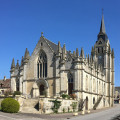
 Easy
Easy