


Refine your search for walks in Pont de l'Alpe
Pont de l'Alpe walks


 Lac et Col de la Ponsonnière via the Grand Lac
 Visorando Member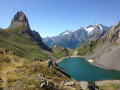
 8.33 mi
 +3,084 ft
 -3,087 ft
 6h 30
6h 30
 Difficult
 Departure from Le Monêtier-les-Bains (Hautes-Alpes)
An alternative route for the round trip to Le Grand Lac and Lac de la Ponsonnière allows for a circular route involving a chimney passage, but this restricts access to those with at least some mountain experience.A breathtaking, panoramic view of the Écrins Massif: Mont Pelvoux, the Barre des Écrins, the Pic de Neige Cordier, the Meije, the Rateau and more.
Grand Galibier from the Pont de l'Alp
 11.67 mi
+5,348 ft
-5,341 ft
8 hrs
11.67 mi
+5,348 ft
-5,341 ft
8 hrs
 Very difficult
Departure from Le Monêtier-les-Bains (Hautes-Alpes)
Very difficult
Departure from Le Monêtier-les-Bains (Hautes-Alpes)
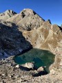
A magnificent hike leading to the legendary Grand Galibier viewpoint, from where you can admire almost the entire French Alps. Part of the hike is off-trail and often on poorly marked paths, but the most difficult part of the route is well marked with cairns.
On the agenda: unique panoramic views, numerous crystal-clear lakes, friendly wildlife, wild valleys dating back to the Ice Age, all under the deep blue skies of the Hautes-Alpes.
Tour of the Arêtes de la Bruyère
 5.02 mi
+2,503 ft
-2,490 ft
4h 30
Difficult
Departure from Le Monêtier-les-Bains (Hautes-Alpes)
5.02 mi
+2,503 ft
-2,490 ft
4h 30
Difficult
Departure from Le Monêtier-les-Bains (Hautes-Alpes)
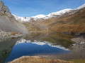
A circular route through spectacular scenery, with the added thrill of a challenging cable-assisted section. Panoramic views of the glaciers, a large lake, soaring peaks, a refuge and chalets – everything you need for a wonderful experience.
Refuge des Drayères – Pont de l’Alpe
 9.08 mi
+2,014 ft
-3,563 ft
5h 55
9.08 mi
+2,014 ft
-3,563 ft
5h 55
 Moderate
Departure from Névache (Hautes-Alpes)
Moderate
Departure from Névache (Hautes-Alpes)
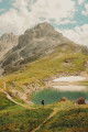
3rd and final stage. Starting from the Refuge des Drayères, head up to the source of the Clarée and return to Pont de l’Alpe via the Col de la Ponsonnière. A tour of the Massif des Cerces taking in numerous lakes, each more beautiful than the last: in turn, the Clarée, Rond, Grand Ban, Cerces, Ponsonnière and, finally, the Grand Lac.
Refuge du Chardonnet - Arsine
11.94 mi
+2,608 ft
-4,436 ft
7h 45
Difficult
Departure from Névache (Hautes-Alpes)
This third stage of the crossing of France, following the 45th parallel as closely as possible, is long and difficult but absolutely magnificent. You will discover or rediscover the two jewels that are the Écrins and Meije massifs. Most of the route is on the GR® 50 and GR® 57. The paths are well marked and well maintained.
This stage can be divided into four sections: 1) an ascent to the Col du Chardonnet; 2) the descent to Lauzet; 3) the ascent to the Col du Lautaret; 4) the descent to Arsine.
Tête de Colombe
 9.36 mi
+4,757 ft
-4,757 ft
8 hrs
Very difficult
Departure from Le Monêtier-les-Bains (Hautes-Alpes)
9.36 mi
+4,757 ft
-4,757 ft
8 hrs
Very difficult
Departure from Le Monêtier-les-Bains (Hautes-Alpes)
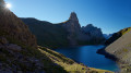
The Tête de Colombe (3,022 m) is a magnificent vantage point accessible to walkers, situated on the ridge running from the eponymous Roche Colombe to the Grand Galibier. Ibex are abundant here; there are no signposted paths leading to this ridge, with the exception of a few cairn-marked tracks.
The spectacular panorama over the highest peaks of the Écrins, Grandes Rousses, Cerces and Queyras stretches as far as Mont Blanc and Viso.
Walks near Pont de l'Alpe
From Le Lauzet to the Col du Lautaret
4.19 mi
+1,325 ft
-26 ft
3h 05
Moderate
Departure from Le Monêtier-les-Bains (Hautes-Alpes)
Stage4 of the Tour du Combeynot: from the Guisane Valley to the Col du Lautaret
Lac de la Ponsonnière – Refuge des Drayères
 5.88 mi
+640 ft
-1,909 ft
3h 15
Moderate
Departure from Le Monêtier-les-Bains (Hautes-Alpes)
5.88 mi
+640 ft
-1,909 ft
3h 15
Moderate
Departure from Le Monêtier-les-Bains (Hautes-Alpes)
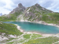
This second, slightly easier stage takes us past four magnificent lakes: Lac des Cerces, Lac du Grand Ban, Lac Rond and Lac de la Clarée
The Crossing from Le Casset to the Col du Lautaret
 11.16 mi
+3,451 ft
-1,693 ft
8h 10
Difficult
Departure from Le Monêtier-les-Bains (Hautes-Alpes)
11.16 mi
+3,451 ft
-1,693 ft
8h 10
Difficult
Departure from Le Monêtier-les-Bains (Hautes-Alpes)
A classic route in the upper Briançon region: reach the Col du Lautaret via Lac d’Arsine and the Crevasses Trail from the hamlet of Le Casset, north of Monetier-les-Bains.
From the Col du Lautaret to the Alpe de Villard d'Arène
 3.99 mi
+463 ft
-315 ft
2h 15
Moderate
Departure from Villar-d'Arêne (Hautes-Alpes)
3.99 mi
+463 ft
-315 ft
2h 15
Moderate
Departure from Villar-d'Arêne (Hautes-Alpes)
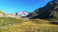
Stage1 of the Tour du Combeynot: From the Col du Lautaret to the Alpe de Villar-d'Arêne refuge via the schistose crevasse trail overlooking the Romanche valley. Unique view of the Écrins and Meije peaks.
Du Monêtier-les-Bains au Lauzet
6.28 mi
+2,336 ft
-1,742 ft
4h 55
Moderate
Departure from Le Monêtier-les-Bains (Hautes-Alpes)
3ème étape du Tour du combeynot : découverte de la vallée de la Guisane en passant par le chemin du Roy pour arriver à l'Alpe du Lauzet
Monêtier-les-Bains - Vallouise
 12.62 mi
+3,307 ft
-4,285 ft
8h 40
Difficult
Departure from Le Monêtier-les-Bains (Hautes-Alpes)
12.62 mi
+3,307 ft
-4,285 ft
8h 40
Difficult
Departure from Le Monêtier-les-Bains (Hautes-Alpes)
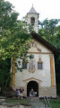
E10th stage lasting 8 hours, covering 21 km, with 1,000 m of ascent and 1,200 m of descent. A very pleasant stage with no technical difficulty, offering magnificent views of the Barre des Écrins at 4,100 m and the very impressive Pelvoux at 3,900 m.
For the more adventurous, there is the option of taking a detour to climb up to Lac de l’Eychauda by leaving theGR® 54 at the Col de l’Eychauda. The stage ends in the village of Pelvoux, which, despite the fatigue, is well worth a quick visit.
Lac des Cerces - Lacs de la Madeleine via Pointe des Cerces
 7.84 mi
+3,963 ft
-3,261 ft
8 hrs
Very difficult
Departure from Valloire (Savoie)
7.84 mi
+3,963 ft
-3,261 ft
8 hrs
Very difficult
Departure from Valloire (Savoie)
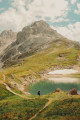
Day 2 in the Clarée Valley: ascent of Pointe des Cerces (unmarked mountain route), passage to Lac and Source de la Clarée and climb to the second bivouac at Lacs de la Madeleine (off-trail on the final section).
As with the other parts of this circular, this route is intended for experienced hikers who are accustomed to high mountains.
Fontcouverte Campsite - Lac de la Ponsonnière
 7.08 mi
+3,691 ft
-1,391 ft
6h 30
Difficult
Departure from Névache (Hautes-Alpes)
7.08 mi
+3,691 ft
-1,391 ft
6h 30
Difficult
Departure from Névache (Hautes-Alpes)
For this first three-day stage, the route offers magnificent views of the Écrins Massif at the Col du Chardonnet and then of the Grand Lac. We have chosen to camp at Lac de la Ponsonnière, but it is entirely possible to camp on the heights of the Grand Lac, near the pastoral house. This allows you to shorten the duration of this first day slightly and, above all, reduce the elevation gain by around 200m.
Lac de la Cula via the circular trail
4.95 mi
+2,001 ft
-1,463 ft
4h 00
Moderate
Departure from Névache (Hautes-Alpes)
A beautiful hike with magnificent scenery. The climb to the Ricou refuge is a little steep but not particularly difficult. Once you reach the circular path, the route is very easy, almost flat until you reach the Torrent de la Cula. The view over the entire valley is truly superb. From the lake, the trail descends to Laval.
Laval car park - Lac des Cerces
 7.23 mi
+3,537 ft
-2,254 ft
7 hrs
Very difficult
Departure from Névache (Hautes-Alpes)
7.23 mi
+3,537 ft
-2,254 ft
7 hrs
Very difficult
Departure from Névache (Hautes-Alpes)
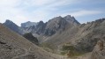
First day of a 4-day circular starting from the Laval car park in the Upper Clarée Valley. As with the other parts of this circular, this route is intended for experienced hikers who are accustomed to high mountains.