Country:
 City:
City:


Starting point and access: Porte de Pantin station.
- Metro – Line 5 (shown on the map). Take Exit 2, Sente des Dorées.
- Tram – Line T3b. Follow Avenue Jean-Jaurès towards the centre of Paris and join the route at the Church of Sainte-Claire d’Assise.
In some places, you’ll come across a GRP®®sign. In the description below, this signposting is only mentioned where necessary.
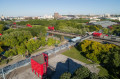
(S) On leaving the metro station, follow Avenue Jean-Jaurès and cross the Sente des Dorées. Just before the Church of Sainte-Claire d’Assise (large metal cross), turn right and take Allée Arthur Honegger (red and yellow markings). Cross the Sente des Dorées and then Rue Petit. Continue along Allée Darius Milhaud (pedestrianised).
At the corner where there is a post office on the left-hand side, cross Rue Goubet and, at the next junction, cross Rue d’Hautpoul. When you reach Place Francis Poulenc, turn left and climb a series of small steps. At the top, turn right to cross Rue de Crimée and then turn left to cross Rue Manin (traffic lights).
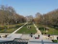
(1) You will then enter the Parc des Buttes Chaumont. At the junction immediately ahead (map), take the second path on the right: it is the narrowest of them all, is not shown on the map and soon gives way to a flight of steps. You will reach a viewpoint overlooking the lake. At the Fork in the road that follows, take the path on the right downhill. Cross a wider path (Avenue J.C. Cave on the map) and take the path opposite, which leads diagonally to the right. Head downhill, following a curve to the left.
Once you reach the lakeside, walk along the lake with it on your right. Cross an artificial stream and, at the next Fork in the road (a solitary tree on the right), take the path on the left. At the junction that appears immediately (with a flight of steps opposite), turn right. Immediately ignore a path that leads back down towards the lake and continue straight on until you enter the “cave” (a dead end as of January 2017 due to building works).
Retrace your steps. At the junction you passed on the way there, ignore the steps leading uphill to the right and continue straight ahead. When you reach the edge of the artificial stream, turn right (do not cross the stream). Under a canopy of trees, follow a path interspersed with a few steps, which ends in a flight of stairs.
At the top (T-junction), turn right (artificial waterfall on the left). At the next fork in the road, take the path on the right, which is fairly level and leads towards a bridge (beautiful cedars on the left).
Cross the bridge and step onto Île du Belvédère. At the fork in the road just beyond the bridge, take the path on the right and, at the next fork immediately after, the path on the left (in January 2017, the one on the right was closed for safety reasons). Ignore a path branching off to the left (also closed) and reach the top of the hill with its gazebo (pseudo-temple).
(2) Retrace your steps. Just before the bridge you crossed on the way there, turn sharply right as you head downhill. Take the suspension footbridge spanning the lake and its Circular Route. As you leave the footbridge, turn left and pass the Pavillon du Lac on your right. At a junction with smaller paths, continue along the wide Avenue Alphand (incorrectly named on the map).
At the next junction (with a water point opposite on the left-hand side and a path leading off to the right), turn left onto a small path and walk past the base of an artificial waterfall on the right-hand side. At the next junction (with a sequoia opposite on the left-hand side), carry on straight ahead and head slightly uphill. At the top, take a few steps to the left onto the wide Avenue des Marnes.
(3) Immediately turn right onto a narrower path towards the bandstand (signposted; do not take the wide Avenue Jacques de Linières, also on the right). Climb gently, ignoring a faint path branching off to the right and then a flight of steps leading down to the left, until you reach the top of a hill (viewpoint to the north-east over the Parc de la Villette and the Grands Moulins de Pantin).
Continue straight ahead along a narrow, downhill path. At a fork in the road just past a bend on the right, turn left, heading down towards a street lamp. At the bottom, turn left onto a wide avenue (Avenue Darcel on the map).
Just before a bridge, at the foot of a street lamp bearing a Red Cross and Yellow Cross, go down a flight of steps on the right amidst artificial rocks. At the bottom, go straight on and leave the park.
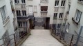
(4) Then cross Rue Manin at the traffic lights and follow it to the left, passing the Institute of Ophthalmology on your right. At the corner of No. 21, turn right under a portico and climb the 80 steps leading up to the Butte Bergeyre.
At the top, continue straight on along Rue Philippe Hecht. At the end, turn left onto Rue Georges Lardennois and you’ll reach a viewpoint (with a fenced-off vineyard and a community garden on your right).
With your back to the viewpoint, head straight ahead into Rue Rémy de Gourmont. At the Fork in the road that appears shortly afterwards, turn right into Rue Edgard Poë. At the end, turn right into Rue Barrelet de Ricou. At the corner of Rue Georges Lardennois, go straight on and go down a steep flight of steps (64 steps).
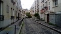
At the bottom, cross Avenue Simon Blivar at the traffic lights, go down another flight of steps and follow Rue Lauzin (wall mural on the right-hand side). At the end, turn left onto Rue Rebéval. Walk back and forth twice to the left, first through the Cité Jandelle (small blocks of flats, houses) and then through the Passage Gauthier (a pretty house at No. 4 and a private courtyard at No. 3).
Continue along Rue Rébeval and, at the junction, follow Rue de l’Équerre straight ahead (red and yellow marker). At the foot of a flight of steps leading up towards Avenue Bolivar, turn right at a right angle (hence the street’s name). At the next junction, turn left.
Cross Rue de Belleville and follow Rue Piat straight ahead. At number 46, turn right into Parc de Belleville. At a junction (with a flight of steps on the right and a view of the Eiffel Tower), take the path furthest to the left. Ignore the steps on the right and head back towards Rue Piat. Then, on the right, make your way to the viewing platform on the roof of the Maison de l’Air (superb panoramic view).
(6) Continue parallel to Rue Piat and re-enter Parc de Belleville via the first entrance on the right, either via a flight of steps or a ramp. Then go down the flight of steps covered by a green arbour. At the end of the arbour, you’ll come to a small concrete path; carry on straight ahead. At the next roundabout, turn right, passing a visitor centre on your left.
Leave Belleville Park, cross Rue Julien Lacroix and enter the Jardin de Pali-Kao. Cross this garden diagonally to the right, passing some table tennis tables. Before a playground with a slide, turn left and head down towards a pond. Walk round the pond, leave the garden and go round a flowerbed on the right to emerge at the junction of Rue de Pali-Kao and Rue Bisson.
Cross Place Alphonse Allais diagonally to the right. At the end, turn right into Rue de Tourtille. Cross Rue Bisson and, at the next junction, turn left into Rue Ramponeau. Just before a set of traffic lights, turn right into Rue Dénoyez.
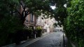
Walk along this street, which is covered in graffiti, and at the end, cross Rue de Belleville at the pedestrian crossing. Turn left and, after a few metres, turn right, cross Place du Général Ingold and pass under the archway of a block of flats. Turn left into a tree-lined lane, walk along the left-hand side of Place Jean Rostand and continue along Rue Hector Guimard, then Place Marcel Achard.
(7) At the end, turn left into Rue Rébeval (there it is again) and follow it to Boulevard de la Villette (traffic lights). Cross the boulevard in two stages and continue along Rue du Buisson Saint-Louis. After passing Rue Civiale on your left, turn right into Rue du Chalet. Then take the first left, into Passage Hébrard. At the end, first turn left then right and follow Rue Arthur Groussier.
At the T-junction, turn right and, at the traffic lights, turn left (red and yellow arrow) to cross Avenue Parmentier. Continue along Rue Alibert, keeping the Hôpital Saint-Louis on your right. At the next junction, turn right onto Rue Bichat (plaque commemorating the victims of the 13 November 2015 attacks). When you reach Place du Docteur Alfred Fournier, turn left onto Avenue Richerand and follow it to Quai de Jemmapes.
(8) Take the footbridge to cross the Canal Saint-Martin. Then turn left onto Quai de Valmy and walk alongside the canal on your left. After the second footbridge, turn left into Square Frédérick-Lemaître and walk alongside the Écluse du Temple. After the lock, leave the square on your right. Cross Quai de Valmy and follow Rue du Faubourg du Temple (pedestrianised) to Place de la République (E).
To get back home:
- Metro – Lines 3, 5, 8, 9 and 11.
- Bus – Routes 20, 56 and 65.




 Visorando Member
 Moderate