Country:
 City:
City:


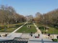
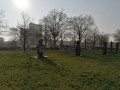
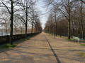
The start is at Porte de la Villette (see access details in the practical information).
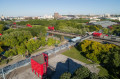
(S) With your back to Boulevard Macdonald (at the metro exit), take the passage leading to the Cité des Sciences et de l’Industrie (to the left of a well-known chain restaurant whose name evokes an imposing representative of African wildlife). Cross a small park and, once in front of the Cité des Sciences building, turn right. You will emerge into the Galerie de la Villette; follow it to the left towards the Géode. Go straight on and cross the Canal de l’Ourcq via a footbridge.
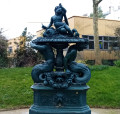
(1) On the other side, go straight on to reach the Grande Halle de la Villette. At the corner of this, turn right into the Jardin des Miroirs. Go round the “Littel Villette” building on the right and leave the garden immediately afterwards. Follow the gallery to the right and walk past the Théâtre Paris-Villette. Then turn left and walk past the Fontaine aux Lions. Walk alongside the museum on your right to reach the Philharmonie.
(2) Follow the path to the right which runs alongside Boulevard Sérurier on your left (as well as the Périphérique). Cross Avenue Jean-Jaurès at Porte de Pantin, walk past the Church of Sainte-Claire d’Assise and continue straight on along the tram tracks. Cross Boulevard Sérurier and follow Boulevard d’Indochine. Cross Avenue de la Porte de Chaumont, continue straight on along Boulevard d’Indochine and pass the “Butte du Chapeau Rouge” tram stop. Finally, cross Avenue de la Porte de Brunet and continue for about fifty metres along Boulevard d’Algérie.
(3) Then turn right into the landscaped park of the Butte de Chapeau Rouge. At the junction immediately ahead, turn right. After a path, turn left and go uphill, then veer right to reach the top of the hill (a beautiful view over eastern Paris). Head back down the other side, then turn right along Boulevard d’Algérie. Leave the park via the south exit. Cross Boulevard d’Algérie at the traffic lights, then the tram tracks. Then turn right onto Promenade Amalia Rodrigues. Pass the “Hôpital Robert Debré” tram stop, then cross Avenue de la Porte du Pré Saint-Gervais to the left.
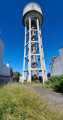
(4) On the other side, turn right and walk past the Church of Notre-Dame-de-Fatima. Continue along Boulevard Sérurier and walk past the Réservoir des Lilas. Cross Allée Marius Barroux on the left and, immediately afterwards, turn left into a passageway leading to Place Jules Sénard. Then head straight on and enter the Jardin Serge Gainsbourg. When you reach a circular path, turn right. Leave the garden and you’ll come out onto Place du Maquis du Vercors.
(5) Turn left and cross Avenue René Fonck. Turn right to cross Avenue de la Porte des Lilas and follow Avenue du Docteur Gley. Walk past a restaurant from the same chain as the one at the very start of the route and cross Avenue du Docteur Gley. Continue straight on along Rue Paul Meurice until it ends. Then turn right onto Rue Léon Frapié and immediately turn left into a public park. Walk right through the park.
(6) At the end, cross Rue de Noisy-le-Sec to enter the Jardin Frida Kahlo opposite. Walk past a building on your left and, at the corner, turn right. At the next junction, turn left. Shortly afterwards, turn right and enter Square Emmanuel Fleury. Cross the square, heading south-west, then turn right and walk past a playground on your right. You’ll come out onto Rue Le Vau; follow it to the left. Go straight on, passing a sports hall on your left, then a secondary school and finally a primary school. Then turn right onto Rue Dulaure.
(7) Just before the end of the street, turn left into Square Séverine. Continue more or less straight ahead, keeping to the right at the junctions. Exit Parc Boulevard Mortier and head left towards Porte de Bagnolet. Go round the roundabout on the left and take the3rd exit, Rue de Bagnolet. At Rue Pelleport (on the right-hand side), turn left into the Jardin de l'Hospice Debrousse. Soon after, turn right to pass in front of the Pavillon de l'Ermitage (on the right-hand side). Then turn left to exit the garden via the south-west near the “Debrousse Centre de Santé” bus stop, located on Rue des Balkans.
(8) Cross Rue des Balkans and take a passageway under a block of flats. Then cross Place Pierre Vaudrey and enter Square Antoine Blondin. Cross the square, curving to the right, and emerge onto Rue de Bagnolet. Follow this street until you reach a small square at the foot of the Église Saint-Germain-de-Charonne (on the right).
(9) Then turn left onto Rue Saint-Blaise and cross Rue Galleron on the right-hand side. You will emerge onto Place du Grès; turn right onto Rue Vitruve, then left onto Rue Roger Bissière. Enter Square de la Salamandre, head towards the central kiosk and turn right. Leave the square between numbers 10 and 11 on Rue Paul-Jean Toulet and follow this street to the left. At the end of the street, turn right onto Rue du Clos. At the traffic lights, go under the bridge of the old Petite Ceinture line and immediately turn left onto Rue des Maraîchers, then take thefirst left onto Rue de la Croix Saint-Simon and go under the Petite Ceinture line again. Turn right at the next junction onto Rue des Rasselins. At the end, turn left onto Rue d’Avron and follow it to Boulevard Davout.
(10) Follow Boulevard Davout to the right and cross Rue du Volga. Immediately enter the Jardin de la Gare de Charonne and start crossing it diagonally to the right. Ignore a path leading off to the left, then turn right. At the next junction, turn right again to come out onto Rue du Volga and follow it to the left. Pass under the old Petite Ceinture line once more and immediately turn left onto Rue des Grands Champs. Cross Rue des Maraîchers then Rue des Pyrénées. Follow this street to the left and take thefirst right, Rue de la Plaine, to the next junction. Then turn right onto Rue de la Plaine and follow it to Rue Mounet-Sully. Take the latter on the left for a few dozen metres.
(11) Turn right into Square Sarah Bernhardt and immediately turn left to cross it. Then cross Rue de Lagny and enter Square Rejane opposite. Cross the square, emerge onto Cours de Vincennes and follow it to the left. Cross Rue des Pyrénées in two stages. Then cross Rue des Maraîchers and turn immediately right to cross Cours de Vincennes and the tram tracks in two stages. Leaving a railway bridge on your left, enter Passage de la Voûte and pass under a red cat-shaped sculpture. You’ll emerge onto Rue de la Voûte; follow it to the left and pass under the railway bridge.
(12) Turn immediately right onto Rue du Gabon. Continue straight ahead and cross Avenue de Saint-Mandé near a railway bridge. Follow the Villa du Bel-Air opposite until it ends, then turn left into a passageway leading to Boulevard Soult. Follow this to the right and take thefirst right, Rue du Sahel. Pass under the old Petite Ceinture line yet again and immediately turn left to cross the Coulée Verte René Dumont via a footpath. Then turn right onto Rue de Montempoivre. At the junction with Rue Marie Laurencin (on the right-hand side), turn left into a passageway leading to Square Charles Péguy. Cross the square and exit via Rue Rottembourg between two railway bridges. Follow the street to the right until you reach the junction.
(13) Turn left into Rue de la Vega (where there is a bar called Don Diego...). At the end of this street, turn left onto Avenue Daumesnil. Stay on this avenue until you reach Porte Dorée. At the traffic lights, first turn right then left to cross Avenue Daumesnil, then Boulevard Poniatowski and the tram tracks. Walk up Place Édouard Renard, cross Avenue du Général Laperrine and continue along Avenue de Daumesnil towards the Bois de Vincennes. At Boulevard de la Guyane (on the left-hand side), turn right to enter the Bois de Vincennes. Follow a pleasant path to Lac Daumesnil.
(14) Turn left and walk along the lake on your right. At the end (south-eastern tip), cross a stream and continue walking along the lake on your right. At the bridge leading to Île de Reuilly (on the right), turn left and leave the lakeside. You’ll come out onto a wide path; follow it to the right. Ignore Route Dom Pérignon coming from the left and you’ll soon reach a Fork in the road.
(15) Then turn left onto Route de la Red Cross. Continue straight ahead and cross over the Périphérique. At Place du Cardinal Lavigerie, take thesecond right, a lane leading to Boulevard Poniatowski. Cross the boulevard and the tram tracks, then turn left along the boulevard. Shortly after No. 43, turn right into a passageway and cross over the Petite Ceinture line.
(16) You will emerge onto Avenue du Général Michel Bizot; follow it to the left. At the end of the avenue, turn left onto Rue de Charenton, then take thefirst right onto Boulevard Poniatowski. Cross the railway tracks and continue straight ahead along the boulevard until you reach the Pont National over the Seine.
(17) Just before the bridge, take a passageway on the right. Pass between the Quai de Bercy (on the left) and Gare de la Rapée (on the right). Cross Avenue des Terroirs de France, then the landscaped park at Place Saint-Estèphe. Walk past a cinema complex on your right and enter Parc de Bercy. Go straight on and cross Rue Joseph Kessel. You will reach the Simone de Beauvoir Footbridge.
(18) Then turn right and cross the Jardin Yitzhak Rabin. Just before a hut, turn left. First turn right then left and veer right to leave the park. You will come out onto Rue de Bercy; follow it to the left. At the traffic lights, cross Boulevard de Bercy and continue along Rue de Bercy, at the foot of the Ministry of the Economy. Carry straight on until you reach the metro station at the foot of Gare de Lyon (E).

 Visorando Member
 Easy
Easy