From Conségudes to Le Pous, returning via the Canal du Végay.

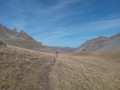
The village of Conségudes is the starting and finishing point of this unique walk, which takes in a variety of landscapes including a small valley, an oak forest and the Canal de Végay, which winds its way along the mountainside. The outward leg, which is very shaded, begins in woodland and then passes through a forest, but those who love panoramic views and sweeping horizons will not be disappointed on the return leg from the vantage point offered by the Canal de Végay.

Details

n°28687590
Creation:
Last update:
Last review:
  • Walking
    Activity: Walking
  • ↔
    Distance: 7.32 mi
  • ◔
    Average duration: 5h 05 
  • ▲
    Difficulty: Moderate

  • ⚐
    Back to start: Yes
  • ↗
    Ascent: + 2,008 ft
  • ↘
    Descent: - 2,014 ft

  • ▲
    Highest point: 2,982 ft
  • ▼
    Lowest point: 1,243 ft

Photos

Description of the walk

The walk starts from the entrance to the village of Conségudes. Simply park along the wide road leading to the village centre. There is space for several cars to park there.

(S/E) From the car park, walk back down towards the church.

(1) Take the first road on the right, the D1. 200 metres further on, at marker 43, take the path on the left which descends into the valley where the Ruisseau de la Bouisse flows.

(2) After crossing the D1, the path continues, still on a gentle slope.

(3) The path leads onto a track suitable for vehicles; take it to the left. After passing an old, disused wash house, cross a small stone bridge over the stream and continue up to the junction with the D1 a few dozen metres further on, at marker 123.

(4) Turn left onto the D1 and follow the hairpin bends uphill for about 800 m.

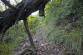
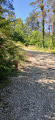
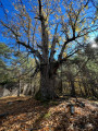
(5) Marker 230 indicates the path on the right, which leads into the forest for a long but gradual climb. Along the way, you can admire some enormous oak trees, probably several centuries old.

(6) At this point, facing the gate of a property surrounded by a fence, turn right, heading due north, onto the path which climbs steeply for 150 m.

(7) At marker 218, leave the path and take the track on the left, which leads to the hamlet of Le Pous – the highest point of the walk and a lovely spot home to a charming property where donkeys are kept. This very open and sunny spot is ideal for a picnic.

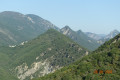
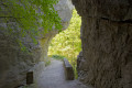
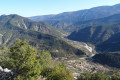
(8) At marker 219, a sign points to the Canal de Végay on the left. Follow it for four kilometres. Magnificent views to the north, east and west.

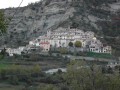
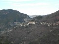
(9) Here, a sign points towards Conségudes. The route then begins a descent, at times very steep and winding, down to the outskirts of the village , which can be seen majestically clinging to the mountainside from several vantage points.

(10) At marker 42, continue straight down the hill.

(11) At marker 41, you’ll come out onto the D1; turn left to return to the junction where the circular route began.

(1) Return to the car park (S/E) via the same route you took on the way out.

Waypoints

  1. S/E : mi 0 - alt. 2,047 ft - Car park by the roadside
  2. 1 : mi 0.11 - alt. 2,008 ft - Junction of the circular loop
  3. 2 : mi 0.62 - alt. 1,670 ft - Path/road junction. Straight ahead
  4. 3 : mi 1.16 - alt. 1,260 ft - Path/road junction. Turn left
  5. 4 : mi 1.23 - alt. 1,270 ft - Crossroads. Turn left
  6. 5 : mi 1.67 - alt. 1,453 ft - Marker 230
  7. 6 : mi 3.49 - alt. 2,789 ft - Gate
  8. 7 : mi 3.81 - alt. 2,904 ft - Marker 218
  9. 8 : mi 3.98 - alt. 2,818 ft - Marker 219
  10. 9 : mi 6.47 - alt. 2,753 ft - Signpost for Conségudes
  11. 10 : mi 6.95 - alt. 2,224 ft - Marker 42
  12. 11 : mi 7.15 - alt. 2,021 ft - Marker 41
  13. S/E : mi 7.32 - alt. 2,041 ft - Car park by the roadside

Reviews and comments

4.2 / 5
Based on 2 reviews

Reliability of the description
4.5 / 5
Ease of following the route
3.5 / 5
Route interest
4.5 / 5
abeauville
abeauville

Overall rating : 4.7 / 5

Date of your route : Oct 18, 2026
Reliability of the description : ★★★★★ Very good
Ease of following the route : ★★★★☆ Good
Route interest : ★★★★★ Very good
Very busy route : No

A lovely walk, off the beaten track. Please note: apart from the section along the canal, the path is hardly signposted at all — a GPS is virtually essential. It’s also poorly maintained, if at all: fallen trees blocking the path, brambles, etc. What a shame!

Machine-translated

PAACAAL
PAACAAL
• Edited:

Hike on 19 March 2026
Yes, indeed, at marker 230, we also hesitated (incidentally, without recalling vidji7’s comment), and we persisted to the end on this uncertain path, without signposts, but with the IGN GPS app. Map downloaded onto the phone and a good GPS/Galileo signal. But the internet was working this time: my wife was receiving calls....
That said, you still had to have a bit of faith!
I said ‘no markers’, but in truth we found two or three (but not four!) whilst looking for them, very faint, on the trees, all the way to Le Pous. There are still places where the path is much better preserved; it must be very old but hasn’t been maintained for far too long. You can tell it’s rarely used.
At Le Pous, a charming spot, a Pyrenean Shepherd dog startled us a bit, but we soon realised he just loved having his belly stroked.... Marker 219 is on the ground, but the directional signs are perched on a fence post; you have to look up a bit.
The return via the canal was no problem. The descending path is also very poorly signposted and often resembles a storm drain, but never mind – we loved the route.
And the village of Consegudes! I don’t know what paradise is like, but I’d certainly like to go to Consegudes! ...

Machine-translated

vidji7
vidji7
• Edited:

Overall rating : 3.7 / 5

Date of your route : Sep 25, 2023
Reliability of the description : ★★★★☆ Good
Ease of following the route : ★★★☆☆ Average
Route interest : ★★★★☆ Good
Very busy route : No

We set off from Conségude; everything had gone well up to marker 230. At the marker, we turned right as indicated on the signpost towards Le Pous, but then, 50 metres from the sign, the path split into two with no explanation: either to the right, slightly downhill, or straight on, uphill. So we went straight on, but after a 45-minute climb with no yellow markings whatsoever, on a path that was often barely visible, and with loads of tree trunks strewn across this uncertain path by hunters, we turned back. We weren’t sure we were on the right track and the GPS wasn’t getting a signal… It’s a shame, then, as it turned out to be a rather uninteresting hike through the forest the whole time, given that we didn’t make it to the Vegay Canal – undoubtedly the highlight of the route. Thanks anyway for posting this hike online; we did give it a go…

Machine-translated

Other walks in the area

For more walks, use our search engine .

The GPS track and description are the property of this route's author. Please do not copy them without permission.