Super Lioran – Murat

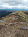
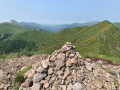
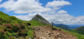
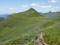
The final stage is fairly gentle, but features a very lovely climb beneath Puy Bataillouse and a few more beautiful ridges all the way to Vassivière.
Moderator’s note added on 06/07/2021: Please note, there have been some changes to the route on the ground: see the comments at the bottom of this page

This walk is part of a multi-day hike: Circuit of the Cantalien volcano via the GR®400, clockwise

Details

n°1937119
Creation:
Last update:
Last review:
  • Walking
    Activity: Walking
  • ↔
    Distance: 12.26 mi
  • ◔
    Average duration: 7h 35 
  • ▲
    Difficulty: Difficult

  • ⚐
    Back to start: No
  • ↗
    Ascent: + 2,218 ft
  • ↘
    Descent: - 3,369 ft

  • ▲
    Highest point: 5,574 ft
  • ▼
    Lowest point: 2,959 ft

Photos

Description of the walk

(S) At Super Lioran, head to the foot of the ski lifts. Retrace the previous day’s route in the opposite direction until you reach the road.

(1) Take the road to the right, heading downhill, and after the bend, follow theGR® sign which turns left. Join a track and turn left onto it. Follow it for quite some time. After crossing the small Torrent de l’Alagnon, turn left.

(2) Climb quite steeply up to the Buron de Meige Costes. Continue in front of the buron, then behind it until you reach a junction.

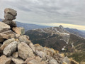
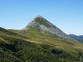
(3) Turn right. Pass beneath the Puy Bataillouse and go under the Téton de Vénus. Continue climbing gently, reach the ridge, then the Rocher du Bec de l’Aigle.

(4) Continue along the ridge, leaving the path leading back down to the resort on your right. Begin the descent to reach the Vassivière fords and then the Ruisseau de Pierre Taillade.

(5) Stay on the hillside on the almost level path. Continue along the path to Peyre Gary.
Please note: the route shown on the map is not clearly marked on the ground; it descends the slope after a gate and is very difficult to follow. You will reach the Peyre Gary de l’Or chalets.

(6) Turn right and follow the path; after a wide bend, you’ll reach the woods. Continue along the track through the woods until you reach the car park above La Roche Percée.

(7) Take the wide track opposite leading to Cheyrouze, and continue to the last buildings.

(8) Turn left onto the path, which climbs quite steeply. Join another track and turn right onto it. You’ll reach another Y-junction.

(9) Turn right onto the road, then take the path opposite at the next junction. Descend into a small valley, then turn left to reach Chazelles.

(10) Head down to the right into the valley, following the red and white markings as you climb back up towards a ruined tower.

(11) Take the tarmac road on the right and follow it to reach the D3 road bypassing Murat.

(12) Cross over to the opposite side, then walk alongside the road; you’ll see the Rocher de Bonnevie opposite. As you approach the roundabout, turn right and enter Murat. You’ll reach the junction with Rue de Lavergne.

(13) Turn left onto this street. Leave it by turning right to reach the church and the Place du Marché. Beneath the church forecourt, take Rue Porte de la Garde, then a side street on the right. This will easily lead you to a sort of promenade on the right, then onto Rue de la Gare and the station car park, marking the end of this 8-day circular route (E).

Waypoints

  1. S : mi 0 - alt. 4,140 ft - Super Lioran. At the foot of the ski lifts.
  2. 1 : mi 0.77 - alt. 4,124 ft - Small road
  3. 2 : mi 1.93 - alt. 4,245 ft - Junction towards Meige Costes
  4. 3 : mi 2.62 - alt. 5,013 ft - Junction towards the Téton de Vénus - Alagnon (rivière)
  5. 4 : mi 3.75 - alt. 5,574 ft - Rocher du - Bec de l'Aigle
  6. 5 : mi 5.17 - alt. 4,669 ft - Crossroads after the Vassivière fords
  7. 6 : mi 6.39 - alt. 4,656 ft - Peyre Gary
  8. 7 : mi 7.34 - alt. 4,039 ft - Return via the wide track
  9. 8 : mi 8.92 - alt. 3,714 ft - Cheyrouze
  10. 9 : mi 9.9 - alt. 3,671 ft - Tarmac...
  11. 10 : mi 10.48 - alt. 3,379 ft - Chazelles
  12. 11 : mi 10.79 - alt. 3,146 ft - Ruins and tarmac road
  13. 12 : mi 11.35 - alt. 3,117 ft - Bypass around Murat
  14. 13 : mi 11.86 - alt. 3,169 ft - Entry into Murat
  15. E : mi 12.26 - alt. 2,959 ft - Murat station

Notes

Water at Cheyrouze.
Signposting on the ground differs from the map before Peyre Gary. Do not try to turn right after the gate, but carry on steadily along the path.
Untested alternative route via Puy de Sécheuse.
Shaded route between the 1288-metre mark and Cheyrouze.

Always be cautious and plan ahead when you're outdoors. Visorando and the author of this route cannot be held responsible for any accidents occurring on this route.

The GR® and PR® markings are the intellectual property of the Fédération Française de Randonnée Pédestre.

Reviews and comments

3.2 / 5
Based on 3 reviews

Reliability of the description
3.3 / 5
Ease of following the route
3 / 5
Route interest
3.3 / 5
Hmartin60
Hmartin60

Overall rating : 3.7 / 5

Date of your route : Jun 17, 2021
Reliability of the description : ★★★★☆ Good
Ease of following the route : ★★★☆☆ Average
Route interest : ★★★★☆ Good
Very busy route : Yes

Hello,

Please make sure you take the correct GR route and not the PR at Super Lioran, otherwise you’ll end up doing some rather dangerous mountaineering in the wind at 1,600 metres. To reach the Col du Bec de l’Aigle, turn right to descend into a meadow, as you’ll need to follow the fence until you reach a herd of Salers cattle. Please note that you must take a path on the right which goes down through the woods, as we are no longer allowed to cross private land. There is a sign indicating this.
Enjoy your walk.
Hervé

Machine-translated

danielrollet
danielrollet

Overall rating : 3.7 / 5

Date of your route : Jun 21, 2021
Reliability of the description : ★★★★☆ Good
Ease of following the route : ★★★★☆ Good
Route interest : ★★★☆☆ Average
Very busy route : Yes

The route has been altered and now passes through LAVEISSIERE, with the ascent to Cheyrouze. The route is well signposted, except perhaps in Laveissière. Please note for those returning by train: the new distance is 21,240 m (instead of 19,730 m) and the elevation gain is +780 m (instead of 630 m). As a result, the appeal of this route is no longer the same.
The water point at Cheyrouze consists of a fountain with no indication as to whether the water is safe to drink. It would be preferable not to list water points.

Machine-translated

bernardgemenos
bernardgemenos

Overall rating : 2.3 / 5

Date of your route : Jun 15, 2021
Reliability of the description : ★★☆☆☆ Disappointing
Ease of following the route : ★★☆☆☆ Disappointing
Route interest : ★★★☆☆ Average
Very busy route : No

Route taken in the opposite direction to that described
Following the withdrawal of a right of way, the first part of the route has been altered, which is a great pity. It has become rather uninteresting: after climbing up to the ridge from Murat, you descend back into the valley, end up walking along the road, and rejoin the GR a little further on after a steep climb. Overall, the distance and elevation gain have increased (by around +300m) whilst the route has become considerably less interesting. The second section along the ridge remains very beautiful, but it does little to make up for this poor treatment of walkers.

Machine-translated

Other walks in the area

For more walks, use our search engine .

The GPS track and description are the property of this route's author. Please do not copy them without permission.