Refine your search for walks in Sudel
Sudel walks


 The Sudel from Masevaux
 Visorando Member
 4.43 mi
 +1,473 ft
 -1,463 ft
 3h 20
3h 20
 Moderate
 Departure from Masevaux (Haut-Rhin)
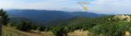
Starting from Masevaux, this hike will take you to Sudel, the south-eastern tip of the Vosges. It offers a beautiful view of the Belfort area, the Jura and the Alps. The hike is not difficult, there is just a slight incline.
The Baerenkopf from Rougemont-le-Château
 12.57 mi
+3,346 ft
-3,343 ft
8h 40
12.57 mi
+3,346 ft
-3,343 ft
8h 40
 Difficult
Departure from Rougemont-le-Château (Territoire-de-Belfort)
Difficult
Departure from Rougemont-le-Château (Territoire-de-Belfort)
A hike with no technical difficulty but a significant elevation gain. Beautiful panoramic views, including the Belfort Gap. This hike takes you past the highlights of the ruins of Rougemont Castle, Sainte Catherine Chapel, the Sudel, the Baerenkopf and the hamlet of Saint Nicolas.
From Lachtelweiher, a circular route that passes via the summits of the Baerenkopf and the Sudel
9.05 mi
+1,821 ft
-1,821 ft
5h 45
Moderate
Departure from Haut-Rhin
From Lachtelweiher (in the municipality of Kirchberg), a pleasant circular route follows the Doller valley, passing over the peaks of Baerenkopf and Sudel in the Southern Vosges and through the farmhouse inns at Lochberg and Bruckenwald. This circular route also has historical interest as it follows, for a long stretch along the ridge, theGR®5, which runs along the former border between France and Germany from 1871 until the First World War.
Walks near Sudel
Gsang towards the Hundsruck Pass
4.44 mi
+499 ft
-1,444 ft
2h 30
 Easy
Departure from Moosch (Haut-Rhin)
Easy
Departure from Moosch (Haut-Rhin)
Return to the Hundrunck Pass via the summit of the Vogelstein.
Giromagny - Belfort
 12.05 mi
+400 ft
-748 ft
5h 55
Moderate
Departure from Giromagny (Territoire-de-Belfort)
12.05 mi
+400 ft
-748 ft
5h 55
Moderate
Departure from Giromagny (Territoire-de-Belfort)
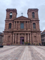
This stage is the last of the Club Vosgien's red rectangle trail through the Vosges. This stage is classified as moderate as there is virtually no elevation gain. Most of the hike takes place under forest cover. The stage starts in the small town of Giromagny and ends in the beautiful city of Belfort, passing by Bartholdi's Lion, a must-see photo spot for those completing the Vosges crossing!
From Chaux to Malsaucy via Fort de Giromagny
 7.69 mi
+453 ft
-584 ft
3h 55
Moderate
Departure from Chaux (Territoire de Belfort) (Territoire-de-Belfort)
7.69 mi
+453 ft
-584 ft
3h 55
Moderate
Departure from Chaux (Territoire de Belfort) (Territoire-de-Belfort)
This walk follows the fortified belt around Belfort. You’ll discover lovely countryside and woodland scenery, as well as several charming villages: Chaux, La Chapelle-sous-Chaux and Évette-Salbert.You’ll pass by Giromagny Fort. The walk ends with a landscape featuring numerous ponds and the Malsaucy nature reserve. As well as a beautiful view of the Vosges, you’ll be able to spot a variety of birds.
The start and finish points are accessible by bus or train.
Ballon d'Alsace - Chalet de l'Alouette
 14.19 mi
+1,860 ft
-3,665 ft
8h 10
Difficult
Departure from Lepuix (Territoire-de-Belfort)
14.19 mi
+1,860 ft
-3,665 ft
8h 10
Difficult
Departure from Lepuix (Territoire-de-Belfort)
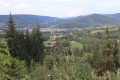
This beautiful route begins with two remarkable peaks in the Vosges and offers beautiful views of the upper Moselle valley, before reaching the Pays des Étangs.
Ballon d'Alsace - Giromagny
 7.75 mi
+417 ft
-2,707 ft
3h 55
Moderate
Departure from Lepuix (Territoire-de-Belfort)
7.75 mi
+417 ft
-2,707 ft
3h 55
Moderate
Departure from Lepuix (Territoire-de-Belfort)
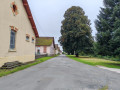
This hike takes you down from Ballon d'Alsace to Giromagny. It is the continuation of the Vosges crossing, proposed by DNA, Passion Vosges and the Journal d'Alsace (see practical information). The first few kilometres are along the ridges, with views of the Black Forest, the Rhine Valley and even the Alps. During this same section, you may come across several ski resorts, such as La Chaumière and La Gentiane. A farmhouse inn at Wissgrut offers lunch. Further on, a shelter at the Col du Chantoiseau provides a place to picnic. The descent then continues, sometimes more steeply than others. The arrival in Giromagny offers views of the city of Belfort.
From Malsaucy near Évette-Salbert to Bavilliers via the forts
 8.71 mi
+1,371 ft
-1,509 ft
5h 10
Moderate
Departure from Évette-Salbert (Territoire-de-Belfort)
8.71 mi
+1,371 ft
-1,509 ft
5h 10
Moderate
Departure from Évette-Salbert (Territoire-de-Belfort)
This walk follows the fortified belt around Belfort. You’ll discover lovely countryside and woodland scenery, the village of Evette Salbert and the towns near Belfort: Essert and Bavilliers. You’ll pass by Fort du Salbert and the Ouvrage de la Côte, which formed part of Belfort’s line of defence. The start and finish points are accessible by bus or train.
Belfort - Fesches-le-Châtel
 13.19 mi
+712 ft
-804 ft
6h 40
Difficult
Departure from Belfort (Territoire-de-Belfort)
13.19 mi
+712 ft
-804 ft
6h 40
Difficult
Departure from Belfort (Territoire-de-Belfort)
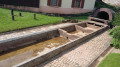
This hike is the first of two stages linking the end of the Vosges crossing in Belfort to the start of the Grande Traversée du Jura (or GTJ on maps), located at the start of Mandeure. This hike is very cultural, starting in the historic town of Belfort. The first part takes you past three forts: Belfort, Basses Perches and Bosmont. The hike is never very far from urban areas and it is even possible to get there by TGV as the high-speed train passes through. It is a hike that alternates between woods, agricultural plains and villages of varying sizes, including Bourogne and its charming wash houses. The end of the hike is the most pleasant part of the route, crossing the dry grasslands of Bourogne and walking along the Rhône-Rhine Canal.
Forests and canal in Danjoutin
 5.88 mi
+213 ft
-203 ft
2h 55
Moderate
Departure from Danjoutin (Territoire-de-Belfort)
5.88 mi
+213 ft
-203 ft
2h 55
Moderate
Departure from Danjoutin (Territoire-de-Belfort)
The aim of this walk is to explore part of the communal forests, the Grand Bois and the Bosmont, the Montbéliard Canal in Haute-Saône, as well as the landscapes near the village of Danjoutin.
An easy walk suitable for everyone.
The walk is signposted.
Le Markstein – Thann
 Tourism professional
 17.72 mi
+2,359 ft
-5,187 ft
10h 10
17.72 mi
+2,359 ft
-5,187 ft
10h 10
 Very difficult
Departure from Oderen (Haut-Rhin)
Very difficult
Departure from Oderen (Haut-Rhin)
From the Markstein, the sixteenth stage of the journey across the Vosges proposed by Passion Vosges magazine continues along the Great Vosges Ridge towards the massif’s highest point, the Grand Ballon. After a visit to the Hartmannswillerkopf battlefield (1914–1918) and a climb to the summit of the Molkenrain, a long descent through the forest begins, heading towards Thann and its famous Gothic collegiate church. Franck Buchy’s account of this sixteenth stage can be found in *Passion Vosges*.