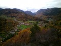
Hochstein (Ranspach) – Edelweiss Mountain Hut

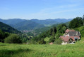
Among the many trails leading to the Edelweiss Ski Club refuge in Saint-Amarin, this route presents no particular difficulty and takes you on a walk along the ridge between the communal forests of Saint-Amarin and Ranspach.

Details

n°235603
Creation:
Last update:
Last review:
  • Walking
    Activity: Walking
  • ↔
    Distance: 2.17 mi
  • ◔
    Average duration: 2h 10 
  • ▲
    Difficulty: Easy

  • ⚐
    Back to start: No
  • ↗
    Ascent: + 1,329 ft
  • ↘
    Descent: - 10 ft

  • ▲
    Highest point: 3,773 ft
  • ▼
    Lowest point: 2,444 ft

Photos

Description of the walk

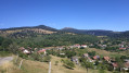
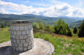
Access: The starting point for our walk is at the summit of the Hochstein, high above Saint-Amarin and Ranspach. It can be reached via a road from Ranspach, following Rue du 2 Décembre, Rue du Général de Gaulle and finally Rue du Koestel. This final section of the road winds its way up the hillside to the summit, where there are a few benches from which to admire the magnificent scenery.

(S) Set off by following the path marked with the ‘Red-White-Red’ symbol, which descends gently into the fir forest. For the most part, this path runs alongside the forest track known as the Koestelweg, alternating between short climbs and gentle slopes.

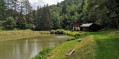
(1) You’ll arrive at a place called Les Dreitafel, where there’s a small wooden chalet built by the Club Vosgien, with a few benches where you can rest a little before tackling the final stretch.
Take the forest track branching off to the right and marked with the ‘Red Circle’ symbol for about 800 metres.

(2) Finally, leave the forest track and take the path on the left-hand side, which climbs quite steeply. This is the final ascent to the refuge, which winds its way in a few bends through the club’s old ski run to arrive opposite the entrance to the refuge (E).

Waypoints

  1. S : mi 0 - alt. 2,454 ft - Starting point at Hochstein
  2. 1 : mi 1.48 - alt. 3,251 ft - Dreitafel
  3. 2 : mi 1.93 - alt. 3,442 ft - Start of the final ascent
  4. E : mi 2.17 - alt. 3,773 ft - Arrival at the Edelweiss Mountain Hut

Notes

This walk presents no particular difficulty, apart from the final climb, which is quite steep. As some sections of the path are occasionally crossed by heavy runoff, it is advisable to wear walking boots.

The refuge is open every weekend and is looked after by club members on a rota basis. For further information, simply visit the Edelweiss Ski Club website.

Reviews and comments

4.7 / 5
Based on 1 review

Reliability of the description
5 / 5
Ease of following the route
5 / 5
Route interest
4 / 5
BARTHEL
BARTHEL
• Edited:

Overall rating : 4.7 / 5

Date of your route : Dec 30, 2024
Reliability of the description : ★★★★★ Very good
Ease of following the route : ★★★★★ Very good
Route interest : ★★★★☆ Good
Very busy route : No

About 900 metres after the start, on the left (the sign is hard to spot), you can see the remains of a goods lift built and used in 1918 to supply troops on the Route des Crêtes towards the end of the war

Machine-translated

Other walks in the area

For more walks, use our search engine .

The GPS track and description are the property of this route's author. Please do not copy them without permission.