Country:

 City:


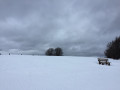
Start at the Ballon d’Alsace near the bomb disposal unit monument.
(S/E) At the car park, cross the D465 main road with care and then put on your snowshoes on the snowfield opposite.
The route is marked with a snowshoe symbol and is numbered 3. However, it is advisable to follow the GPS track closely as the markings are often missing.
The route starts on the right, running along the north side of the road and heading east towards the Auberge du Ballon.
(1) After La Savoureuse, go round the Auberge du Ballon to the north and then continue along the track which runs alongside the main road, about thirty metres away.
(2) You’ll come across a small road. There’s a section with a bit of snow suitable for snowshoes. There are plenty of snowshoe tracks in this area, and you mustn’t head left towards the water reservoir but carry on straight ahead. At this point, following the GPS track is very helpful.
Pass the ‘Les Sapins’ holiday complex on your left and follow the path into the forest, keeping parallel to the road.
(3) Pass the restaurant “La Chaumière” on your right and the Mannheimer ski lift on your left. Continue along the route which runs north of the D466 road leading to Sewen.
(4) As you emerge from the forest, pass by the foot of the Le Tourtet – La Tête des Redoutes ski lift. Leave it on your left and continue through a lovely little wood. Reach the Les Bruyères ski lift, turn right and head downhill alongside the lift without crossing it.
Cross the D466 via the bridge built for skiers. Keep well to the right so as not to get in the way of skiers on the ski lift. Continue downhill until you reach La Gentiane (E).

 Visorando Member

 Moderate
 Difficult