Hot Spring - Pont du Rondin, Torrent le Ravage and Reherrey Lakes

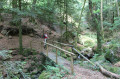
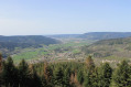
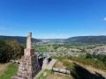
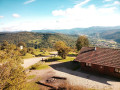
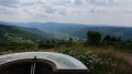
Walk under the fir trees, passing by the Chaudefontaine hot spring and the beautiful ponds overlooking Reherrey. This hike is ideal during hot weather.

Details

n°19169325
Creation:
Last update:
Last review:
  • Walking
    Activity: Walking
  • ↔
    Distance: 5.14 mi
  • ◔
    Average duration: 3h 15 
  • ▲
    Difficulty: Moderate

  • ⚐
    Back to start: Yes
  • ↗
    Ascent: + 997 ft
  • ↘
    Descent: - 997 ft

  • ▲
    Highest point: 2,260 ft
  • ▼
    Lowest point: 1,601 ft

Photos

Description of the walk

Park along the small road, opposite the sign for the hot spring on the left-hand side or just before it (see § Practical Information).

This route is signposted by the Club Vosgien from the Reherrey car park

(S/E) Follow the path down the steps to the Source Chaude.

(1) Cross the stream and continue down to the village of Reherrey.

(2) Cross the bridge and first turn right then left to reach the car park where the walks start.

Follow the Blue Triangle markings as far as the ponds.

(3) Cross the bridge at the end of the car park and turn right, following the Ravage stream. Reach the Pont du Rondin by heading slightly down to the right of the main path.

(4) Once you’ve rejoined the path, turn right and continue until you reach a forest track.

Red Cross markings

(5) Carry on to the left until you reach the Étang de la Besace and go round it on the left. Keep to the left for about a hundred metres.

(6) Take the path on the left towards the Grand Étang.

(7) At the far end of the pond, turn right. Walk past a beautiful house on your left and continue to the next junction (house opposite, slightly lower down).

Blue Cross signposting

(8) Turn left towards Pré Grandemange.

No further signposting

(9) Head down the forest track to the left.

(10) Cross the Thibieu stream and head down to the Reherrey car park.

(3) Follow the route you took on the way there back to the starting point of the walk (S/E).

Waypoints

  1. S/E : mi 0 - alt. 1,873 ft - Car park sign pointing to the Hot Spring
  2. 1 : mi 0.07 - alt. 1,811 ft - Crossing a stream - Source Chaude de Chaudefontaine
  3. 2 : mi 0.44 - alt. 1,601 ft - Bridge at the - Ravage (ruisseau) - Affluent du Ruisseau de Reherrey
  4. 3 : mi 0.58 - alt. 1,644 ft - Crossing the bridge - Reherrey (ruisseau) - Affluent de la Moselle
  5. 4 : mi 1.09 - alt. 2,018 ft - Junction
  6. 5 : mi 1.41 - alt. 2,198 ft - Turn-off towards the - Étang de la Besace
  7. 6 : mi 1.89 - alt. 2,244 ft - Path on the left
  8. 7 : mi 2.05 - alt. 2,247 ft - Junction after - le Grand Étang
  9. 8 : mi 2.69 - alt. 2,067 ft - Junction leading to Pré Grandemange.
  10. 9 : mi 3.18 - alt. 1,795 ft - Forest track on the left
  11. 10 : mi 4.02 - alt. 1,900 ft - Thibieu (ruisseau) - Affluent du ruisseau de Reherrey
  12. S/E : mi 5.14 - alt. 1,873 ft - Car park sign pointing to the Hot Spring

Notes

There are few parking spaces directly by the hot spring. It is also possible to park in the large car park at the start of the hiking trails in Reherrey (3). In this case, if you wish to see the hot spring, you will need to make a return trip from the car park before setting off towards the ponds.

Reviews and comments

4.6 / 5
Based on 12 reviews

Reliability of the description
4.8 / 5
Ease of following the route
4.6 / 5
Route interest
4.3 / 5
User 28448670

Overall rating : 5 / 5

Date of your route : Oct 11, 2026
Reliability of the description : ★★★★★ Very good
Ease of following the route : ★★★★★ Very good
Route interest : ★★★★★ Very good
Very busy route : No

A lovely walk. The setting is really lovely.

Machine-translated

Virginie Alc
Virginie Alc

Overall rating : 5 / 5

Date of your route : Sep 28, 2025
Reliability of the description : ★★★★★ Very good
Ease of following the route : ★★★★★ Very good
Route interest : ★★★★★ Very good
Very busy route : No

Superb hike, following the stream for half the route
Be careful at point 8 not to miss the path; we took a detour, but all roads lead to Rome 😅

Machine-translated

Lélie
Lélie

Overall rating : 4.7 / 5

Date of your route : Mar 25, 2025
Reliability of the description : ★★★★★ Very good
Ease of following the route : ★★★★★ Very good
Route interest : ★★★★☆ Good
Very busy route : No

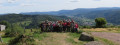
There is no car park, so you have to park at the side of the road to go down to the hot spring and then climb back up towards Vecoux via a Vosges cow farm. On the other side, many trees are being felled. The pleasant side is the collection of ponds and views from houses far away from the population. There are lots of frogs in the first pond. Lots of birds. The first climb is next to a stream, which is very pleasant, then you follow a very easy path.

Machine-translated

Sylvieetjeanclaude
Sylvieetjeanclaude

Overall rating : 4 / 5

Date of your route : Mar 09, 2025
Reliability of the description : ★★★★☆ Good
Ease of following the route : ★★★★☆ Good
Route interest : ★★★★☆ Good
Very busy route : Yes

Nice walk, a bit long, the section on the forest road.

Machine-translated

Philorando
Philorando

Overall rating : 5 / 5

Date of your route : Nov 27, 2024
Reliability of the description : ★★★★★ Very good
Ease of following the route : ★★★★★ Very good
Route interest : ★★★★★ Very good
Very busy route : No

A lovely, peaceful walk with a surprising hot spring, especially when you know the Vosges and its usually cold springs and torrents. A wonderful discovery!

Machine-translated

b.ziel
b.ziel

Overall rating : 4.3 / 5

Date of your route : Aug 08, 2024
Reliability of the description : ★★★★★ Very good
Ease of following the route : ★★★★★ Very good
Route interest : ★★★☆☆ Average
Very busy route : No

Find a parking space! We started the route at the hot spring fountain, then after the bridge we turned left. The path is quite steep and rocky, but fairly wide.
We found this route boring and it requires good walking shoes.
The second part is through the forest and downhill, very pretty, with the path following a stream. Be careful though, you need to be well equipped with hiking boots, as it is slippery and the path can be tricky. My wife was caught out on a descent but managed to stop in time. The walk took 2 hours 20 minutes.

Machine-translated

Tigador
Tigador
• Edited:

Overall rating : 4.7 / 5

Date of your route : Aug 29, 2023
Reliability of the description : ★★★★★ Very good
Ease of following the route : ★★★★★ Very good
Route interest : ★★★★☆ Good
Very busy route : No

The first part of the hike is very pleasant, following a magnificent stream along a narrow but charming path. The second part of the hike is less interesting, following a wide path made of crushed stone. You could extend the hike a little at point 8 to follow the small path that leads to Reherrey. Tip: park at the Reherrey car park, which is designed for this purpose (point 2). It's worth making the round trip to the hot spring.

Machine-translated

gazok54
gazok54 ★
• Edited:

Metcigillestruchot@sfr.fr

crapaudon tells us:

The so-called "hot" spring is only 21°C.

Indeed, 21 degrees is not hot in the middle of summer, but in winter it's a different story. We'll have to come back.

Machine-translated

gillestruchot@sfr.fr

Overall rating : 4 / 5

Date of your route : Jul 31, 2023
Reliability of the description : ★★★★☆ Good
Ease of following the route : ★★★★☆ Good
Route interest : ★★★★☆ Good
Very busy route : No

A lovely walk, very pleasant even in hot weather.

Machine-translated

gazok54
gazok54 ★

Thank you all for your feedback. 👍

Machine-translated

crapaudon
crapaudon

Overall rating : 4 / 5

Date of your route : Jul 11, 2023
Reliability of the description : ★★★★☆ Good
Ease of following the route : ★★★☆☆ Average
Route interest : ★★★★★ Very good
Very busy route : No

The so-called "hot" spring is only 21°C, but it's perfect for a hot summer's day.
Much of the hike takes place in the forest, but it is magnificent and varies greatly along the route. The first pond is my favourite, and with a bit of luck you will see some very large carp there.
In any case, this route is far from the crowds and allows you to discover some charming spots.

Machine-translated

carole68
carole68

Overall rating : 5 / 5

Date of your route : Aug 21, 2022
Reliability of the description : ★★★★★ Very good
Ease of following the route : ★★★★★ Very good
Route interest : ★★★★★ Very good
Very busy route : No

I loved this route, especially the first half with the little paths along the river The second half was more traditional, but also very pleasant. Definitely worth doing! (I just noticed a small error on the map for the last part, but it's only in the explanation, so it wasn't a problem.)

Machine-translated

colcri
colcri

Overall rating : 4.7 / 5

Date of your route : Aug 08, 2022
Reliability of the description : ★★★★★ Very good
Ease of following the route : ★★★★★ Very good
Route interest : ★★★★☆ Good
Very busy route : No

Very busy at the Chaudefontaine fountain, but not so many people on the rest of the route.

Machine-translated

FredericW
FredericW

Overall rating : 4.3 / 5

Date of your route : Jun 11, 2022
Reliability of the description : ★★★★★ Very good
Ease of following the route : ★★★★☆ Good
Route interest : ★★★★☆ Good
Very busy route : No

Be careful at the hairpin bend at point 7, there is no indication to turn left (no signpost).

Machine-translated

Other walks in the area

For more walks, use our search engine .

The GPS track and description are the property of this route's author. Please do not copy them without permission.