Country:

 City:
City:


Park at the very end of Rue du Rapré in Dommartin-les-Remiremont. As soon as the tarmac road turns into a forest track, you can park on the verge.
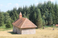
(S/E) To start the walk, take the path on the right, heading north-east, signposted with a white ‘Vierge de Mai’ sign. This path follows the ‘Blue Ring’ markings. Continue up this path until you reach the statue of the Virgin Mary. ‘Vierge de Mai’ signs are visible at regular intervals. There are two benches by the statue of the Virgin Mary.
(1) After viewing the statue and the orientation board, retrace your steps slightly until you rejoin the Blue Ring path, which lies straight ahead as you return from the statue of the Virgin. Continue along this path until you come to a forest track. On the forest track, turn left, following the sign for “Dommartin” and the Blue Ring and Red Cross markings. Continue along this path until you reach the next junction.
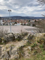
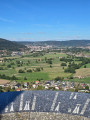
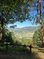
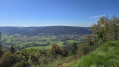
(2) Turn right. Right at the start of the path, follow the sign for “Église des Chèvres – Viewpoint (round trip)”, which takes the path furthest to the left. Continue along this path until you reach the sign for “Église des Chèvres” and enjoy the view over the valley.
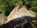
(3) After passing the boulder on the right, there is a path on the left leading downhill. The path is not signposted but is clearly visible. However, the descent is quite steep and a little slippery: see the alternative route in the Practical Information section. Carry on until you rejoin the forest track.
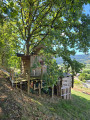
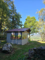
(4) Continue to the right along the forest path, following the sign for “Dommartin” and the Blue Ring and Red Cross markings. You can stop briefly at the chalet, where you’ll find a lovely view and a picnic table. Continue down the forest path to the bottom of the village.
(5) Take the street on the left just before the Stop sign (Rue du Cuchot) and follow the Blue Ring markings, which take you along a village road but offer a lovely view of the village.
(6) Turn left onto Rue de la Forêt, signposted with the Blue Ring; the path is tarmac at first, then becomes a forest track, and continue straight on to the car park (S/E).
 Visorando Member
 Moderate
 Difficult