Bélué Chalet Route

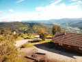
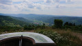
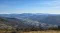
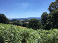
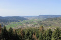
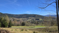
This circular route will take you to two viewpoints, passing through a variety of landscapes. You’ll follow the Dessus de Rupt valley and, after a stretch through the woods, you’ll reach the Bélué with its panoramic views, before descending via steep paths to reach the Croix de Parier viewpoint and return to your starting point.
This walk is published with the permission of the Club Vosgien de Rupt Vecoux Ferdrupt.

The walk is accessible via Rupt/Moselle Centre station.

Details

n°64557152
Creation:
Last update:
Last review:
  • Walking
    Activity: Walking
  • ↔
    Distance: 6.23 mi
  • ◔
    Average duration: 4h 05 
  • ▲
    Difficulty: Moderate

  • ⚐
    Back to start: Yes
  • ↗
    Ascent: + 1,421 ft
  • ↘
    Descent: - 1,421 ft

  • ▲
    Highest point: 2,825 ft
  • ▼
    Lowest point: 1,404 ft
  • ⚐ Country: France
  • ⚐
  • ⚐ City: Rupt-sur-Moselle (88360)
  • ⚑
    Start/End: N 47.926786° / E 6.66316°
  • Accessible from the train station Gare de Rupt/Moselle Centre.
  • ❏
    IGN map(s): Ref. 3519OT, 3619OT, 3619OTR
  • Hour-by-hour weather

Photos

Description of the walk

Head to Rupt-sur-Moselle via the D466; at the traffic lights, turn left if you’re coming from Épinal, or right if you’re coming from Bussang. Park in the Place Albert Montémont car park, below the church.

(S/E) Walk round the left-hand side of Saint-Étienne Church, stay on Rue de Parier, and follow the ‘Blue Ring’ signposts. At the Y-junction, leave this street and take the one on the right. Atthe third hairpin bend, you’ll reach a junction with a footpath.

(1) Turn left onto this path to walk through the forest and join Rue des Déportés.

(2) Turn right onto it to look out over the Dessus de Rupt Valley, and arrive at a junction with a monument in honour of the deportees.

(3) Turn left, continuing to follow the ‘Blue Ring’ markings, and you’ll soon come to a wider track after a right-hand bend. Turn left onto it and follow it until you reach the crossroads at a place called La Biolle.

(4) Turn right and, a little further on, pass the Green Ring path on your left, continuing along the Blue Ring-marked path. Continue uphill until you reach the major crossroads at La Croix du Lait.

(5) Turn right at a 90° angle onto the path marked ‘Blue Ring’ to reach the Chalet de Bélué and the orientation table. 

(6) Carry on to the right, still following the Blue Ring markings. Complete the climb, then begin the descent through the forest. Go round the Haut de Bélué and reach the junction with a steep path.

(7) Head down to the right along this steep path and, further on, you’ll come to a junction with a path marked with a Red Triangle.

(8) Continue along this path, following both sets of markings, to return to the original junction you passed on the way there.

(1) Follow the route you took on the way there in the opposite direction until you reach the car park at Place Albert Montémont (S/E).

Waypoints

  1. S/E : mi 0 - alt. 1,404 ft - Place Albert Montémont car park - Église Saint-Étienne (Rupt-sur-Moselle)
  2. 1 : mi 0.33 - alt. 1,552 ft - Crossroads of the circular loop
  3. 2 : mi 0.75 - alt. 1,696 ft - Rue des Déportés
  4. 3 : mi 0.91 - alt. 1,821 ft - Monument to the deportees
  5. 4 : mi 1.98 - alt. 2,254 ft - La Biolle
  6. 5 : mi 2.56 - alt. 2,585 ft - Croix du Lait
  7. 6 : mi 3.3 - alt. 2,805 ft - Bélué chalet
  8. 7 : mi 4.47 - alt. 2,556 ft - Steep path
  9. 8 : mi 5.13 - alt. 2,201 ft - Crossroads with dual signposting
  10. S/E : mi 6.23 - alt. 1,404 ft - Place Albert Montémont car park

Notes

(S/E) If the car park at Place Albert Montémont is full, there are others nearby.
(6) You’ll pass the Chalet de Bélué: this chalet is open to everyone and has a stove, tables and a dormitory.
(7) The path is steep and then narrow as it winds along the mountainside; walking sticks are a good idea.

Worth a visit

(6) Belué has two paragliding take-off sites, one of which is near the chalet.

Reviews and comments

5 / 5
Based on 2 reviews

Reliability of the description
5 / 5
Ease of following the route
5 / 5
Route interest
5 / 5
User 31377356

Overall rating : 5 / 5

Date of your route : Sep 27, 2026
Reliability of the description : ★★★★★ Very good
Ease of following the route : ★★★★★ Very good
Route interest : ★★★★★ Very good
Very busy route : No

A hike consisting entirely of uphill and downhill sections that requires a good level of fitness: it’s all uphill and downhill. It’s well worth the effort, though, as the view from the very top is absolutely magnificent. At the summit, there are several picnic tables near the chalet and an orientation table. The chalet is open, and you can take shelter there if the weather isn’t ideal. Our tip: do the route in reverse so that you tackle the steepest section right at the start.

Machine-translated

SchumSchum
SchumSchum

Overall rating : 5 / 5

Date of your route : Apr 22, 2026
Reliability of the description : ★★★★★ Very good
Ease of following the route : ★★★★★ Very good
Route interest : ★★★★★ Very good
Very busy route : No

A magnificent route, perfectly signposted and easy to follow, offering superb views into the distance at various points.

Machine-translated

Other walks in the area

For more walks, use our search engine .

The GPS track and description are the property of this route's author. Please do not copy them without permission.