The Octroi Trail in Ferrière-la-Grande

This route, on the outskirts of Maubeuge, takes in farm tracks, small country lanes and the streets of Ferrière-la-Grande, allowing you to explore a lush, rolling countryside. In wet weather, waterproof footwear is essential. Take care when crossing the RD 295 and 95.

Details

n°1548238
Creation:
Last update:
Last review:
  • Walking
    Activity: Walking
  • ↔
    Distance: 4.37 mi
  • ◔
    Average duration: 2h 10 
  • ▲
    Difficulty: Easy

  • ⚐
    Back to start: Yes
  • ↗
    Ascent: + 197 ft
  • ↘
    Descent: - 197 ft

  • ▲
    Highest point: 604 ft
  • ▼
    Lowest point: 440 ft

Photos

Description of the walk

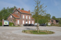
Start at Place Gambetta (large car park by the town hall).

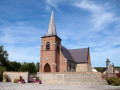
(S/E) Head towards the town hall and, at the junction, turn right up Rue du 8 mai 1945. Walk past the church and cross to the left onto Place de la République
(D27 towards Rousies-Maubeuge, Avenue du Général de Gaulle).

(1) At the Fork in the road, leave Rue du Cinéma on your left and take Rue Léonce Delens. Continue straight on along Rue Léonce Delens (part of the Avesnois GRP®, marked in yellow and red). Follow this road to the end and pass the school complex. Continue along Chemin Vert for about 300 metres.

(2) At the junction, take the Chemin d’Hautmont on the left and walk past a detached house. Continue south-west across the Champ de l’Alouette plain.

(3) At the T-junction (elevation 162), turn left onto the Chemin de Beaufort, walk past the cemetery and join the D295 (Octroi de Louvroil).

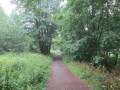
(4) Cross the road and follow a wide dirt track opposite (Sentier de l’Octroi) which climbs through fields and meadows bordered by hedgerows, in a landscape typical of the Sambre-Avesnois region. Panoramic view of Ferrière-la-Grande.

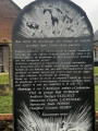
(5) After the gas installation, turn left onto Rue du Fort and follow the D95 for about 800 metres (caution: heavy traffic, narrow verges). On your right, the Fort du Bourdiau (closed to the public), built in 1886, is one of the seven forts that defended Maubeuge. Let the GRP® trail branch off to the right.

(6) Leave the D95 at the Fork in the road, turn right and continue straight on along the Chemin Stratégique (linking Fort du Bourdiau to Fort d’Haumont) for about 200 metres. Take the first street on the left. Continue along a dirt track, the Chemin des 4 vaches, which then becomes Rue de Marlière and leads you towards Ferrière-la-Grande (in wet weather, this track is very muddy).

(7) At the end of this track, at a place called Le Trieu Baudet, turn right onto the pavement of Rue Casimir Fournier (D295) and follow it for about 100 metres. Take the first right, cross the Besaces stream, pass Rue du Marais and then Rue de la Barrière on your right, and continue straight down Rue Roger Salengro until you reach the town hall. You’ll find the car park at Place Gambetta (S/E).

Waypoints

  1. S/E : mi 0 - alt. 440 ft - Place Gambetta (large car park at the town hall)
  2. 1 : mi 0.25 - alt. 463 ft - Rue Léonce Delence
  3. 2 : mi 1.07 - alt. 541 ft - Crossroads
  4. 3 : mi 1.41 - alt. 535 ft - Beaufort Trail
  5. 4 : mi 1.76 - alt. 515 ft - The Octroi Trail
  6. 5 : mi 2.62 - alt. 571 ft - D95 road
  7. 6 : mi 2.92 - alt. 597 ft - Strategic path
  8. 7 : mi 3.98 - alt. 456 ft - Le Trieu Baudet
  9. S/E : mi 4.37 - alt. 440 ft - Place Gambetta (large car park at the town hall)

Notes

In wet weather, waterproof footwear is essential. Take care when crossing the D295 and D95.

This route is listed in the PDIPR (Departmental Plan for Walking and Hiking Routes)

Follow the yellow markings.

Worth a visit

The ‘octroi’ was the administrative office responsible for collecting the duties paid on certain foodstuffs or goods before they entered the town. The Octroi de Louvroil is the locality between the communes of Louvroil and Ferrière-la-Grande where the former octroi was situated; it was abolished in 1948.

Eco-cycle stop and mountain-bike centre

Museam
Potters’ Courtyard Museum

Reviews and comments

4.7 / 5
Based on 1 review

Reliability of the description
5 / 5
Ease of following the route
5 / 5
Route interest
4 / 5
Tony59
Tony59

Overall rating : 4.7 / 5

Date of your route : Jul 08, 2021
Reliability of the description : ★★★★★ Very good
Ease of following the route : ★★★★★ Very good
Route interest : ★★★★☆ Good
Very busy route : No

Between Louvroil and Ferrière, the GR trail is not well maintained; there is a lot of bramble, nettles and other tall weeds, making the path virtually impassable.

Machine-translated

Other walks in the area

For more walks, use our search engine .

The GPS track and description are the property of this route's author. Please do not copy them without permission.