Country:

 City:
City:


If you’re travelling by car, you can park on Place du Général de Gaulle in Ferrière-la-Petite, near the town hall, and leave another vehicle at the Maubeuge Zoo car park.
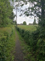
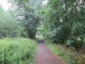
(S) From Place du Général de Gaulle, head towards Maubeuge on the D436, then turn right onto the Voie Verte. A little further on, cross the river and continue through the woodland. Ride alongside the industrial estate, cut across a road and continue straight on, following the river and the railway line on either side until you reach a junction a few metres past a playground.
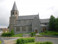
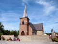
(1) Cross the road and continue opposite along Rue de l’Industrie. Pass under the height restriction barrier and continue along the main route (Route des Censes de Raidmont), still following Rue de l’Industrie. Run alongside the Stade de la Digue, then further on cross the footbridge over the River Solre and, immediately afterwards, keep left and run alongside the river. Pass the chicane and carry on straight ahead to the War Memorial and the church.
(2) Opposite the church, turn right onto the D27, towards Maubeuge. Pass the Notre-Dame primary school , then turn left onto Rue Léonce de Lens. Follow this road to the end, then continue straight ahead on the cycle path (Sentier de l’Octroi du Chemin Vert).Pass by the foot of a water tower, enter Maubeuge and continue straight ahead until you reach the large roundabout.
(3) Go round the roundabout and carry on straight ahead onto the D602. At the next junction, turn left and then immediately right, towards the town centre. Follow Avenue de France and cross the bridge over the Sambre.
(4) At the roundabout, carry on straight ahead along Avenue Jean Mabuse, towards the Town Hall. Walk along Place des Nations, then turn left just before the church onto Rue Jules-Henri Walran. Next, cross Place Vauban, head towards the Tourist Office and walk under the building. Head towards the Vauban ramparts and the fortified ruins, walk past the Corps de Garde Museum and you’ll arrive on a road at the “Fournier” bus stop.
(5) Turn right (Rue de Fleurus), then take the stairs on the left located in the bend to the right. Follow the small path down to La Pisselotte, then keep to the right until you reach the tarmac near a roundabout.
(6) Cross the road and continue straight ahead along the path to avoid the roundabout. As you come out of the bend to the right, turn left and walk along the ramparts on your left. Cross a car park, take the steps opposite and follow the path to the banks of the Sambre.
(7) Turn right, walk alongside the Sambre and head towards the roundabout you have already passed.
(4) Continue straight ahead along the Sambre for a few metres, then turn right onto Rue Hospice Saint-Nicolas. Pass under the building, then take the stairs immediately on the right to reach Rue Lazare Carnot. Turn left, then left again at the corner of the old church, Salle Sthrau. Walk behind the Maubeuge post office, then, facing the wall, turn right.
(8) At the end of Rue Coutelle, turn left onto Avenue Franklin Roosevelt; at the roundabout, keep left and you’ll arrive at Maubeuge Zoo (E).
 AONB
AONB
 Moderate
 Visorando Member