


Refine your search for walks in Sem
Sem walks


 Col de Risoul and Rancié Mines circular.
 Visorando Member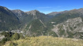
 5.66 mi
 +1,680 ft
 -1,667 ft
 4h 05
4h 05
 Moderate
 Departure from Sem (Ariège)
A beautiful route alternating between beech forests, stunning views of the Os Valley and old iron mines, starting from the small village of Sem, above Vicdessos. Best done in dry, clear weather.
The Chemin du Minier in Sem
 6.17 mi
+1,749 ft
-1,749 ft
4h 20
Moderate
Departure from Sem (Ariège)
6.17 mi
+1,749 ft
-1,749 ft
4h 20
Moderate
Departure from Sem (Ariège)
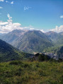
A magnificent circular route through the forest with numerous information panels along the route, offering welcome breaks during the tough climb and breathtaking panoramic views. With two must-see sights, the Refuge de Grail (closed) and the Col de Grisoul!
This short but steep hike in the Vicdessos valley reveals an important part of the mining history of the Ariège. Here, in the heart of the mountains, the Mines du Rancié began with modern open-pit iron ore extraction at an altitude of over 1,500 metres, before more and more tunnels were dug, descending ever deeper! Connected to each other, they saved many lives during the frequent rockfalls that led to their permanent closure in 1931, despite the fact that the deposit was far from exhausted.
La Soulane de Vicdessos
7.99 mi
+1,457 ft
-1,447 ft
4h 55
Moderate
Departure from Vicdessos (Ariège)
As its name suggests, the hike takes place on the southern slope and on the heights of Vicdessos. You will take an old, entirely paved road to reach the village of Illier with its interesting narrow streets, then follow a balcony path through a forest of boxwood, cherry, oak, acacia and hazelnut trees to the village of Orus. From there, the landscape opens up onto a safe path built on the mountainside, offering beautiful views as you reach the village of Sentenac, from where you will return partly via the D18. All these roads and paths are built on foundations that bear witness to civil engineering skills in terms of their volume and position.
Circular Bège ridges from Vicdessos
 6.81 mi
+1,811 ft
-1,801 ft
4h 45
6.81 mi
+1,811 ft
-1,801 ft
4h 45
 Difficult
Departure from Vicdessos (Ariège)
Difficult
Departure from Vicdessos (Ariège)
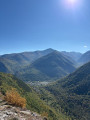
This hike is for experienced hikers who are comfortable using the app, as it takes place on unmarked roads and trails until the junction with the GR® Tour des Trois Seigneurs at the highest point of the Crêtes de Bège. The trails are old but still easily identifiable and easy to follow. However, you will need to be in good physical condition as there is a significant elevation gain over a relatively short distance. You will also need to be able to identify the best routes when you reach the rocky part of the ridge. From there, you will discover exceptional 360° panoramic views. The return journey, which is not particularly difficult, follows the GR® trail.
The Mine Trail
 Tourist office
 3.71 mi
+1,122 ft
-1,138 ft
2h 40
Moderate
Departure from Vicdessos (Ariège)
3.71 mi
+1,122 ft
-1,138 ft
2h 40
Moderate
Departure from Vicdessos (Ariège)
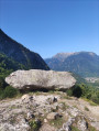
The mining trail winds its way through the woods around the delightful Sem valley. Follow in the footsteps of the former miners of Rancié and discover the past.
Orus Viewpoint via Donseille
 1.97 mi
+1,375 ft
-1,375 ft
2h 05
Moderate
Departure from Orus (Ariège)
1.97 mi
+1,375 ft
-1,375 ft
2h 05
Moderate
Departure from Orus (Ariège)
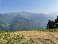
A fairly easy walk from Orus, a charming village with cobbled streets and picture-postcard scenery. The path winds through the undergrowth and ferns, past numerous low walls and abandoned shelters, bearing witness to the agricultural and pastoral activity of days gone by. The route ends at a paragliding launch site. Superb views across all the mountain ranges to the south of the Vicdessos Valley, with the Pique d’Endron in the centre and Montcalm to the right. Not to be missed!
From Goulier to the resort via the ridges and woods
 9.06 mi
+2,667 ft
-2,657 ft
6h 30
Difficult
Departure from Goulier (Ariège)
9.06 mi
+2,667 ft
-2,657 ft
6h 30
Difficult
Departure from Goulier (Ariège)
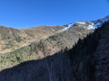
A lovely circular walk starting from Goulier, passing through the ski resort and following theGR®10.
Crête d’Esplas – Crête de la Calvière from Goulier
8.83 mi
+2,822 ft
-2,828 ft
6h 30
Difficult
Departure from Goulier (Ariège)
This hike is suitable for walkers who know how to use the app and are observant of their surroundings. Most of the route follows paths marked on the map, but these are often difficult to spot. There are no signposts from the Col de Grail onwards; however, some sections remain clearly visible and provide reassurance regarding the route. Do not attempt this hike if there is a risk of fog or after rain, as the descent into the gispet could prove very difficult. Otherwise, there are remarkable views of the Pique d’Endron, Vicdessos, the Pic des Trois Seigneur, Montcalm and others...
The Pic du Sarrasi and Pic du Garbié – Col de Grailet and Col de Risoul from Goulier
 9.25 mi
+3,885 ft
-3,862 ft
7h 40
Difficult
Departure from Goulier (Ariège)
9.25 mi
+3,885 ft
-3,862 ft
7h 40
Difficult
Departure from Goulier (Ariège)
Second day of a three-day trip (August 2023) starting from Vicdessos (Val de Sos).
A challenging hike at the start.
From (2) to (8), gradient 30%, distance 3 km, elevation gain 1000 m.
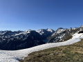
After (6), the stunning scenery makes the effort required to reach the Crête du Sarrasi (8) well worth it.
From this high vantage point, a lovely descent follows, with stunning views throughout.
From the Col de Grail (13), the return journey via theGR®10is much more comfortable.
Please note: the section from (6) to (12) is exposed.
Pique d'Endron
 5.00 mi
+3,238 ft
-3,238 ft
5h 05
Difficult
Departure from Goulier (Ariège)
5.00 mi
+3,238 ft
-3,238 ft
5h 05
Difficult
Departure from Goulier (Ariège)
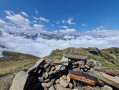
The Pique d'Endron, which can be seen majestically from Goulier, is located on a ridge separating the Siguer and Vicdessos valleys. Magnificent viewpoint with a 360° panorama of all the great peaks around, and below, the Étangs d'Izourt and Gnioure lakes.
La Pique d'Endron
 5.67 mi
+3,245 ft
-3,235 ft
5h 25
Difficult
Departure from Goulier (Ariège)
5.67 mi
+3,245 ft
-3,235 ft
5h 25
Difficult
Departure from Goulier (Ariège)
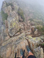
The Pique d’Endron is a central vantage point in the Haute-Ariège. From here, you can see the Montcalm massif and the Bassiès massif with its terraced lakes up close, and look out over two large lakes: Gnioure, with its small island, and Izourt. The view to the north stretches for miles. The hike is relatively short but quite challenging, with a 1,000-metre elevation gain, dizzying views and a short section where you’ll need to ‘get your hands dirty’.
Étang de Peyregrand
 9.13 mi
+3,232 ft
-3,219 ft
7h 00
Moderate
Departure from Siguer (Ariège)
9.13 mi
+3,232 ft
-3,219 ft
7h 00
Moderate
Departure from Siguer (Ariège)
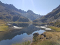
This hike in the Siguer valley is very varied. The climb along the Brouquenat stream is bucolic and feels easy despite the length and elevation gain.
The first Neych pond from Bouychet
 7.01 mi
+3,465 ft
-3,468 ft
6h 15
Difficult
Departure from Siguer (Ariège)
7.01 mi
+3,465 ft
-3,468 ft
6h 15
Difficult
Departure from Siguer (Ariège)
Third day of a three-day trip (August 2023) starting from Vicdessos (Val de Sos).
A (very) difficult round-trip hike: 1,200 m elevation gain and an average gradient of 21 per cent.
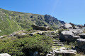
A magnificent path all the way to the Pont de le Peyre over the Ruisseau de Brouquenat. Then a narrow path until you cross the Ruisseau d’Auruzan.
Next, a steep path leads to the first Neych lake.
After the second footbridge, the landscape opens up. From the Pont de la Peyre, there are stunning views over various valleys and the Ariège mountain ranges as far as the lake.
Very old yellow signposting.
Two-day circular walk taking in the lakes of Gnioure, Rouch, Llassiès and Peyregrand
 17.00 mi
+6,398 ft
-6,388 ft
2 days
17.00 mi
+6,398 ft
-6,388 ft
2 days
 Very difficult
Departure from Siguer (Ariège)
Very difficult
Departure from Siguer (Ariège)
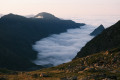
A magnificent but very demanding circular route with highly varied landscapes and terrain:Numerous waterfalls during the ascent, which is at times steep and very stony, up to the Peyre bridge.A short, slightly vertiginous ledge section to reach the vast Gnioure pond.A long path running alongside the lake, then the stream, and winding its way into the valley.A hillside climb that starts off fairly gentle but ends up quite steep, leading to the Étang du Rouch.Cross the pass and enjoy a gentle descent towards the very pretty Llassiès lakes.A challenging descent via a chimney (which can be bypassed via a hairpin bend) into the valley.A long and gentle descent (very long) via the Peyregrand and Brouquenat lakes from above.A gruelling descent along stony paths back to the car park.
The route follows the streams of Escalès, Auruzan and Gnioure on the ascent, then those of Llassiès, Peyregrand and Brouquenat on the descent.
Étang du Rouch via Étang de Gnioure
 8.63 mi
+6,322 ft
-1,004 ft
10 hrs
Very difficult
Departure from Siguer (Ariège)
8.63 mi
+6,322 ft
-1,004 ft
10 hrs
Very difficult
Departure from Siguer (Ariège)
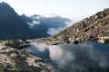
Climb the ridge marking the border with Andorra to the beautiful Étang du Rouch, which seems to sit at the foot of the Pic de Font Blanca, passing by the majestic Étang de Gnioure and its lovely, long valley:
- numerous waterfalls during the fairly steep and very stony climb up to the Peyre bridge;
- a short, slightly vertiginous ledge section to reach the immense Étang de Gnioure;
- a long path running alongside the lake, then the stream, and winding its way into the valley;
- a hillside climb that starts off fairly gentle but ends up quite steep, leading up to the Étang du Rouch.
Blaou Pond and Port de Siguer
 13.69 mi
+5,115 ft
-5,115 ft
10h 45
Difficult
Departure from Siguer (Ariège)
13.69 mi
+5,115 ft
-5,115 ft
10h 45
Difficult
Departure from Siguer (Ariège)
This is a fairly long route, taking around 6 hours to climb up to Étang Blaou. The route is easy up to Cabane de Peyregrand, where you simply follow the yellow markings. In the plain around the hut, the markings are more or less faded and it is easy to lose track of them. They reappear at the start of the final climb, where the cairns and yellow markings are fairly easy to see.
It's a real treat once you reach the lake, where there is no one else around and the landscape is magnificent.
The Étangs de Bassiès from Massada
 9.11 mi
+3,212 ft
-3,202 ft
7h 00
Difficult
Departure from Auzat (Ariège)
9.11 mi
+3,212 ft
-3,202 ft
7h 00
Difficult
Departure from Auzat (Ariège)
First day of a three-day trip (August 2023) starting from Vicdessos (Val de Sos).Please note: the suggested route, which is in excellent condition, is only sparsely signposted, except for the section of theGR®®10.This hike is classified as difficult due to the need for a good sense of direction, the poor condition of theGR®®10, the numerous steps to negotiate, the duration, etc.If it is simply a return trip to the refuge via theGR®®10, then the walk can be classified as moderate.=> August 2026: access to the lakes and the refuge may be affected by this => GR®10 in Ariège: Temporary closure of the Marc > Port de Saleix section (diversion)It should be possible to do a return trip to the lakes and the refuge via the power station (6) without returning via the GR®10!
Bassiès Lakes
 7.45 mi
+2,940 ft
-2,943 ft
6h 00
Difficult
Departure from Auzat (Ariège)
7.45 mi
+2,940 ft
-2,943 ft
6h 00
Difficult
Departure from Auzat (Ariège)
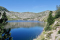
The granite cirque of Bassiès, near the Montcalm massif, is impressive for its size and its lakes. It is accessed from the right bank of the steeply-sided Bassiès stream via a comfortable but steep path that passes through a beautiful forest before coming out onto a rocky outcrop that marks the first lake. The descent is on the other bank, which is just as steep, following a well-maintained stony mule track.