


Refine your search for walks in Givonne (rivière)
Givonne (rivière) walks


 Along the streams of Olly
 Visorando Member
 5.49 mi
 +558 ft
 -558 ft
 3h 00
3h 00
 Easy
Easy
 Departure from Illy (Ardennes)
Amidst the greenery and the scents of the woodland, a short walk to the sound of babbling brooks that you cross by fording.
Along the Givonne and the Ruisseau des Fraichis
 7.58 mi
+676 ft
-650 ft
4h 05
7.58 mi
+676 ft
-650 ft
4h 05
 Moderate
Departure from Givonne (Ardennes)
Moderate
Departure from Givonne (Ardennes)
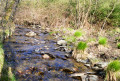
This forest walk features numerous small paths, with two main landmarks: the Givonne and the Ruisseau des Fraichis.
31/7/22: the footbridge over the Givonne at (6) has been fully restored
The Douaire, Lazareth and Bouillonnais paths
 11.27 mi
+1,257 ft
-1,250 ft
6h 15
Moderate
Departure from Givonne (Ardennes)
11.27 mi
+1,257 ft
-1,250 ft
6h 15
Moderate
Departure from Givonne (Ardennes)
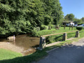
This route follows a variety of paths through a forest with a wide range of tree species. It is located almost entirely within the Sedan National Forest.
From Les Glaynées to Woaygnie
 4.79 mi
+371 ft
-374 ft
2h 30
Easy
Departure from Illy (Ardennes)
4.79 mi
+371 ft
-374 ft
2h 30
Easy
Departure from Illy (Ardennes)
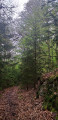
A short, leisurely walk through woodland with varied terrain.
Following the water between the Givonne and the Hatrelle
5.81 mi
+597 ft
-577 ft
3h 10
Easy
Departure from Illy (Ardennes)
This walk, mostly through state-owned forest, will take you close to or past the Givonne and two of its main tributaries: the Ruisseau des Dix Frères and the Ruisseau de la Hatrelle. In places, you will also walk along the old route of the Bouillonnais, a small train that linked Sedan and Bouillon.
Walks near Givonne (rivière)
From Bouillon Castle to Sedan Castle
14.14 mi
+1,385 ft
-1,601 ft
7h 40
 Difficult
Departure from Bouillon (Belgique) (Province de Luxembourg)
Difficult
Departure from Bouillon (Belgique) (Province de Luxembourg)
This fully signposted cross-border trail links Bouillon Castle in Belgium to Sedan Castle in France.
This is one of the possible return routes for the hike from one castle to another across the border, hike no. 36479520
After following the Semois river, you will climb up to Corbion, a small village perched high in the municipality of Bouillon. Then, after crossing the border stream near the "Maison Verlaine", you will join the old Bouillonnais road, which will take you gently to the Sedan region.
Bouillon – Florenville
 16.41 mi
+1,529 ft
-1,470 ft
8h 55
16.41 mi
+1,529 ft
-1,470 ft
8h 55
 Very difficult
Departure from Bouillon (Belgique) (Province de Luxembourg)
Very difficult
Departure from Bouillon (Belgique) (Province de Luxembourg)
Leaving Bouillon and its castle to reach Florenville means linking the two ends of the Semois by crossing the plateau and its forests rather than following the river’s course and meanders; it is therefore a long climb followed by a gradual descent; it also means leaving a town on tarmac, travelling along stony paths and dirt tracks, crossing two fords, and returning to tarmac to reach the town again. And it’s a long walk of over 26 kilometres. The accommodation I’ve chosen in Florenville is the campsite.
Circular of the great REX from Botassart
7.23 mi
+1,434 ft
-1,854 ft
4h 35
Moderate
Departure from Bouillon (Belgique) (Province de Luxembourg)
Circular passing by the resting place of the great L.D.
A route with elevation changes and beautiful scenery, but not too difficult. You can even avoid getting your feet wet. About 4½ hours of walking at a good pace.
Rochehaut – Bouillon
 7.89 mi
+1,168 ft
-1,270 ft
4h 40
Moderate
Departure from Bouillon (Belgique) (Province de Luxembourg)
7.89 mi
+1,168 ft
-1,270 ft
4h 40
Moderate
Departure from Bouillon (Belgique) (Province de Luxembourg)
The starting point, the Rochehaut viewpoint, is one of the region’s most beautiful spots, offering a bird’s-eye view of a circular bend in the River Semois and the little village of Frahant. As for the finishing point, it is one of the most popular tourist attractions, with its superb fortified castle perched above the town. In between, along the way, there are forests, steep ascents and descents, and magnificent scenery. Accommodation at the Youth Hostel.
 From Douzy (Camping du Lac) to Chassepierre
14.70 mi
+958 ft
-551 ft
2.5 hrs
Moderate
Departure from Douzy (Ardennes)
From Lac de Douzy, after passing through the Forges de Brévilly industrial site – which was very active in the 19th century – we reach the nearby Belgian border (10 km) via a small road that turns into a track suitable for vehicles. From there, simply follow numbers 30, then 11, then 13 on the cycle network’s ‘points-nœuds’ system to reach the village of Chassepierre and the campsite on the banks of the Semois. Halfway along the route, after Muno, a short walk takes you to a remarkable geological feature.
Walk along the Semois from Bohan to Alle
7.48 mi
+505 ft
-397 ft
1 hr
Easy
Departure from Vresse-sur-Semois (Province de Namur)
An easy and peaceful route following the meanders of the Semois, mainly on cycle paths (RAVeL) and small, quiet roads. From Bohan, follow the river towards Vresse, Mouzaive and Alle-sur-Semois, with beautiful views of wooded hills, typical villages and picturesque bridges. The perfect route for a family outing or a contemplative stroll, with the option of picnicking by the water.
From Carlsbourg to Paliseul (long version via Our)
 13.85 mi
+1,001 ft
-935 ft
7h 15
Difficult
Departure from Paliseul (Province de Luxembourg)
13.85 mi
+1,001 ft
-935 ft
7h 15
Difficult
Departure from Paliseul (Province de Luxembourg)
The walk starts at Carlsbourg station and winds its way between the provinces of Namur and Luxembourg, through pastures, farmland and forests. Passing through Our, Wallonia’s most beautiful village, it ends at Paliseul station.
Chassepierre – Arlon Official Campsite
47.67 mi
+1,962 ft
-1,634 ft
8 hrs
Difficult
Departure from Florenville (Province de Luxembourg)
Starting from Chassepierre, this route through the Gaume region allows time to visit remarkable cultural sites and another of the ‘most beautiful villages in Wallonia’. This involves a few detours, but fewer than those along the Semois, where the route cuts across several bends! The route description refers to the ‘nodes’ of the cycle network developed in Belgium. The route includes a loop through Arlon to the viewpoint at the top of Knippchen, which can be done in the evening or the following morning.
From Chassepierre to Pétange (Luxembourg) along the Semois
46.66 mi
+1,430 ft
-1,398 ft
6 hrs
Difficult
Departure from Florenville (Province de Luxembourg)
For most of the route, this third stage follows roads suitable for cycling, smooth paths and cycle lanes. The Semois meanders so much that it is impossible to ‘follow’ it along its entire length, but this route crosses it numerous times and heads all the way up to its source in Arlon!The ride takes you through the Gaume and the Arlon region, away from the main roads with heavy motor traffic.
Chassepierre – Longuyon
36.76 mi
+2,024 ft
-2,254 ft
7 hrs
Difficult
Departure from Florenville (Province de Luxembourg)
For a return trip to Metz in a single day, this route takes you to Longuyon station. Provided you set off early enough, you’ll be able to visit Orval Abbey, then the citadel of Montmédy, stop for lunch by the Étang de Charency-Vezin and reach Longuyon by mid-afternoon.