


Possibilité d'hébergements suivant votre budget tant à Sedan qu'à Bouillon
Pas d'eau potable sur le parcours
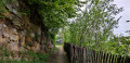
Quelques passages à gués
D'un château à l'autre, de Sedan à Bouillon

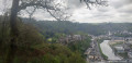
Parcours en grande partie dans la Forêt Domaniale de Sedan, entre deux châteaux, entre deux pays, sans grandes difficultés à part les kilomètres.
Details
Creation:
Last update:
Last review:
–
–
-
 Activity: Walking
 -
 Distance: 24.15 mi
 -
 Average duration: 2 days
 -
 Difficulty: Moderate
 -
-
 Back to start: Yes
 -
 Ascent: + 2,654 ft
 -
 Descent: - 2,644 ft
 -
-
 Highest point: 1,391 ft
 -
 Lowest point: 545 ft
-
 Country:
France
Country:
France
-
 Area: Massif des Ardennes
 -
 City:
Sedan (08200)
City:
Sedan (08200) -
 Start/End: N 49.702768° / E 4.950401°
 -


 Hour-by-hour weather
Photos
Stages of the route
This route needs several days, find the details below:
Notes
Worth a visit
Château de Sedan.
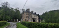
Château d'Olly : privé ne se visite pas.
Ruine d'un ancien Moulin à blé : Les Glaynées.
Arboretum de Bouillon.
Château de Bouillon.
Other walks in the area
Sedan–Bouillon
 Visorando Member
 12.42 mi
+1,401 ft
-1,227 ft
6h 55
Moderate
12.42 mi
+1,401 ft
-1,227 ft
6h 55
Moderate
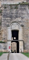
 Departure from Sedan (Ardennes)
From Sedan Castle, set off through the Val d’Olly to explore the Sedan State Forest and the Givonne Stream, following the route of the former Bouillonnais railway line. Once you’ve crossed the border, walk through the Bouillon Botanical Arboretum and finish at the Ramonette viewpoint overlooking Bouillon Castle.
Discovering the Sedan region
 5.60 mi
+492 ft
-486 ft
3h 00
Moderate
Departure from Sedan (Ardennes)
5.60 mi
+492 ft
-486 ft
3h 00
Moderate
Departure from Sedan (Ardennes)
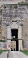
Set off to discover the historic sites that have shaped the Sedan region. Places steeped in history and emotion.
From the heights of Sedan to the Chasseurs d’Afrique memorial in Floing
 8.71 mi
+725 ft
-725 ft
4h 40
Moderate
Departure from Sedan (Ardennes)
8.71 mi
+725 ft
-725 ft
4h 40
Moderate
Departure from Sedan (Ardennes)
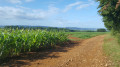
A lovely walk combining the idyllic charm of a pleasant country stroll with the educational aspect of a chapter in French history: the Battle of Sedan, which took place on1 September 1870 and led to the surrender of the French army the very next day and, consequently, the end of the Franco-Prussian War of 1870.
Sedan, the lake and the canal
 4.64 mi
+39 ft
-36 ft
2h 10
4.64 mi
+39 ft
-36 ft
2h 10
 Easy
Departure from Sedan (Ardennes)
Easy
Departure from Sedan (Ardennes)
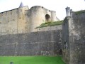
A walk around the lake in November, shrouded in mist, with a detour through the town centre and the renovated old quarters, then back along the canal, admiring the reflections of the bourgeois houses in its dark waters.
The Piot Cross at the start of the route from Wadelincourt
 11.01 mi
+1,230 ft
-1,214 ft
6h 10
Moderate
Departure from Wadelincourt (Ardennes)
11.01 mi
+1,230 ft
-1,214 ft
6h 10
Moderate
Departure from Wadelincourt (Ardennes)
A route with very few sections through woodland which, throughout the walk, offers hikers sweeping panoramic views over the Bar and Meuse valleys.
The Margueritte Division March
6.18 mi
+646 ft
-646 ft
3h 25
Easy
Departure from Ardennes
During the Franco-Prussian War of 1870, the sacrifice of the Chasseurs d’Afrique of the Margueritte Division earned the admiration of William I, who remarked, “Ah! What brave men.” Follow in their footsteps and discover the countryside and battlefields of the Sedan region.
Iges Peninsula
4.89 mi
+253 ft
-256 ft
2h 30
Easy
Departure from Glaire (Ardennes)
The Iges peninsula, formed by a circular bend in the Meuse downstream from Sedan, has always been a crossing point. A secondary Roman road, linking the two major routes from Reims to Cologne and from Reims to Trier, passed through Iges and crossed the Meuse via a paved ford. Following the surrender of 1870, 80,000 French soldiers were crammed onto the peninsula in appalling conditions before being transferred to Germany, hence the name ‘Camp de la Misère’ (Camp of Misery) given to the peninsula.
The Marfée massif, a promontory steeped in history
 9.14 mi
+863 ft
-843 ft
4h 55
Moderate
Departure from Sedan (Ardennes)
9.14 mi
+863 ft
-843 ft
4h 55
Moderate
Departure from Sedan (Ardennes)
Rising to an altitude of 340 metres, the Marfée massif was particularly coveted during various conflicts. This wooded promontory, overlooking the Meuse valley, has witnessed many historic tragedies in the ‘Pays Sedanais’.
From the viewpoint, where more than ten villages can be seen, it is easy to understand the strategic importance of this key location near the border. Nearly 30,000 German and French soldiers are buried in the two cemeteries at Noyers.
For more walks, use our search engine .
The GPS track and description are the property of this route's author. Please do not copy them without permission.

