


Refine your search for walks in Refuge du Hannenbrunnen
Refuge du Hannenbrunnen walks


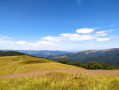
 Between Hahnenbrunnen and Lauchenkopf
 Visorando Member
 4.16 mi
 +499 ft
 -495 ft
 2h 20
 Easy
 Departure from Metzeral (Haut-Rhin)
Walk on the high moorland via Lauchenkopf, Nonselkopf, Uff Rain and Salzbach.
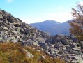
Chaumes and forests of Lauchen
 10.29 mi
+1,995 ft
-1,985 ft
6h 30
 Moderate
Departure from Linthal (Haut-Rhin)
Near the source of the Lauch, on the secondary ridge between Breitfirst and Petit Ballon, Lauchen is an area of stubble fields with remarkable views and forests, including the most beautiful and highest altitude beech forests in the Vosges mountains. It is also a peaceful area, within the Guebwiller integral biological reserves, dominated by the Klintzkopf, home to the emblematic animal of the Vosges, the capercaillie or wood grouse.
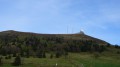
Col de la Schlucht – Le Grand Ballon: the Sentier des Crêtes
 16.57 mi
+3,238 ft
-2,556 ft
8 hrs
 Very difficult
Departure from Le Valtin (Vosges)
A very beautiful hike, taking in some remarkable sights: the Martinswand rocks, the summit of the Hohneck, the summit of the Kastelberg and the Grand Ballon (with the ‘Boule’ at the summit).
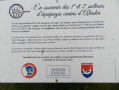
Exploring the Bois de Munster
 5.27 mi
+876 ft
-883 ft
3h 10
Moderate
Departure from Metzeral (Haut-Rhin)
A route with little elevation gain but offering magnificent panoramic views of the peaks of the Hautes-Vosges on several occasions. Passing by two farmhouse inns, it offers the chance to sample regional specialities.
High-altitude grasslands and beech forests via the Pfahlrunz and Salzbach waterfalls
 11.56 mi
+2,215 ft
-2,192 ft
7h 15
 Difficult
Departure from Metzeral (Haut-Rhin)
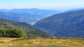
After a pleasant climb alongside the Pfahlrunz waterfalls, a final push leads to the Schweisel hilltop and its exceptional viewpoint. This is followed by a walk through a beautiful beech forest along the ridge, which leads to the Hahnenbrunnen mountain refuge.
The return route via the Salzbach and Uff Rain ridges offers remarkable views of the highest peaks before a long descent through the Muhlbach Woods. It ends at a pretty footbridge over the Salzbach stream, which becomes the River Fecht; following its left bank leads back to the car park.
Crossing the Southern Vosges from Kintzheim to Willer-sur-Thur
 56.12 mi
+10,161 ft
-9,600 ft
5 days
Difficult
Departure from Kintzheim (Bas-Rhin)
This route takes you across the Vosges in the Haut-Rhin, with moderate daily stages ranging from 15 to 20 km and an elevation gain generally between 800 and 900 m. These stages take between 6 and 7 hours, always ending near a mountain refuge, which must be booked in advance. The route follows paths marked by the Club Vosgien and passes through a wide variety of landscapes.
Hahnenbrunnen – Willer-sur-Thur
13.02 mi
+886 ft
-3,524 ft
6h 45
Moderate
Departure from Metzeral (Haut-Rhin)
The final stage passes via the Markstein and beneath the Grand Ballon, with more downhill sections and shade provided by the trees, ending in the Thur Valley where you can catch a train to Mulhouse.
Schupferen – Hahnenbrunnen
 12.27 mi
+1,798 ft
-1,762 ft
7h 15
Moderate
Departure from Stosswihr (Haut-Rhin)
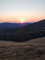
A stage of around twenty kilometres that begins in the shade of the forest, then runs alongside the Hirschsteine and Spitzenfels rocks, with a few sections secured by metal steps and fixed handrails, before continuing along the ridges after the Col de la Schlucht and passing beneath thethird-highest peak in the Vosges, the Hohneck.