


Refine your search for walks in Trois-Fours
Trois-Fours walks


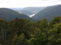
 Schlucht - Hohneck - Lac de La Lande- Chitelet- Small pass
 Visorando Member
 7.99 mi
 +804 ft
 -797 ft
 5 hrs
 Moderate
 Departure from Le Valtin (Vosges)
A beautiful snowshoe hike from the Col de la Schlucht.
 Frankenthal and Wormsa
 9.05 mi
+2,867 ft
-2,851 ft
6h 40
 Difficult
Departure from Le Valtin (Vosges)
A beautiful hike combining technical and physical sections. Only to be done in good weather, preferably between May and October.
Please note! This hike is not possible in winter (see practical information below)
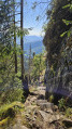
Sentiers des Roches and Sentiers des Couloirs from the Col de la Schlucht
 9.03 mi
+2,523 ft
-2,507 ft
6h 20
Difficult
Departure from Le Valtin (Vosges)
A beautiful, challenging hike in the Vosges mountains, taking the Sentier des Roches and the Couloirs trails and the lesser-known climb up to the Col de Falimont from Frankental, then going around the Petit Hohneck via the Schiessroth and returning via the Hohneck and the Trois Fours.
Please note: hiking is prohibited in winter. Read the practical information about the difficulties encountered on this hike.
Discovering the flowers in the Frankenthal-Missheimle nature reserve
 3.39 mi
+1,089 ft
-1,086 ft
2h 30
Moderate
Departure from Xonrupt-Longemer (Vosges)
A hike starting from the Route des Crêtes, via Frankenthal, to discover the flowers of the Hautes-Vosges.Please note! This hike is not possible in winter (see practical information below)
Circular loop starting from the Col de la Schlucht
8.40 mi
+2,192 ft
-2,195 ft
5h 45
Difficult
Departure from Le Valtin (Vosges)
Circular route starting from the Col de la Schlucht, passing via the Hohneck and the Petit Hohneck, and returning via the challenging but magnificent Sentier des Roches.
This hike is not possible in winter. See the practical information below.
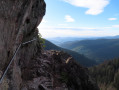
Le Hohneck - Sentier des Roches: alternative route with a circular figure-of-eight loop
 7.81 mi
+2,320 ft
-2,333 ft
5h 35
Difficult
Departure from La Bresse (Vosges)
Starting from the summit of Hohneck, the route will take you to the Sentier des Roches, "the" hike to do in the region. Its route through the rocks offers splendid views towards Alsace.Please note! This hike is not accessible in winter (see practical information below)
Crossing the Southern Vosges from Kintzheim to Willer-sur-Thur
 56.12 mi
+10,161 ft
-9,600 ft
5 days
Difficult
Departure from Kintzheim (Bas-Rhin)
This route takes you across the Vosges in the Haut-Rhin, with moderate daily stages ranging from 15 to 20 km and an elevation gain generally between 800 and 900 m. These stages take between 6 and 7 hours, always ending near a mountain refuge, which must be booked in advance. The route follows paths marked by the Club Vosgien and passes through a wide variety of landscapes.
Schupferen – Hahnenbrunnen
 12.27 mi
+1,798 ft
-1,762 ft
7h 15
Moderate
Departure from Stosswihr (Haut-Rhin)
A stage of around twenty kilometres that begins in the shade of the forest, then runs alongside the Hirschsteine and Spitzenfels rocks, with a few sections secured by metal steps and fixed handrails, before continuing along the ridges after the Col de la Schlucht and passing beneath thethird-highest peak in the Vosges, the Hohneck.