


Refine your search for walks in Belvédère de Hirschteine
Belvédère de Hirschteine walks


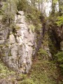
 The Hirschsteine rocks by the stairs
 Visorando Member
 7.01 mi
 +1,847 ft
 -1,847 ft
 4h 50
 Moderate
 Departure from Le Valtin (Vosges)
A beautiful hike through the Hirschsteine rocks, an area less well known than the famous sentier des Roches, but just as impressive! You'll be amazed by the imposing metal staircase leading up to the rocks, the passageway carved into the rock and the vertiginous but safe path on the mountainside. Return via the ridges from Tanet. Beautiful views over the Munster valley and Lac Vert.
This hike is not permitted in winter! (see practical information)
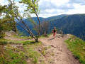
The Hirschteine trail
 2.97 mi
+971 ft
-945 ft
2h 15
 Difficult
Departure from Le Valtin (Vosges)
This route offers some of the most beautiful and spectacular views of the Munster Valley, all in the heart of the Frankenthal-Missheimle Nature Reserve.
Several difficult passages along the cliffside.
Not suitable for those who are afraid of heights.
From Tanet to Lac Vert from altitude 1000
 5.87 mi
+1,276 ft
-1,299 ft
3h 50
Moderate
Departure from Soultzeren (Haut-Rhin)
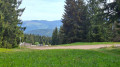
This hike allows you to discover varied landscapes, access the ridge and enjoy superb views of the entire Vosges mountains and the Alsace plain. It crosses two nature reserves: the Franckenthal-Missheimle Reserve and the Tanet Gazon du Faing Reserve.The hike also passes by the Rocher de Hirchsteine, the summit of Tanet and Lac Vert. The entire climb is through forest.
⚠️ 21/07/2025: starting point of the hike changed.
From Lac Blanc to Gazon de Faing via the Hisrchsteine and the lakes
15.99 mi
+3,222 ft
-3,196 ft
10h 10
 Very difficult
Departure from Orbey (Haut-Rhin)
A long, challenging hike with a series of ups and downs: it goes up and down. Starting from Lac Blanc, the hike climbs quite steeply towards the Rocher du Hans, offering views over Lac Blanc. This is followed by a descent to Lac Noir, which adds to the beauty of the landscape. Next comes an ascent, then a flat section leading to Lac du Forlet. The hike climbs again and descends to the final lake: Lac Vert. Heading towards the Col de la Schlucht, the route takes you past the Hirschsteine steps and their viewpoint over the Munster valley, followed by a dizzying and somewhat technical section along the cliff face. The return journey then follows the ridge, offering numerous views, along a slightly flatter path that passes through the Tanet and the Gazon du Faing.
Crossing the Southern Vosges from Kintzheim to Willer-sur-Thur
 56.12 mi
+10,161 ft
-9,600 ft
5 days
Difficult
Departure from Kintzheim (Bas-Rhin)
This route takes you across the Vosges in the Haut-Rhin, with moderate daily stages ranging from 15 to 20 km and an elevation gain generally between 800 and 900 m. These stages take between 6 and 7 hours, always ending near a mountain refuge, which must be booked in advance. The route follows paths marked by the Club Vosgien and passes through a wide variety of landscapes.
Schupferen – Hahnenbrunnen
 12.27 mi
+1,798 ft
-1,762 ft
7h 15
Moderate
Departure from Stosswihr (Haut-Rhin)
A stage of around twenty kilometres that begins in the shade of the forest, then runs alongside the Hirschsteine and Spitzenfels rocks, with a few sections secured by metal steps and fixed handrails, before continuing along the ridges after the Col de la Schlucht and passing beneath thethird-highest peak in the Vosges, the Hohneck.
Stosswihr, the Col de la Schlucht, the Tanet and Lake Soultzeren
14.52 mi
+3,579 ft
-3,583 ft
9h 50
Very difficult
Departure from Stosswihr (Haut-Rhin)
A challenging hike due to its elevation gain and occasionally alpine terrain. An exposed section near the Hirschsteine. Do not attempt this in wet weather. The route offers magnificent views, with peat bogs and lakes, and perhaps even chamois, if the hiker remains quiet (around the Hirschsteine and amongst the rocks on the ridges). Following the suggested route, all the ascents are in the shade. On the ridge sections or descents, you’ll discover some of the ‘must-see’ highlights of the Hautes-Vosges!