


Refine your search for walks in Col du Herrenberg (1191m)
Col du Herrenberg (1191m) walks


 The Schweisel, flowing along the banks of the Pfahlrunz and the Salzbach
 Visorando Member
 7.81 mi
 +2,119 ft
 -2,106 ft
 5h 25
 Moderate
 Departure from Metzeral (Haut-Rhin)
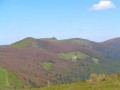
The Schweisel is a peak on the main ridge of the Vosges, between the Thann valley to the west and the Munster valley to the east.It is renowned not only for its exceptional panoramic views but also for its heathland, forest and wetland area, the Schweiselwasen, on its eastern slope. It is via this eastern slope, criss-crossed by numerous streams, that this route takes you on a journey of discovery.
Col de la Schlucht – Le Grand Ballon: the Sentier des Crêtes
 16.57 mi
+3,238 ft
-2,556 ft
8 hrs
 Very difficult
Departure from Le Valtin (Vosges)
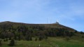
A very beautiful hike, taking in some remarkable sights: the Martinswand rocks, the summit of the Hohneck, the summit of the Kastelberg and the Grand Ballon (with the ‘Boule’ at the summit).
The Pearl of the Vosges from Mittlach
16.90 mi
+4,308 ft
-4,301 ft
11h 30
Very difficult
Departure from Mittlach (Haut-Rhin)
This circular, starting from Mittlach at the bottom of the Munster Valley, is undoubtedly the most alpine in the Vosges. Shortly after Mittlach, the entrance to the Wormsa glacial valley sets the tone and offers unique panoramic views of the Hautes Vosges peaks. The highlight of this route is the majestic Frankenthal cirque, the Martinswand rocks and the daunting climb to the Col du Fallimont.This is a circular for experienced hikers or hikers who are not afraid of suffering, or both. It is long, challenging but absolutely stunning.
Cottages from the Herrenberg Pass to the Rainkopf, Altenweiher Lake
10.54 mi
+3,064 ft
-3,054 ft
7h 30
Moderate
Departure from Mittlach (Haut-Rhin)
From the exit at Mittlach at the bottom of the Munster Valley, there is a steady climb through the beautiful Vosges forest of Herrenberg up to the high-altitude scree slopes between the Schweisel to the south (Herrenberg Pass) and the Rainkopf to the north, offering a 360° view of the mountains (Grand Ballon, Hohneck...) and the surrounding valleys, as well as the more distant mountain ranges (the Swiss Alps, the Black Forest, etc.) on a clear day;
High-altitude grasslands and beech forests via the Pfahlrunz and Salzbach waterfalls
 11.56 mi
+2,215 ft
-2,192 ft
7h 15
 Difficult
Departure from Metzeral (Haut-Rhin)
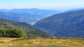
After a pleasant climb alongside the Pfahlrunz waterfalls, a final push leads to the Schweisel hilltop and its exceptional viewpoint. This is followed by a walk through a beautiful beech forest along the ridge, which leads to the Hahnenbrunnen mountain refuge.
The return route via the Salzbach and Uff Rain ridges offers remarkable views of the highest peaks before a long descent through the Muhlbach Woods. It ends at a pretty footbridge over the Salzbach stream, which becomes the River Fecht; following its left bank leads back to the car park.
Crossing the Southern Vosges from Kintzheim to Willer-sur-Thur
 56.12 mi
+10,161 ft
-9,600 ft
5 days
Difficult
Departure from Kintzheim (Bas-Rhin)
This route takes you across the Vosges in the Haut-Rhin, with moderate daily stages ranging from 15 to 20 km and an elevation gain generally between 800 and 900 m. These stages take between 6 and 7 hours, always ending near a mountain refuge, which must be booked in advance. The route follows paths marked by the Club Vosgien and passes through a wide variety of landscapes.
Schupferen – Hahnenbrunnen
 12.27 mi
+1,798 ft
-1,762 ft
7h 15
Moderate
Departure from Stosswihr (Haut-Rhin)
A stage of around twenty kilometres that begins in the shade of the forest, then runs alongside the Hirschsteine and Spitzenfels rocks, with a few sections secured by metal steps and fixed handrails, before continuing along the ridges after the Col de la Schlucht and passing beneath thethird-highest peak in the Vosges, the Hohneck.
Rothenbachkopf circular and the Schafert Farm Inn
 Tourism professional
 7.52 mi
+1,640 ft
-1,621 ft
4h 55
Difficult
Departure from Kruth (Haut-Rhin)
Starting from the Route des Crêtes, this circular route offers a succession of 360-degree panoramic views, each more breathtaking than the last, with a lovely detour through the pastures of the Schafert Farm Inn, on the heights of Kruth.