


Refine your search for walks in Schönwald im Schwarzwald
Schönwald im Schwarzwald walks


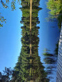
 Schönwald – Blindensee route
 Visorando Member
 8.13 mi
 +1,155 ft
 -1,155 ft
 4h 45
 Moderate
 Departure from Schönwald im Schwarzwald (Regierungsbezirk Freiburg)
A route exploring the Blindensee (translation: ‘blind lake’), a natural peat bog – an elevated moorland lake with a dense population of trees and poor visibility due to its shallow depth. Beautiful views over part of the Southern Black Forest Nature Park.
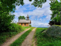
Nußhurtkapelle and Triberger Wasserfälle from Triberg (Germany)
 7.21 mi
+1,421 ft
-1,437 ft
4h 35
Moderate
Departure from Triberg im Schwarzwald (Regierungsbezirk Freiburg)
This loop will take you from Triberg (Baden-Württemberg) which, as well as being a major cuckoo factory, is also famous for its waterfall, the highest in Germany. A hike for everyone.
The route is in two parts:
The long 9 km loop takes you through forests and mountain meadows to discover some magnificent scenery.
The shorter 2.3 km loop takes you to the waterfall, which unfortunately is very popular with tourists, so there is a charge for admission (€8).
Genießerpfad – Rohrhardsberg U(h)rwald Trail
 Tourist office
 5.39 mi
+1,240 ft
-1,230 ft
3h 35
Moderate
Departure from Schonach im Schwarzwald (Regierungsbezirk Freiburg)
This premium hiking trail through the Rohrhardsberg Nature Reserve offers everything that makes the Black Forest so special. From lush pastures and meadows to woods and moors, a waterfall and, time and again, stunning views. Cuckoo clocks in all shapes and colours adorn the woods and make for a truly special hiking experience!
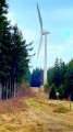
The Braunhörnle and the Rohrhardsberg via the Genießerpfade
 8.81 mi
+1,804 ft
-1,811 ft
5h 35
Moderate
Departure from Schonach im Schwarzwald (Regierungsbezirk Freiburg)
A pleasant route leading to the Braunhörnle. This summit offers a panoramic view of the Yach valley. The route also passes through the Rohrhardsberg nature reserve. The landscapes here are varied, alternating between forests, pastures and meadows.
Elzhof–Schonacher Wälderweg circular loop via Blindensee
 7.89 mi
+1,070 ft
-1,047 ft
4h 35
Moderate
Departure from Schonach im Schwarzwald (Regierungsbezirk Freiburg)
A pleasant route that initially follows the Elz stream past a beautiful waterfall. The route then follows part of the Schonach forest path, then passes through the Blindenhöhe nature reserve and around Blindensee.
Circular route around Schonach via the Blindensee
 7.25 mi
+1,010 ft
-1,014 ft
4h 15
Moderate
Departure from Schonach im Schwarzwald (Regierungsbezirk Freiburg)
A pleasant route in the hills above Schonach. You will pass through the Blindensee nature reserve. This deep black lake is surrounded by marshy wetlands, home to many rare plant species.
Triberg Black Forest Railway Trail
 3.64 mi
+1,050 ft
-1,047 ft
2h 35
Moderate
Departure from Triberg im Schwarzwald (Regierungsbezirk Freiburg)
An interesting route that follows the Black Forest railway line. Several vantage points showcase the ingenuity used to overcome the difference in height with the help of double circular loops. Along the way, you’ll see the world’s largest cuckoo clock.
Balzer Herrgott Circular Walk, Gütenbach
 Tourism professional10.26 mi
+2,402 ft
-2,408 ft
6h 50
 Difficult
Departure from Gütenbach (Regierungsbezirk Freiburg)
The Balzer Herrgott Circular Walk near Gütenbach links two of the Black Forest’s most famous photo spots in a particularly impressive way: the Balzer Herrgott, a statue of Christ that has grown into a willow beech, and the Hexenlochmühle mill. In between, a varied hike awaits you, featuring steep climbs and narrow paths.
Shepherd’s Trail (Hirtenweg) starting from Yach
12.80 mi
+2,986 ft
-2,982 ft
8h 30
 Very difficult
Departure from Elzach (Regierungsbezirk Freiburg)
A long hike with significant elevation gain. Follow the sign featuring a shepherd, then the unmistakable Yellow Diamond. Please note that the signs are sometimes a few dozen metres past the junctions, so keep an eye out!
Circular route from Schöne Aussicht and the Hauenstein Rock
 5.58 mi
+1,198 ft
-1,171 ft
3h 35
Moderate
Departure from Hornberg (Regierungsbezirk Freiburg)
The Hauenstein rock offers a magnificent view (Schöne Aussicht) of the southern and eastern parts of the Black Forest. This route follows part of the Schwarzwald West Weg and passes through beautiful forests above Niederwasser.
Simonswald Mill Trail
5.65 mi
+1,033 ft
-1,027 ft
3h 30
Moderate
Departure from Simonswald (Regierungsbezirk Freiburg)
In Simonswald and its tranquil side valleys, where crystal-clear mountain streams murmur, six old mills clatter away. The mill trail connects the mills in a beautiful hike.
Mathilde the Ladybird Tour in Winden
5.33 mi
+768 ft
-764 ft
3h 05
Moderate
Departure from Winden im Elztal (Regierungsbezirk Freiburg)
Pram-friendly family walk around Winden
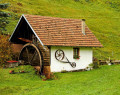
On the Great Hornberg Mill Trail
 9.11 mi
+2,136 ft
-2,119 ft
6h 05
Moderate
Departure from Hornberg (Regierungsbezirk Freiburg)
On this walker-friendly circular route through the Reichenbach and Schwanenbach valleys, we pass numerous traditional Black Forest farm mills. Along the way, we’ll find beautiful viewpoints and a romantic rock labyrinth.A family-friendly walk near Hornberg.
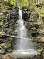
Zweribach Waterfalls from Sankt-Märgen
 7.09 mi
+1,529 ft
-1,526 ft
4h 35
Difficult
Departure from St. Märgen (Regierungsbezirk Freiburg)
From Sankt-Märgen to the Zweribach waterfalls via the Hischbach waterfall and back via the Kapfen chapel.
A circular walk in the vicinity of Waldkirch in the Black Forest
 4.10 mi
+810 ft
-807 ft
2h 35
Moderate
Departure from Waldkirch (Regierungsbezirk Freiburg)
A lovely hike in the Black Forest near Waldkirch, 30 km north-east of Freiburg (Freiburg im Breisgau) and 40 km north of Titisee.You can admire the countryside and woodland scenery from the top of the Kandel at an altitude of 1,241 metres, a popular spot for motorcyclists and paragliders.You’ll pass by a rockfall, Kandel Rock, where 2,000 m³ of rock collapsed in 1981.
Around Sankt Peter
 7.93 mi
+1,234 ft
-1,211 ft
4h 45
Moderate
Departure from St. Peter (Regierungsbezirk Freiburg)
A walk around Sankt Peter to discover stunning scenery as you cross vast meadows and follow cliff-top paths offering remarkable views of the Feldberg massif.
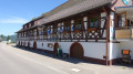
Gutach Valley in the Black Forest – Gutachtälersteig
 8.76 mi
+2,398 ft
-2,379 ft
6h 05
Moderate
Departure from Gutach (Schwarzwaldbahn) (Regierungsbezirk Freiburg)
A very lovely walk in the Black Forest, 50 km north-east of Freiburg (Freiburg im Breisgau) and 60 km north of Lake Titisee.
You can admire the countryside and woodland scenery, as well as the village of Gutach with its beautiful traditional houses.
S’Turm Connoisseur Beer Trail
3.01 mi
+322 ft
-341 ft
1h 40
 Easy
Departure from Lauterbach (Regierungsbezirk Freiburg)
Experience a very special leisurely walk on the Fohrenbühl centred around the theme of beer. On the “s’ Turm-Genießer-Bierwegle”, you’ll discover fascinating facts about the history of beer at various information points – informative, entertaining and set amidst beautiful countryside. The starting point is the memorial house on the Fohrenbühl plateau in the climatic health resort of Lauterbach. A tour for anyone who wants to combine beer knowledge with nature and exercise.
Mühlenbach Panoramic Trail – “King of the Hiking Trails” (short loop)
5.66 mi
+1,558 ft
-1,562 ft
4h 00
Moderate
Departure from Mühlenbach (Regierungsbezirk Freiburg)
The Mühlenbach Panoramic Trail is known as the ‘King of the Hiking Trails’. It offers an idyllic hiking experience amongst the unspoilt Black Forest valleys and farmsteads. The ‘Short Loop’ is designed to give a taste of the entire Panoramic Trail and can be extended to include the ‘Long Loop’ to create an excellent day’s hike.
AugenBlick Circular Walk, Lauterbach Güntersberg
6.27 mi
+1,184 ft
-1,178 ft
3h 55
Moderate
Departure from Lauterbach (Regierungsbezirk Freiburg)
The Lauterbach–Güntersberg ‘AugenBlick’ circular walk takes you along varied paths through woods, meadows and quiet valleys, rewarding you time and again with magnificent views. A particular highlight is the ‘AugenBlick’ viewpoint on the Güntersberg, offering a distant view all the way to Hohenzollern Castle.
Lauterbach hiking trail
20.88 mi
+3,438 ft
-3,435 ft
12h 35
Moderate
Departure from Lauterbach (Regierungsbezirk Freiburg)
This trail has it all: the "Qualitätsweg Wanderbares Deutschland" (Quality Trail Wanderbares Deutschland) runs for 34 kilometres at altitudes between 568 and 879 metres. Nevertheless, the ascents on the "Lauterbacher Wandersteig" add up to a good 1350 metres in altitude.