


 Country:

 City:
City:


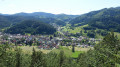
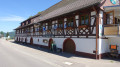
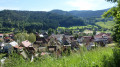
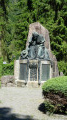
Park in the car park in the centre of the village of Gutach.
The path is signposted with a distinctive hat bearing five red dots. The signs point to the Gutachtälersteig.
(S/E) From the car park, head towards the Hauptstrasse (Main Street), cross it, taking care of oncoming traffic. Turn left towards the south. Turn right onto Knappenacker and, immediately afterwards, take the path on the left which climbs along the edge of the forest. Shortly afterwards, the path joins a main track.
(1) Turn left at the hairpin bend. The path enters the forest and continues to climb. It then follows the ridge.
(2) Follow the track carefully so as not to miss this junction and head off to the left. Pass a path on the right and another on the left. Walk alongside the road on your left, slightly above it, and arrive near the junction.
(3) Turn left, cross the road and take the path opposite which appears to run alongside it. Further on, it crosses a main track at an angle and gradually veers away from it. Join a main track, follow it to the left to reach a hairpin junction.
(4) Turn left through a 180° bend and walk alongside a meadow. At the crossroads by the forest, carry on straight ahead. You’ll reach the tarmac road; take it to the left. Leave it to the right to cross the Steinebach (the ‘stream of stones’).
(5) Continue along the path that climbs up the meadow. Pass a path on your right, enter the forest and, at the next junction, take a sharp left to head back down into the forest. Pass a path on your right, leave the forest and walk along the edge of the meadow.
Then cross the meadow, pass to the left of a farm and turn right into Rue Leimen. Cross the Gutach via the footbridge.
(6) Cross the main road and head up the meadow opposite. Cross the railway line at the level crossing and continue straight on.
(7) After the level crossing, turn left onto the path that runs between the farm buildings and zigzags before reaching the forest track. Cross it and continue uphill along the path.
At the next junction, turn left, then right about a hundred metres further on. Follow the track and the signposts to turn left, then right, and then left again for a very short distance.
(8) At the next junction, take the hairpin bend to the left, passing a path on the left and then another on the right.
(9) At the next junction, continue slightly to the right (north-east).
(10) In the bend, take the left-hand path.
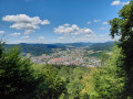
(11) This junction is a bit confusing. Take a circular detour to admire a superb view of the village of Gutach. To do this, follow the path which descends slightly to the left until you reach a small building at the edge of the meadow. Superb view.
Head back along the path that runs parallel to the previous one and return to the crossroads.
(11) Follow the path furthest to the left, which follows the contour line. Walk alongside a meadow until you reach the Schmittsbach crossroads.
(12) There are numerous signposts here:
- to the left, the Gutachtälersteig walk descends into the valley and leads directly to the return junction.
- to the right, an optional route, the Mosersteinschleife, which is the one described below.
The path climbs steeply. Pass a path on the right and one on the left, then follow the hairpin bend to the left. Continue slightly to the left at the next Fork in the road, where you join a long-distance hiking trail, the Gutach Schondelhöhe.
(13) At the next junction, turn left onto the path leading downwards. Pass one path on the left and one on the right
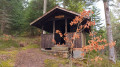
You’ll reach a shelter with a stunning view over the valley. Continue downhill to reach the junction on the way back.
(14) Join the Gutachtälersteig. Continue to the right.
Cross the railway line and the meadows to return to the starting point, the car park in the centre of the village of Gutach (S/E).



 Tourist office

 Visorando Member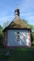
 Very difficult
