Mathilde the Ladybird Tour in Winden

Pram-friendly family walk around Winden

Details

29293593
Creation:
Last update:
Last review:
  • Walking
    Activity: Walking
  • ↔
    Distance: 5.33 mi
  • ◔
    Average duration: 3h 05 
  • ▲
    Difficulty: Moderate

  • ⚐
    Back to start: Yes
  • ↗
    Ascent: + 768 ft
  • ↘
    Descent: - 764 ft

  • ▲
    Highest point: 1,719 ft
  • ▼
    Lowest point: 1,079 ft

Description of the walk

The walking tour starts at Oberwinden railway station (Bahnhofstraße)

(S/E) From Oberwinden railway station, the route heads above the railway line towards Elzach.

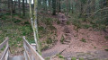
(1) Before the Yach sports ground, turn right and head up into the Kalmerwald. From there, follow a steep path. We cross the Yach Höhenweg and continue along the path.

(2) We come to a cross-path and turn right.

(3) We continue to follow the path, soon crossing the Yacher Höhenweg again and carrying on to the next cross-path. Here, we turn left.

(4) We cross the Staudenbach and soon reach the edge of the forest.

(5) We turn right and walk through the Lehen residential area back to the railway line. Here we turn left and walk back into the village (S/E).

Waypoints

  1. S/E : mi 0 - alt. 1,112 ft - Oberwinden railway station
  2. 1 : mi 1.2 - alt. 1,184 ft - Yacher sports ground
  3. 2 : mi 2.08 - alt. 1,463 ft - Crossing
  4. 3 : mi 2.77 - alt. 1,716 ft - Yacher Höhenweg
  5. 4 : mi 3.6 - alt. 1,578 ft - Staudenbach
  6. 5 : mi 3.92 - alt. 1,545 ft - Lehen residential area
  7. S/E : mi 5.33 - alt. 1,112 ft - Oberwinden railway station

Notes

Pram-friendly walk

Reviews and comments

4.3 / 5
Based on 3 reviews

Reliability of the description
4.3 / 5
Ease of following the route
4.3 / 5
Route interest
4.3 / 5
User 28517358

Overall rating : 4 / 5

Date of your route : Feb 23, 2026
Reliability of the description : ★★★★☆ Good
Ease of following the route : ★★★★☆ Good
Route interest : ★★★★☆ Good
Very busy route : No

The hike is not suitable for pushchairs, but otherwise it is easy to walk, although much of the route is through the forest.

Machine-translated

User 28517358

Overall rating : 4 / 5

Date of your route : Feb 23, 2026
Reliability of the description : ★★★★☆ Good
Ease of following the route : ★★★★☆ Good
Route interest : ★★★★☆ Good
Very busy route : No

The hike is not suitable for pushchairs, but otherwise easy to walk.

Machine-translated

JLS68
JLS68

Overall rating : 5 / 5

Date of your route : May 13, 2025
Reliability of the description : ★★★★★ Very good
Ease of following the route : ★★★★★ Very good
Route interest : ★★★★★ Very good
Very busy route : No

The route is on paths that you can follow with a pushchair.
I only used the map to follow the route, which was no problem at all.

Machine-translated

Other walks in the area

For more walks, use our search engine .

The GPS track and description are the property of this route's author. Please do not copy them without permission.