


Refine your search for walks in Salaise-sur-Sanne
Salaise-sur-Sanne walks


 From Salaise through the orchards towards the prison and the Tour d’Anjou
 Visorando Member
 9.31 mi
 +732 ft
 -712 ft
 4h 55
4h 55
 Average
 Departure from Salaise-sur-Sanne (Isère)
In the plain between Salaise and Anjou, amongst the fruit trees, exploring the ruins.
Trails of the Edict of Roussillon
 3.14 mi
+69 ft
-66 ft
1h 30
3.14 mi
+69 ft
-66 ft
1h 30
 Easy
Departure from Roussillon (Isère)
Easy
Departure from Roussillon (Isère)
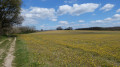
The town of Roussillon has created a network of trails named “de l’édit” in memory of the edict issued in 1564 in Roussillon, which established1 January as the start of the year throughout France. These trails are perfect for family walks, with no difficulty, no elevation gain and very little tarmac. They pass through apple orchards and quite varied landscapes. The names of the trails are indicated on signs put up by the town of Roussillon.
Circular loop between Roussillon and Le Gué d'Agnin
 4.91 mi
+292 ft
-266 ft
2h 30
Easy
Departure from Roussillon (Isère)
4.91 mi
+292 ft
-266 ft
2h 30
Easy
Departure from Roussillon (Isère)
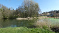
Explore the Roussillon leisure area and its pond. Walk along the Edit trails. Cross the River Sanne via a footbridge to avoid the ford. Please note that part of the return journey runs alongside the D131C road. This route is not suitable for those who dislike tarmac roads.
From Sablons to the north of Île de la Platière
 6.40 mi
+23 ft
-23 ft
3h 00
Easy
Departure from Sablons (Isère) (Isère)
6.40 mi
+23 ft
-23 ft
3h 00
Easy
Departure from Sablons (Isère) (Isère)
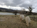
A beautiful, easy hike on Île de la Platière that is a feast for the eyes.
The inland area is a protected natural zone. Don't forget to read the signs in this area and their explanations.
TO ALL HIKERS (SES) WHO TRAVEL MY HIKES, you can post photos indicating the location on the route.
Through the orchards between Anjou and Salaise-sur-Sanne
 4.95 mi
+351 ft
-344 ft
2h 35
Easy
Departure from Agnin (Isère)
4.95 mi
+351 ft
-344 ft
2h 35
Easy
Departure from Agnin (Isère)
This is a walk best enjoyed when the fruit trees are in bloom; it’s a gentle stroll where you can simply look at and smell the flowers. There’s also an alternative route to explore the archaeological site of Anjou.
From Roussillon to Salaise
 7.56 mi
+505 ft
-509 ft
3h 55
Average
Departure from Roussillon (Isère)
7.56 mi
+505 ft
-509 ft
3h 55
Average
Departure from Roussillon (Isère)
A visit to a built or historical heritage site, beautiful views and a varied route.
The heights of Limony and the Limony valley
 8.57 mi
+965 ft
-935 ft
4h 45
Average
Departure from Limony (Ardèche)
8.57 mi
+965 ft
-935 ft
4h 45
Average
Departure from Limony (Ardèche)
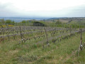
An easy hike starting from the village of Limony. Once you have climbed to the top, weather permitting, you will have a beautiful view of the Alps to the east. The return journey will take you along the Limony.
On the hills above Limony-Charnas
 6.28 mi
+863 ft
-853 ft
3h 40
Average
Departure from Limony (Ardèche)
6.28 mi
+863 ft
-853 ft
3h 40
Average
Departure from Limony (Ardèche)
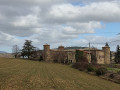
A walk through the orchards and vineyards on the hills above the villages of Limony and Charnas.
The Rhône River from Sablons to Serrières via Peyraud
 4.87 mi
+20 ft
-20 ft
2h 15
Easy
Departure from Sablons (Isère) (Isère)
4.87 mi
+20 ft
-20 ft
2h 15
Easy
Departure from Sablons (Isère) (Isère)
Discovering the banks of the Rhône. The route passes along the left and right banks via the Peyraud SNCF bridge. It introduces us to the river's developments, its floods, and its flora and fauna. Graduated markers indicate the various flood levels along the way.
The Louze Plateau and the Bois des Bruyères
6.98 mi
+105 ft
-108 ft
3h 20
Average
Departure from Ville-sous-Anjou (Isère)
A pleasant walk, flat, with a few views of the Pilat and the surrounding hills. Suitable for all seasons, particularly in spring when the orchards are in bloom and in summer when the fruit is ripe. Also features two sections through the forest.
TO ALL HIKERS (SES) WHO FOLLOW MY ROUTES: you can post photos indicating their location on the route.
On the heights of Serrières
 6.92 mi
+928 ft
-932 ft
4h 00
Average
Departure from Serrières (Ardèche)
6.92 mi
+928 ft
-932 ft
4h 00
Average
Departure from Serrières (Ardèche)
This hike will take you to the heights overlooking the Rhône valley around the village of Serrières. Clear paths offering beautiful views of the Rhône valley and the Alps, and pleasant wooded paths will follow one another throughout the route. The start of the walk will take you through the old village of Serrières, which is well worth a detour.
The heights of Serrières
 3.58 mi
+722 ft
-722 ft
2h 15
Easy
Departure from Serrières (Ardèche)
3.58 mi
+722 ft
-722 ft
2h 15
Easy
Departure from Serrières (Ardèche)
A short, easy walk offering beautiful panoramic views of the Île de la Platière Nature Reserve, the Rhône and the vineyards.
Village of Bogy from Peyraud
 7.33 mi
+1,332 ft
-1,316 ft
4h 30
Average
Departure from Peyraud (Ardèche)
7.33 mi
+1,332 ft
-1,316 ft
4h 30
Average
Departure from Peyraud (Ardèche)
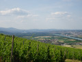
Walk in the hills around Peyraud and Serrières. The climb up the Crémieux stream valley will take you to the small village of Bogy. The hike offers numerous viewpoints overlooking the Rhône valley and the Alps, visibility permitting.
In the woods on the heights of Peyraud
3.16 mi
+896 ft
-906 ft
2h 15
Average
Departure from Peyraud (Ardèche)
The heights of Peyraud through woods and vineyards, with spectacular views of the Rhône and the Alps.
From Verlieux in the municipality of Peyraud to the hamlets of Bogy
6.64 mi
+709 ft
-719 ft
3h 40
Average
Departure from Peyraud (Ardèche)
Stunning views over the Rhône valley, but also inland towards the remarkable valleys and plateaus.
This is a unique route as it has very little elevation gain in this part of the Ardèche, alternating between fields and woods several times. It can also be shortened to 7.6 km for afternoon hikers in winter.
To all walkers: please feel free to post photos, specifying the location on the route.
WARNING! A hiker has warned me to take great care, following heavy rain, as the section along the stream is very difficult.
I advise hikers to wait four or five days after the rain before undertaking this hike.