Country:

 City:
City:


Park in the dirt car park behind Limony Church.
(S/E) Take Rue d’Embras, then Rue de l’Église, to reach the RD1086, which you must cross with great care. Continue along the road opposite, then turn left into Rue du Maillet. Carry on along this small road, passing a hiking signpost with a bench nearby.
(1) Continue along the tarmac, ignoring the path that branches off to the left, until you reach a house with a cross on its façade in the hamlet of Négret. Go round it on the left, taking a path that runs alongside the Limony stream. Ignore the small bridge on the right that spans the Limony and continue along the path. Cross the Priolet stream and pass under a power line. At the next junction of paths, stay on the one on the right to reach the ford over the Verdier stream.
(2) Cross the ford and take the path that climbs up opposite; note that this path is narrow and often obstructed by branches, but remains easily passable. After two hairpin bends, you’ll reach the plateau amidst the orchards and vineyards.
(3) Continue along the path, which widens, and pass behind Château Cheymié to reach the Picardel crossroads via the Route des Thuillières Sud.
(4) Turn left; you’ll soon reach the hamlet of Picardel and cross through it by turning left onto Rue de la Font Bois. At the end of the street, join a footpath.
(5) Continue through the vineyards, passing close to Château Cheymié. At the four-way crossroads, head straight ahead to reach the hamlet of Liponnet.
(6) Turn right and cross the Jaune et Noir bridge. Continue along the road until you reach a sharp bend, then take the path on the right – be careful, as it is not very visible. Turn left onto this path and continue along a track through the vineyards. You will reach a crossroads marked by a cross.
(7) Cross the road, continue straight ahead and pass under a power line. You will then come to the Route des Combes; follow this to reach a Y-junction in the Garennes district of the village of Charnas.
(8) Turn left and follow a stream and a small pond. Continue due north, then cross the Ruisseau de Montrond at Les Rotisses. Carry on through the vineyards to reach a junction with a new road in the hamlet of Gros.
(9) Take this road to the right. At a place called Montrond, leave it and turn 180° onto the track leading through the vineyards. After a circular bend, rejoin a road and turn left onto it. At the next hairpin bend, leave the road to enter the woods and, further on, return to the original junction you passed on the way out.
(1) Turn right and follow the route back in the opposite direction to the outward journey via Rue du Maillet to return to the car park at Limony church (S/E).

 Visorando Member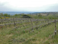

 Easy
Easy