


Refine your search for walks in Saint-Leu (La Réunion)
Saint-Leu (La Réunion) walks


 From Pointe au Sel to Stella via the Sentier Sucré Salé
 Tourist office
 3.42 mi
 +449 ft
 -449 ft
 2h 00
2h 00
 Easy
Easy
 Departure from Saint-Leu (La Réunion) (Réunion)
Réunion has a few remarkable museums, such as the Salt Museum and the Stella Matutina Museum. It is possible to visit both by taking a circular route via the Sentier Sucré Salé, which was used by the Stella factory owners to come and help the workers in the salt flats during the Second World War. You can also return via Piton des Roches Tendres, which offers a lovely view of the west of the island.
Maïdo, Grand Bénare, from Vaudeville to Trois Bassins
 Visorando Member23.51 mi
+5,712 ft
-5,705 ft
10 hrs
Visorando Member23.51 mi
+5,712 ft
-5,705 ft
10 hrs
 Extremely difficult
Departure from Les Trois-Bassins (Réunion)
Extremely difficult
Departure from Les Trois-Bassins (Réunion)
Set off on an epic hike in the Hauts de Trois-Bassins! Starting from the Vaudeville trail, head to Maïdo, continue to the legendary Grand Bénare, then return via Petit Bénare for an unforgettable circular tour in the heart of Réunion's mountains. Breathtaking panoramas of Mafate, legendary peaks and endemic forest!
Piton de la Croix
 1.20 mi
+630 ft
-630 ft
1h 05
1.20 mi
+630 ft
-630 ft
1h 05
 Moderate
Departure from L'Étang-Salé (Réunion)
Moderate
Departure from L'Étang-Salé (Réunion)
Piton la Croix is a peak in the commune of Étang-Salé. From its summit, you can enjoy one of the island’s most beautiful views! Indeed, from up there you have a 360° panorama stretching from Saint-Pierre to Étang-Salé-les-Bains, taking in Piton des Neiges, the hills above Étang-Salé, Saint-Louis, Le Tampon, L’Étang-Salé-les-Hauts, La Rivière and L’Entre-Deux! It’s also a wonderful spot for quiet reflection!
Le Grand Bénare via the Tamarin Lodge
 9.30 mi
+3,629 ft
-3,629 ft
7 hrs
9.30 mi
+3,629 ft
-3,629 ft
7 hrs
 Very difficult
Departure from Les Trois-Bassins (Réunion)
Very difficult
Departure from Les Trois-Bassins (Réunion)
Le Grand Bénare is an iconic peak on the island. The approach via the Tamarin Lodge is much more strenuous than from Le Maïdo. You’ll need calves of steel to tackle the inevitable sharp rocks. The views are spectacular, and this is the case well before you reach the summit. The climb is steady and the elevation gain is quite significant. The route through the Caverne de la Glacière and the various shafts encountered during the ascent add an extra dimension to this hike.
A short forest walk from Étang-Salé les Bains
 4.45 mi
+203 ft
-203 ft
2h 15
Easy
Departure from L'Étang-Salé (Réunion)
4.45 mi
+203 ft
-203 ft
2h 15
Easy
Departure from L'Étang-Salé (Réunion)
A pleasant walk through varied woodland. A lovely glimpse of the local flora.
The Bras Patate valley
2.76 mi
+722 ft
-735 ft
1h 55
Easy
Departure from Saint-Louis (La Réunion) (Réunion)
The Makes region offers a wealth of hiking opportunities. The Bras Patate valley trail is one of the easiest and best known. The trail winds its way through a magnificent valley, offering superb views of Cilaos. Bras Patate was the entrance to the Cirque de Cilaos before the Piton des Neiges collapsed. However, the water did not have time to carve out a deep canyon like the Bras de Cilaos, but be sure to bring your camera: you will see many endemic birds.
From Camp Montplaisir to La Fenêtre via Les Fleurs Jaunes
 3.70 mi
+1,273 ft
-1,296 ft
2h 50
Moderate
Departure from Saint-Louis (La Réunion) (Réunion)
3.70 mi
+1,273 ft
-1,296 ft
2h 50
Moderate
Departure from Saint-Louis (La Réunion) (Réunion)
This hike offers beautiful panoramic views of Cilaos! On the way back, we pass through the magnificent Bras Patate valley.
Fenêtre des Makes Piton Cabri
 3.57 mi
+1,640 ft
-1,673 ft
3h 05
Moderate
Departure from Saint-Louis (La Réunion) (Réunion)
3.57 mi
+1,640 ft
-1,673 ft
3h 05
Moderate
Departure from Saint-Louis (La Réunion) (Réunion)
A lovely hike starting from Fenêtre des Makes which, in addition to magnificent views of Cilaos, allows you to discover completely different vegetation depending on the altitude.
La Fenêtre des Makes at Camp 2000
 5.77 mi
+2,221 ft
-2,208 ft
4h 35
Moderate
Departure from Saint-Louis (La Réunion) (Réunion)
5.77 mi
+2,221 ft
-2,208 ft
4h 35
Moderate
Departure from Saint-Louis (La Réunion) (Réunion)
An easy hike starting from a charming village offering magnificent views of the Cirque de Cilaos.
The circular of the Canals
 4.56 mi
+1,759 ft
-1,759 ft
3h 40
Moderate
Departure from Saint-Louis (La Réunion) (Réunion)
4.56 mi
+1,759 ft
-1,759 ft
3h 40
Moderate
Departure from Saint-Louis (La Réunion) (Réunion)
This is an original way to hike off the GR® trails. There are few trails winding through the Chaîne du Bois de Nèfle. This route takes you deep into the heart of this mountain range through a dense forest of colourful woods and offers some panoramic views of the south of the island and Les Makes. In addition, a picnic area has been set up at the end of the hike. Avoid this route in rainy weather!
Le Grand Bénare from Le Maïdo
 10.54 mi
+2,431 ft
-2,454 ft
7h 00
10.54 mi
+2,431 ft
-2,454 ft
7h 00
 Difficult
Departure from Saint-Paul (La Réunion) (Réunion)
Difficult
Departure from Saint-Paul (La Réunion) (Réunion)
There are several notable peaks on Réunion. Two of them rise above 3,000 metres: Gros Morne and Piton des Neiges. The third is none other than Grand Bénare. The latter is accessible from several points. The routes via Le Grand Bord and La Glacière are the easiest. It is advisable to take the outward route via Le Grand Bord to enjoy the views over Mafate before the clouds roll in. The summit offers a 360-degree view, and the return via La Glacière adds a touch of history.
Maïdo and Grand Bord
 2.60 mi
+541 ft
-554 ft
1h 40
Easy
Departure from Saint-Paul (La Réunion) (Réunion)
2.60 mi
+541 ft
-554 ft
1h 40
Easy
Departure from Saint-Paul (La Réunion) (Réunion)
This short hike along the Grand Bord du Maïdo offers the same superb views of Mafate as a longer hike.
From Maïdo to Le Bronchard
 9.44 mi
+4,213 ft
-4,190 ft
6 hrs
Very difficult
Departure from Saint-Paul (La Réunion) (Réunion)
9.44 mi
+4,213 ft
-4,190 ft
6 hrs
Very difficult
Departure from Saint-Paul (La Réunion) (Réunion)
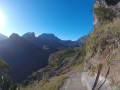
The route to Mafate via Maïdo is one of the most challenging ways to reach Mafate. This fairly strenuous round trip allows you to see the charming village of Roche Plate and go beyond it to Le Bronchard, which offers sweeping views of the surrounding area. The village of Roche Plate is typical of the villages in Mafate with its Creole houses. It is quite spread out and consists of two neighbourhoods. There are numerous lodges in the area.
Piton des Orangers and return via the Omega Forest Road
4.61 mi
+932 ft
-906 ft
2h 55
Easy
Departure from Saint-Paul (La Réunion) (Réunion)
An easy hike to see all the islets of the Cirque de Mafate. It is best to set off no later than 10:00 a.m. to enjoy the magnificent views along the edge of the rampart. The start and end of the route are on forest roads. It is possible to picnic along these roads on the way back.
Roche Plate – La Nouvelle
5.03 mi
+2,923 ft
-1,909 ft
4h 50
Moderate
Departure from Saint-Paul (La Réunion) (Réunion)
A stage made all the more enjoyable by the unforgettable setting of the Trois Roches.
Roche Plate - Marla
 5.01 mi
+2,680 ft
-968 ft
4h 40
Moderate
Departure from Saint-Paul (La Réunion) (Réunion)
5.01 mi
+2,680 ft
-968 ft
4h 40
Moderate
Departure from Saint-Paul (La Réunion) (Réunion)
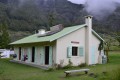
Second day of the hike in the Cirque de Mafate.
Marla - Roche Plate
 5.15 mi
+1,037 ft
-2,726 ft
3h 15
Moderate
Departure from Saint-Paul (La Réunion) (Réunion)
5.15 mi
+1,037 ft
-2,726 ft
3h 15
Moderate
Departure from Saint-Paul (La Réunion) (Réunion)
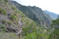
Stage 3 of the 6-day route in the Cirque de Mafate.
On this stage, we’ll make our way from Marla to Roche Plate via the superb site of the 3 Roches. It is here that the Galets River disappears into an impressive crevasse.
The Roche Plate site is situated directly below the Maïdo viewpoint.
Marla - Cilaos
 2.65 mi
+1,588 ft
-2,687 ft
2h 35
Moderate
Departure from Saint-Paul (La Réunion) (Réunion)
2.65 mi
+1,588 ft
-2,687 ft
2h 35
Moderate
Departure from Saint-Paul (La Réunion) (Réunion)
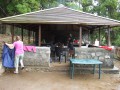
Third and final day in the Cirque de Mafate, heading back to Cilaos.
From Tapage to La Fenêtre
 7.42 mi
+3,123 ft
-3,117 ft
6h 10
Difficult
Departure from Saint-Louis (La Réunion) (Réunion)
7.42 mi
+3,123 ft
-3,117 ft
6h 10
Difficult
Departure from Saint-Louis (La Réunion) (Réunion)
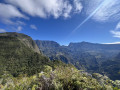
This hike takes you to Les Makes (at the La Fenêtre viewpoint) via a rarely visited spot: Le Tapage. This route offers magnificent views of the Cirque de Cilaos and the south of the island. On the way back, we take a detour through the beautiful Bras Patate valley.
The climb up Ravine Barrage
 4.74 mi
+449 ft
-449 ft
2h 35
Moderate
Departure from Saint-Louis (La Réunion) (Réunion)
4.74 mi
+449 ft
-449 ft
2h 35
Moderate
Departure from Saint-Louis (La Réunion) (Réunion)
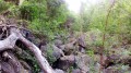
The Ravine du Gol is fed by three main branches: the Ravine de Bellevue, the Ravine Barrage and the Ravine Goyaves. This guide allows you to hike the entire length of the Ravine Barrage as far as the Source de l’Éperon. The stream is usually dry, but a few springs provide patches of water here and there. The going isn’t too difficult over the pebbles, and those who enjoy large boulders will be in their element!
La Nouvelle - Le Bélier
4.09 mi
+1,926 ft
-1,227 ft
3h 35
Moderate
Departure from La Possession (Réunion)
The final stage of the Mafate circular loop.
The Col du Taïbit from the road from Ilet to Cordes
 4.62 mi
+2,805 ft
-2,805 ft
4h 35
Difficult
Departure from Cilaos (Réunion)
4.62 mi
+2,805 ft
-2,805 ft
4h 35
Difficult
Departure from Cilaos (Réunion)
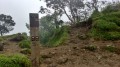
This hike provides access to the Cirque de Mafate from the Îlet à Cordes road, leading to the Cirque de Cilaos. It is a classic route in this part of the island. It also forms part ofthe GR® R1 andGR® R2 trails. Admittedly, this hike is not for everyone, but the view from the pass is spectacular when the weather permits. We will pass through Îlet des Salazes, known for its herbal tea.
Ascent to the Col du Taïbit
 Association / Club / Walk leader
 4.02 mi
+2,851 ft
-2,838 ft
4h 20
Moderate
Departure from Cilaos (Réunion)
4.02 mi
+2,851 ft
-2,838 ft
4h 20
Moderate
Departure from Cilaos (Réunion)
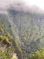
A round trip to enjoy the view at Col du Taïbit. View of the Cirque de Cilaos and, on the other side, the Cirque de Mafate. On the way, you will pass by Îlet des Salazes.
The Chapel at the start of the trail from Cilaos
 4.56 mi
+2,041 ft
-2,067 ft
3h 55
Difficult
Departure from Cilaos (Réunion)
4.56 mi
+2,041 ft
-2,067 ft
3h 55
Difficult
Departure from Cilaos (Réunion)
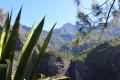
One of the most beautiful hikes around Cilaos, offering the chance to discover an exceptional site: the entrance to a canyon carved out by the river through a monolith over 100 metres wide and high, with three pools of clear, cool water.
Scout Trail starting from Grand Place
 7.28 mi
+4,288 ft
-2,090 ft
7h 05
Difficult
Departure from La Possession (Réunion)
7.28 mi
+4,288 ft
-2,090 ft
7h 05
Difficult
Departure from La Possession (Réunion)
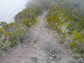
The famous Scout Trail, where the ridge sections offer impressive views of the Mafate cirque.
Saint-Louis – l’Étang-Salé les Bains
 11.19 mi
+102 ft
-285 ft
5h 15
Moderate
Departure from Saint-Louis (La Réunion) (Réunion)
11.19 mi
+102 ft
-285 ft
5h 15
Moderate
Departure from Saint-Louis (La Réunion) (Réunion)
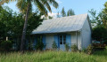
The second stage of the walk runs closest to the railway line; it begins in the multicultural town of Saint-Louis and takes you past two branch lines of the railway. It then winds through the Étang-Salé forest, following the main railway line as closely as possible, before arriving at the peaceful seaside village of Étang-Salé les Bains. Of course, you’ll come across a few remnants of the railway line.
Cayenne - Roche Plate
4.34 mi
+3,583 ft
-1,683 ft
5h 05
Difficult
Departure from La Possession (Réunion)
The passage near the Ravine Grand Mère caldera is breathtaking.
The Bras Rouge Waterfall
 2.61 mi
+1,047 ft
-1,066 ft
2h 05
Easy
Departure from Cilaos (Réunion)
2.61 mi
+1,047 ft
-1,066 ft
2h 05
Easy
Departure from Cilaos (Réunion)
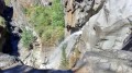
the Bras Rouge waterfall is a must-see site in the Cirque de Cilaos. Two trails lead to the waterfall: the first starts at the old thermal baths and the second at the start of the Taïbit trail. This itinerary is the first of the two. Easy and family-friendly, it offers beautiful views of the western part of the cirque. It is a classic in Cilaos and is very popular!
From Col des Bœufs to La Nouvelle
 7.02 mi
+2,087 ft
-2,073 ft
5h 05
Moderate
Departure from La Possession (Réunion)
7.02 mi
+2,087 ft
-2,073 ft
5h 05
Moderate
Departure from La Possession (Réunion)
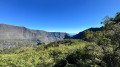
The hike from Col des Bœufs to La Nouvelle offers an accessible route for exploring the Cirque de Mafate. This excursion can be done in one day or over two days if you book a lodge. It allows you to discover the Plaine des Tamarins, the small hamlets of La Nouvelle (considered the capital of Mafate) and Marla.
More walks in Saint-Leu (La Réunion)
Select a point of interest below: