


Refine your search for walks in Musée du Sel
Musée du Sel walks


 From Pointe au Sel to Stella via the Sentier Sucré Salé
 Tourist office
 3.42 mi
 +449 ft
 -449 ft
 2h 00
2h 00
 Easy
Easy
 Departure from Saint-Leu (La Réunion) (Réunion)
Réunion has a few remarkable museums, such as the Salt Museum and the Stella Matutina Museum. It is possible to visit both by taking a circular route via the Sentier Sucré Salé, which was used by the Stella factory owners to come and help the workers in the salt flats during the Second World War. You can also return via Piton des Roches Tendres, which offers a lovely view of the west of the island.
Walks near Musée du Sel
The TiTrain railway line in Saint-Leu
 Visorando Member3.15 mi
+56 ft
-52 ft
1h 30
Easy
Departure from Saint-Leu (La Réunion) (Réunion)
Visorando Member3.15 mi
+56 ft
-52 ft
1h 30
Easy
Departure from Saint-Leu (La Réunion) (Réunion)
The town of Saint-Leu is bordered to the north by the Petite Ravine and to the south by the Ravine des Avirons. The main aim of the walk is to follow, where possible, the route taken by the TiTrain from the time of its inauguration on 12 February 1882. We will cross six bridges and viaducts, the old railway station and two railway halts.
L’Étang-Salé les Bains – Saint-Leu
 8.39 mi
+141 ft
-138 ft
4h 00
8.39 mi
+141 ft
-138 ft
4h 00
 Moderate
Departure from L'Étang-Salé (Réunion)
Moderate
Departure from L'Étang-Salé (Réunion)
The third stage of the route runs closest to the railway line. It starts in the charming seaside village of Étang-Salé les Bains and ends in another seaside town: Saint-Leu. The terrain is flat throughout, but a few off-trail sections are tricky. There are numerous remains of the railway line on this stage, far more than on the previous one. This stage runs constantly along the coast and also offers some beautiful views of the ocean and the hills.
Saint-Louis – l’Étang-Salé les Bains
 11.19 mi
+102 ft
-285 ft
5h 15
Moderate
Departure from Saint-Louis (La Réunion) (Réunion)
11.19 mi
+102 ft
-285 ft
5h 15
Moderate
Departure from Saint-Louis (La Réunion) (Réunion)
The second stage of the walk runs closest to the railway line; it begins in the multicultural town of Saint-Louis and takes you past two branch lines of the railway. It then winds through the Étang-Salé forest, following the main railway line as closely as possible, before arriving at the peaceful seaside village of Étang-Salé les Bains. Of course, you’ll come across a few remnants of the railway line.
Saint-Gilles – Saint-Paul
6.73 mi
+673 ft
-679 ft
3h 40
Easy
Departure from Saint-Paul (La Réunion) (Réunion)
Fifth stage of the island tour, running close to the railway line. This stage is flat and relatively easy. The first section is urban and passes through the tourist towns of Saint-Gilles and Boucan Canot, renowned for their white sandy beaches. The second section is more rural, running along the cliffs of Cap la Houssaye. The final section is urban once again and takes you through the town of Saint-Paul. Along the way, you’ll come across around ten remnants of the railway line.
Marla - Roche Plate
 5.15 mi
+1,037 ft
-2,726 ft
3h 15
Moderate
Departure from Saint-Paul (La Réunion) (Réunion)
5.15 mi
+1,037 ft
-2,726 ft
3h 15
Moderate
Departure from Saint-Paul (La Réunion) (Réunion)
Stage 3 of the 6-day route in the Cirque de Mafate.
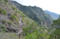
On this stage, we’ll make our way from Marla to Roche Plate via the superb site of the 3 Roches. It is here that the Galets River disappears into an impressive crevasse.
The Roche Plate site is situated directly below the Maïdo viewpoint.
Marla – Rivière des Galets
 1.27 mi
+0 ft
-1,056 ft
0h 35
Moderate
Departure from Saint-Paul (La Réunion) (Réunion)
1.27 mi
+0 ft
-1,056 ft
0h 35
Moderate
Departure from Saint-Paul (La Réunion) (Réunion)
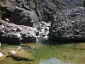
After crossing the Col du Taïbit, which offers a magnificent view of the cirques of Cilaos and Mafate, this challenging descent towards the Rivière des Galets allows you to continue exploring the southern part of the Mafate cirque. This stage can be included in a multi-day route.
Roche Plate – La Nouvelle
5.03 mi
+2,923 ft
-1,909 ft
4h 50
Moderate
Departure from Saint-Paul (La Réunion) (Réunion)
A stage made all the more enjoyable by the unforgettable setting of the Trois Roches.
Marla - Cilaos
 2.65 mi
+1,588 ft
-2,687 ft
2h 35
Moderate
Departure from Saint-Paul (La Réunion) (Réunion)
2.65 mi
+1,588 ft
-2,687 ft
2h 35
Moderate
Departure from Saint-Paul (La Réunion) (Réunion)
Third and final day in the Cirque de Mafate, heading back to Cilaos.
Roche Plate - Marla
 5.01 mi
+2,680 ft
-968 ft
4h 40
Moderate
Departure from Saint-Paul (La Réunion) (Réunion)
5.01 mi
+2,680 ft
-968 ft
4h 40
Moderate
Departure from Saint-Paul (La Réunion) (Réunion)
Second day of the hike in the Cirque de Mafate.
Roche Plate – Grand Place
 6.56 mi
+2,897 ft
-4,016 ft
5h 30
Moderate
Departure from Saint-Paul (La Réunion) (Réunion)
6.56 mi
+2,897 ft
-4,016 ft
5h 30
Moderate
Departure from Saint-Paul (La Réunion) (Réunion)
Stage 4 of the 6-day route in the Cirque de Mafate.
On this stage, we set off from Roche Plate and head for Grand Place les Hauts, passing through the hamlets of Les Orangers, Les Lataniers and Cayenne.
At a place known as La Brèche, we’ll cross the path leading up to Le Maïdo.